10 entries match your criteria.
Related Historical Markers
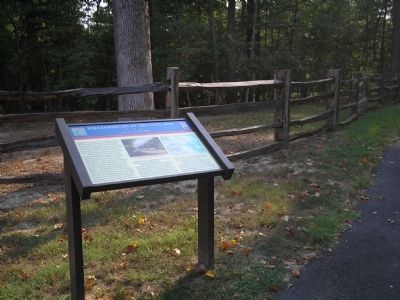
By Bill Coughlin, August 10, 2008
Marker on Quarterpath Road
SHOWN IN SOURCE-SPECIFIED ORDER
1 ► Virginia, Williamsburg — Williamsburg in the Civil War — Gateway to Richmond — 1862 Peninsula Campaign —  |
| On Quarterpath Road, on the left when traveling south. | |||
| 2 ► Virginia, Williamsburg — Defending the Peninsula — Avenue of Attack — 1862 Peninsula Campaign — |
| On Quarterpath Road, on the left when traveling south. | |||
| 3 ► Virginia, Williamsburg — Redoubt 1 — Engineers Debate the Williamsburg Line — 1862 Peninsula Campaign — |
| Near Quarterpath Road, on the left when traveling south. | |||
| 4 ► Virginia, Williamsburg — Quarterpath Road — Historic Avenue — 1862 Peninsula Campaign — |
| Near Quarterpath Road, on the left when traveling south. | |||
| 5 ► Virginia, Williamsburg — Battle of Williamsburg — Emory’s Failed Advance — 1862 Peninsula Campaign — |
| Near Quarterpath Road, on the left when traveling south. | |||
| 6 ► Virginia, Williamsburg — Redoubt 2 — Constructing a Fortification — 1862 Peninsula Campaign — |
| Near Quarterpath Road (Virginia Route 637) 0.8 miles south of York Street (U.S. 60), on the left when traveling south. | |||
| 7 ► Virginia, Williamsburg — Battle of Williamsburg — Redoubt 2 — 1862 Peninsula Campaign — |
| Near Quarterpath Road (Virginia Route 637) 0.8 miles south of York Street (U.S. 60), on the left when traveling south. | |||
| 8 ► Virginia, James City County, Williamsburg — Fort Magruder — An Ugly Place to Have to Attack — 1862 Peninsula Campaign — |
| On Penniman Road at Queens Creek Road, on the left when traveling north on Penniman Road. | |||
| 9 ► Virginia, Williamsburg — Battle of Williamsburg — The Bloody Ravine — 1862 Peninsula Campaign — |
| On Pocahontas Trail (U.S. 60), on the right when traveling east. | |||
| 10 ► Virginia, York County, Williamsburg — Redoubt 12 — Hancock the Superb — 1862 Peninsula Campaign — |
| On Lakeshead Drive, on the right when traveling east. | |||