16 entries match your criteria.
Related Historical Markers
the relationship...markers shown in North Carolina
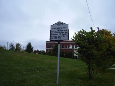
By Stanley and Terrie Howard, October 19, 2008
Stoneman's Raid Marker
SHOWN IN SOURCE-SPECIFIED ORDER
| On Hendersonville Road (U.S. 25). |
| On Lenoir Road (State Highway 16) 0.2 miles north of Sanford Drive (County Route 64), in the median. |
| On Norwood Street Southwest at Pennton Avenue Southwest, on the right when traveling south on Norwood Street Southwest. |
| On U.S. 29 at Old Salisbury Road, on the right when traveling north on U.S. 29. |
| On Shallowford Road, on the left when traveling east. |
| On South Tradd Street (U.S. 21) at East Front Street, on the right when traveling north on South Tradd Street. |
| On Lynn Road (State Highway 108) at Old Howard Gap Road and Story Road, on the right when traveling south on Lynn Road. |
| On N Main Street, on the left when traveling north. |
| On West Innes Street, on the right when traveling north. Reported permanently removed. |
| On North Washington Street north of West 2nd Street, on the right when traveling north. |
| On Main Street (State Highway 89), on the left when traveling east. |
| On S Main Street (U.S. 601), on the right when traveling south. |
| On Rockford Street, on the right when traveling north. |
| On U.S. 321 south of Norwood Circle, on the right when traveling south. Reported permanently removed. |
| On East King Street (State Highway 321), on the right when traveling west. |
| On Main Street (Route 18) at Bridge Street, on the right when traveling west on Main Street. |
Nov. 11, 2026
