21 entries match your criteria.
Entries Containing All of the Phrases «james city county» AND «virginia»
This list will also include matches for inflectional* forms of the words.
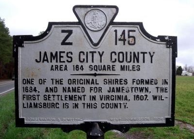
By Bernard Fisher, March 29, 2010
James City County Marker (reverse)
RANKED BY RELEVANCE
| On Old Stage Road (Virginia Route 30) 0.1 miles south of Richardson Road ( Route 705), on the right when traveling east. |
| Near Lot Cary Road (Virginia Route 602) at Samaria Lane, on the left when traveling south. |
| Near Poquoson Avenue (Virginia Route 171) east of Laydon Way, on the right when traveling east. |
| Near Wilcox Neck Road (Virginia Route 623) 0.5 miles north of The Glebe Lane ( Route 615). |
| On Colonial Trail E (Route 10), on the right when traveling north. |
| Near Hotwater Trail 1 mile west of Centerville Road ( Route 614), on the right when traveling west. |
| On Francis Street East at Colonial Street, on the right when traveling east on Francis Street East. |
| On Outpost Road 0.6 miles south of Rockahock Road, on the right when traveling south. |
| Near Courtland Farm Road (Virginia Route 820) 0.2 miles east of Hanover Courthouse Road (U.S. 301), on the right when traveling east. |
| Near Colonial Parkway, on the right when traveling west. |
| Near John Tyler Highway (Route 5) east of Greensprings Road, on the right when traveling east. |
| On Rochambeau Drive (Virginia Route 755) 1.3 miles west of Lightfoot Road ( Route 646), on the right when traveling west. |
| Near Hotwater Trail 1 mile west of Centerville Road ( Route 614), on the right when traveling west. |
| Near Croaker Road (Virginia Route 607) at Rose Lane, on the left when traveling south. |
| Near Colonial National Historical Parkway 1.5 miles south of Jamestown Road ( Route 31), on the right when traveling south. |
| Near Hotwater Trail 1 mile west of Centerville Road ( Route 614), on the left when traveling west. |
| On Elmhurst Street 0.1 miles south of Yorktown Road ( Route 238), on the right when traveling south. |
| Near Campbell Road 0.1 miles north of Warwick Boulevard (U.S. 60), on the right when traveling north. |
| Near Hotwater Trail 1 mile west of Centerville Road ( Route 614), on the right when traveling west. |
| Near South Scott Street 0.1 miles south of Government Street (U.S. 98). |
Thin black lines indicate changes in relevance. Between each pair of lines entries are ordered geographically but all have the same relevance.* Inflectional forms of words are their plurals, singulars, and possessives as well as gramatical tenses and similar variations.
This website earns income from purchases you make after using our links to Amazon.com. We appreciate your support.
Nov. 13, 2026
