By Mark Hilton, August 23, 2018
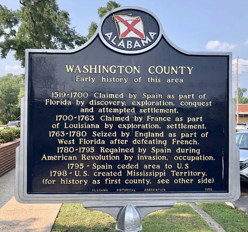
Washington County Marker (reverse)
RANKED BY RELEVANCE
| On Court Street north of Central Avenue (Alabama Route 56), on the left when traveling north. |
| On Saint Stephens Avenue at Howell Road, on the right when traveling north on Saint Stephens Avenue. |
| On Old Saint Stephens Road at Jim Long Road when traveling east on Old Saint Stephens Road. |
| On Old Saint Stephens Road 1.2 miles east of Cement Plant Road, on the right when traveling west. |
| On East Washington Street, on the right when traveling east. |
| On Holmes Valley Road 0.2 miles east of Reno Road, on the left when traveling east. |
| On Red Fox Road 3.2 miles west of U.S. 43, on the right when traveling west. |
| On Roy's Store Road at Patton Road, on the left when traveling north on Roy's Store Road. |
| On State Highway 36 south of Jungle Lane, on the right when traveling north. |
| On Cummings Street (Alternate U.S. 58) at Mont Calm Street, on the right when traveling west on Cummings Street. |
| On U.S. 231 0.2 miles north of State Route 36, on the right when traveling north. |
| On U.S. 84 at River Street, on the right when traveling west on U.S. 84. |
| On Farm to Market Road 531 0.2 miles south of Alternate U.S. 77, on the left when traveling north. |
| On County Route 203 at Peaceful Valley Road, on the right when traveling west on County Route 203. |
| Near MP Daniel Esplanade at South 5th Street, on the right when traveling north. |
| On County Road 28 2.5 miles east of State Route 95, on the right when traveling east. |
| On Omussee Creek Road 0.5 miles north of Picnic Road, on the right when traveling north. |
| On Court Street at Central Avenue (Alabama Route 56), on the left when traveling north on Court Street. |
| Near West G Street (Tennessee Route 67) 0.1 miles west of Sabine Street, on the left when traveling west. |
| On State Highway 7 at Ebenezer Church Road (County Highway 462), on the right when traveling east on State Highway 7. |
| On Rabon Chapel Road 0.4 miles west of South Pine Lake Road, on the left when traveling east. |
| On Farm to Market Road 1161 0.4 miles east of Farm to Market Road 102, on the right when traveling east. |
| On County Road 430 0.6 miles south of County Road 248, on the left when traveling south. |
| On 4th Avenue (U.S. 11) 0.6 miles north of Longshore Drive, on the right when traveling north. |
| On New York State Route 32 at Herkimer Street, on the right when traveling south on New York State Route 32. |
| On 6th Avenue North, on the left when traveling north. |
| On Alabama Route 56 0.8 miles west of U.S. 43, on the right when traveling east. |
Thin black lines indicate changes in relevance. Between each pair of lines entries are ordered geographically but all have the same relevance.* Inflectional forms of words are their plurals, singulars, and possessives as well as gramatical tenses and similar variations.
Nov. 13, 2026
