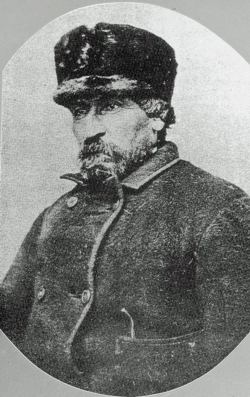
Pierre Bottineau, son of Charles Joseph Bottineau, a French-Huggenot and Marguerite Adhik Songab (Clear Sky Woman) a Lake of the Woods Chippewa, was born near the mouth of the Turtle River (twelve miles north of Grand Forks, North Dakota). . . . — — Map (db m231815) HM
Erected in 1954 by the Bottineau County Old Settler’s Association and friends, as a memorial to our pioneer settlers who met the toil, trials, hazards and wants of life; who broke the sod with oxen or horses; built their homes of sod or logs as a . . . — — Map (db m231821) HM
1887 Patrick McHugh 1888 Joseph B. Boyd • Established retail store at this site 1925 John J. & Richard Boyd • Golden Rule Store 1936 Kathren Boyd 1974 Richard S. Johnson • JC Penny Store 1992 Jon Brosseau 2000 Wm. Bodelson, Hans & Diane . . . — — Map (db m206400) HM
When Cavalier County was being settled in the 1880s, spring wheat and durum were the primary crops. Other crops produced were barley, flax, and oats. Major changes in farming operations took place in the 1910s. On-farm grain storage became . . . — — Map (db m214097) HM
Alsen/Storlie (est. 1905) This Soo Line Railroad townsite was named for local settlers who came from Alsen Island off the coast of Denmark. Alsen reached a peak population of 358 in 1930. Ambro (1891-1901) This small Bohemian settlement . . . — — Map (db m214096) HM
1738 • The first known white, non-native men to have set foot in Cavalier County were those in the Verendrye expedition. Through researching journals, it is believed that the expedition passed through Cavalier County in November of 1738 and . . . — — Map (db m214094) HM
One of a kind While original plans called for twelve sites, on May 26, 1972, an interim agreement that came out of the Strategic Arms Limitations Talks I (SALT 1) was signed. The Anti-ballistic Missile (ABM) Treaty limited strategic missile . . . — — Map (db m214102) HM
On this day we honor the memory of those who lost their lives in the Cyclone of May 29, 1909 Mrs. J.B. (Gertrude) Boyd Mrs. F.W. (Rebecca) Bleakley Donalda Sheehan Agnes Bain Joseph Power, Jr. and give thanks for those who persevered to rebuild . . . — — Map (db m206431) HM
Not much is known of the very early history of Cavalier County. The Sioux are believed to have been the earliest residents. The first known white men to have set foot in Cavalier County were those in the Verendrye expedition, which camped in the . . . — — Map (db m214095) HM
In a 1974 North Dakota State University interview-poll of long-time residents, newcomers, and local officials, four out of five respondents indicated that the overall effect of the Safeguard project had been beneficial in terms of the . . . — — Map (db m214104) HM
Located along the northeastern edge of North Dakota, just south of the US-Canadian border, Cavalier County is a vibrant, thriving place to live, work, and visit. As of 2020, population was estimated at 3,800. Agriculture drives the local economy . . . — — Map (db m214098) HM
Ballistic Missile Development WWII spurred a huge leap in missile technology. During the last months of WWII, the Germans introduced the V2, which is considered the first ballistic missile. At the conclusion of WWII, German V1 and V2 rockets . . . — — Map (db m214099) HM
1 • The Perimeter Acquisition Radar (PAR) performed long-range surveillance detection and tracking of ICBMs for interception. The PAR scanned an area of more than 1,000 miles for incoming missiles over the North Pole. Identified . . . — — Map (db m214103) HM
This property has been placed on the National Register of Historic Places by the United States Department of the Interior November 25, 1980 — — Map (db m209445) HM
This missile is a full-scale model of a United States Army interceptor called a Spartan. Cavalier Air Force Station was originally part of a 6-part system known as SAFEGUARD designed to provide an anti-ballistic missile capability for defending . . . — — Map (db m209099) HM
This is the location of a log church constructed in 1885 under the direction
of Rev. Ransom Waite, a Presbyterian minister. The land for the
church and cemetery was deeded by Mary and Wm. Gavin. Timber for the log
church was cut locally and . . . — — Map (db m286015) HM
The first church in the northwest stood about three hundred feet
east of this marker. It was founded in 1818 by Father Joseph Dumoulin,
along with a school and cemetery. The site was abandoned after the
boundary survey and was not used until . . . — — Map (db m286060) HM
Site of "Fort Panbian", a Northwest fur trading post built by Charles Baptiste Chaboileez in 1797. In 1801 Alexander Henry Jr. built a fur trading post on the north side of the Pembina River for the Northwest Fur Company Opposition posts operated . . . — — Map (db m286063) HM
Marie Bottineau Baldwin, born Pembina 1863. Ojibwa attorney, suffragist. Stated Native women had “virtual suffrage since time immemorial.” — — Map (db m205232) HM
In honor of Walter Welford, the twentieth governor of North Dakota (1935-1936) and resident of the town of Pembina, Governor George A. Sinner planted this tree on September 30, 1992. A tree was planted in the hometown of every North Dakota governor . . . — — Map (db m306006) HM
Between 1843 and 1873, this house and store owned by Antoine B. Gingras served the Metis community in the northern Red River Valley.
The Metis emerged from the fur trade of the early 19th Century. Descended from French and British traders . . . — — Map (db m305666) HM
This warehouse is the eldest building in North Dakota having been
built about 1851 by Norman Kittson agent for the American Fur
Company. This building was originally built on the townsite of
Walhalla, then called St. Joseph, adjoining Father . . . — — Map (db m286014) HM
[English] Founders We dedicate this monument to the memory of the Finnish pioneers who came here in 1896 and after. They tilled this soil with oxen and horses and lived in houses of earth sod. Through their early . . . — — Map (db m231967) HM
This American Legion Memorial Band Shelter is Dedicated to: The Hal Parker Post #79 American Legion and all Veterans The Hal Parker American Legion Post #79 was named after Harold Malloy Parker who was the first Soldier from Cando, ND killed in . . . — — Map (db m231868) HM WM