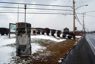
On Duss Avenue at Anthony Wayne Drive, on the left when traveling north on Duss Avenue.
On the plateau, southwest of this spot, was
situated the camp of the army of General Anthony Wayne. This army, known as the Legion of the United States, encamped at this place when on the expedition against the Indians west of the Ohio from . . . — — Map (db m40299) HM
On Duss Avenue, on the right when traveling south.
Site of Anthony Wayne's training camp, for the "Legion of the United States" November 1792 to April 1793-his legion trained here to prepare for the Battle of Fallen Timbers on August 20, 1794. Wayne chose this site adjacent to abandoned Logstown, . . . — — Map (db m40230) HM
On Ohio River Boulevard (Pennsylvania Route 65) at Logan Lane, on the right when traveling east on Ohio River Boulevard.
This cemetery was originally part of the Depreciation Lands (Leet's District), Tract #22, and was surveyed by Daniel Leet in 1785. Known as "McKean", it was patented to Governor Thomas McKean for his service in the American Revolution. After his . . . — — Map (db m46823) HM
On Broadway at Arch Street, on the left when traveling south on Broadway.
Beneath this building lies the powder magazine of Fort Washington, the major military outpost of the United States in the Northwest Territory, 1789-1808. The magazine was uncovered in October, 1952 when footers were being excavated. It is the only . . . — — Map (db m24948) HM
Southwest of Lytle was Fort Washington, built in 1789 and 1790 and named for President George Washington. The fort protected settlers in the new Ohio country from Indian attacks. It became the base headquarters for the Indian campaigns of Generals . . . — — Map (db m24891) HM
Regular and militia troops under General James Wilkinson built this supply post and defensive fortification in March 1792 in preparation for Gen. “Mad Anthony” Wayne's campaign against the Indians of the Northwest Territory, following . . . — — Map (db m19152) HM
A Witness
Nov. 6. 1792
The International Society of Arborculture and the National Arborist Association jointly recognize this significant tree in this bicentennial year as having lived here during the American Revolutionary Period.
1776 - . . . — — Map (db m19161) HM
On Weavers-Fort Jefferson Road 0.1 miles west of Route 121, on the left when traveling west.
Fort Jefferson. During the Indian Wars of 1790-1795, the United States built a chain of forts in the contested area of what is today western Ohio. These forts were built as a result of various tribes of the region attacking the encroaching . . . — — Map (db m20254) HM
Near Weavers-Fort Jefferson Road 0.1 miles west of Route 121, on the left when traveling west.
Built by the Army of
General Arthur St. Clair
in October 1791
and used as a military post
during the campaigns against
the North-Western Indian tribes
MCMVII — — Map (db m19885) HM
On Weavers-Fort Jefferson Road 0.1 miles west of Route 121, on the left when traveling west. Reported permanently removed.
Fort Jefferson was just a link in a chain of forts stretching north from Fort Washington (Cincinnati) to Fort Deposit (Waterville).
During the Indian War of 1790-1795, the United States felt it necessary to build forts in contested . . . — — Map (db m306303) HM
On South Broadway Street (Ohio Route 49) at West Main Street, on the right when traveling south on South Broadway Street.
Site of
Fort Greene-Ville
»»««
The largest pioneer fort
in Ohio, built in 1793, by
General Anthony Wayne.
Here, August 5, 1795, the
Treaty was signed by which
much of present Ohio was
opened to White . . . — — Map (db m19878) HM
On Ohio Route 49 2.2 miles north of Route 47, on the left when traveling north.
The army of Major General Anthony Wayne camped on the rising ground immediately eastward on the night of July 28th, 1794 A.D. After advancing twelve miles from headquarters at Fort Greene Ville on the expedition against the Indian tribes of the . . . — — Map (db m20252) HM
On County Route 171 0.2 miles south of County Route 177, on the left when traveling north.
The Indians in early times plied the Auglaize River as they traveled between the Ohio and the Great Lakes. The French, the British, and then the Americans came into the valley as they succeeded in conquering the land. In the Indian Wars (1790 - . . . — — Map (db m19327) HM
On Fort Street at Washington Avenue, on the right when traveling west on Fort Street.
Fort Defiance
The arrival of the Legion of the United States at this point on August 8, 1794 marked the end of General Anthony Wayne's difficult march, through swamps and forests, from Fort GreeneVille. On this site, in the center of the . . . — — Map (db m239102) HM
On Fort Street at Washington Avenue, on the right when traveling west on Fort Street.
Fort Defiance was erected upon this site by General Wayne August 9-17, 1794 and thus "The Grand Emporium of the hostile Indians of the west was gained without loss of blood."
From this point General Wayne advanced against the Indians and . . . — — Map (db m18751) HM
On South River Road (U.S. 24) at Waterville Monclova Road, on the left when traveling west on South River Road.
Fort Deposit
Gen. Mad Anthony Wayne built Fort Deposit near here on Aug. 19, 1794 when advancing against theforces ofthe hostile Indian Confederacy gathered at the foot of the Rapida. The following day, leaving Capt. Zebulon Pike with 200 . . . — — Map (db m19589) HM
On Fallen Timbers Lane 0.5 miles north of U.S. 24, on the left when traveling west. Reported permanently removed.
Resentment by the Indians against white encroachment reached a peck in the 1790’s. Encouraged by the British, they began to raid settlements. Two poorly organized American military campaigns, led by General Josiah Harmar in 1790 and Governor Arthur . . . — — Map (db m256260) HM
Near State Park Road 0.1 miles south of Fallen Timbers Lane.
(Front)
The Greenville Treaty
To General Anthony Wayne who organized the “Legion of the United States” by order of President Washington and defeated Chief Little Turtle’s warriors here at Fallen Timbers August 20, 1794. . . . — — Map (db m8175) HM
Near Fallen Timbers Lane 0.5 miles north of U.S. 24, on the left when traveling west.
On the Battlefield of Fallen Timbers, in unmarked graves, rest the brave soldiers of General Anthony Wayne's Legion of the United States and the Kentucky Volunteers, who were killed on August 20, 1794, in the victorious conflict with the Indians and . . . — — Map (db m181774) HM
Near Fallen Timbers Lane 0.5 miles north of U.S. 24, on the left when traveling west.
On this rock according to tradition, Chief Turkey Foot of the Ottawa Indians rallied his warriors during the Battle of Fallen Timbers. Here he was killed and for many years tribesmen made offerings of tobacco on the rock to appease the Great . . . — — Map (db m19572) HM WM
On River Road at Michigan Avenue, on the left when traveling south on River Road. Reported permanently removed.
On this site in 1794, the British built Fort Miamis to block Gen. Anthony Wayne's expected march on Detroit. Its strategic location commanded both the land and water routes in the Maumee Valley. The post, constructed after the manner of the noted . . . — — Map (db m236317) HM