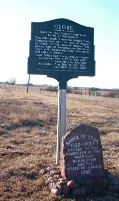
Santa Fe Trail followed high land to the SW of this marker.
Two miles south of here the Marion Town Company laid out the Town of Marion in honor of Gen. Francis Marion, "The Swamp Fox" of Revolutionary War fame. Town well, Blacksmith Shop, two . . . — — Map (db m19729) HM
Erected this building and opened its door for instruction November 22, 1858
Werner Renick Davis, President
The trustees realizing their financial inability to construct a building to meet their dreams of the future requirements of the . . . — — Map (db m19976) HM
This place holds many meanings to the many peoples who have called this region home. Through the 1700s, this area was part of the Kanza (today known as the Kaw Nation) homeland where they lived, farmed, and traded in towns along the Missouri . . . — — Map (db m287468) HM
Lynching in America.
In 1861, after a violent struggle over whether to legalize slavery, Kansas entered the Union as a free state, and the false belief grew that the state welcomed free Black people. Following the end of the Civil War in . . . — — Map (db m287470) HM
After escaping from Fort Robinson on January 9, 1879, the Cheyennes climbed the buttes to the south and fled through this area, pursued by Third Cavalrymen. Soldiers and Cheyennes fought sharp engagements west of here on January 11 and 13. The . . . — — Map (db m235873) HM
Constructed in 1912 for Perkins Loan and Trust Company 1912-1914
Kansas Electric Power Company (later Kansas Power & Light) 1924-1960
Douglas County Title Company 1977-1996 — — Map (db m76298) HM
Samuel Jones was an entrepreneur. He constructed Constitution Hall in 1856 and it is now a National Landmark. He was appointed Sheriff of Douglas County, Kansas, in 1856 by Territorial Governor Daniel Woodson. Sheriff Jones enforced the laws of the . . . — — Map (db m119138) HM
In 1855 the new town of Lecompton became the capital of Kansas Territory. President James Buchanan appointed a governor and officials to establish government offices in Lecompton, and construction began on an elegant capitol building. In the fall . . . — — Map (db m287500) HM
On the afternoon of September 14th, 1856, the Free State settlement of Lawrence, Kansas Territory was threatened with invasion by an army of 2700 Pro-slavery Missourians under the command of Generals David R. Atchison and John W. Reid. Encamping . . . — — Map (db m76325) HM
This is the oldest surviving courthouse designed by George P Washburn of Ottawa. Before coming to town, Washburn had worked for the Kansas City architectural firm of Cross and Taylor where he supervised construction of Union railroad depots . . . — — Map (db m67586) HM
Shawnee Tribal Leader Paschal Fish and his daughter, Eudora
This statue has been created to commemorate the 150th anniversary of the City of Eudora (1857-2007). The statue portrays Shawnee Tribal Leader Paschal Fish and his daughter, . . . — — Map (db m239853) HM
South of this park are 18 acres of virgin prairie. Purchased 1967 by Douglas County from Russell Hays for a permanent prairie preserve and historic site. Evidence of Santa Fe Trail plainly visible. Original site of DAR marker was near pioneer . . . — — Map (db m20062) HM
The current structure at 719 Main dates to the early 20th century. In the building's early days, it was used as a barber shop and a furniture warehouse. In the last several decades, the building has been home to numerous restaurants, most notably . . . — — Map (db m76468) HM
This building was completed around 1915 when the Trefz Variety Store was founded by William Trefz. Carl Trefz later operated the store until 1976. Numerous businesses including hardware stores, antique stores and coffee shops later operated at . . . — — Map (db m76471) HM
The reasons for Douglas County’s popularity in the late twentieth century-rolling landscapes, pastoral scenery, and the proximity to a big city-also attracted late-nineteenth century settlers. In November 1861, territorial legislators created . . . — — Map (db m46117) HM
Panel 1
Russellville
For a few exciting months, Russellville felt like Colorado's gold-rush capital. The town rose five miles southeast of here in late 1858, after William Green Russell discovered a few gleaming . . . — — Map (db m97969) HM
Recognizes the extraordinary sacrifices of ordinary citizens - men and women of Douglas County, Kansas who gave their lives to protect freedom, our community and our way of life. It stands as an eternal symbol of hope, renewal and the indomitable . . . — — Map (db m50822) WM
A geologic phenomenon known as a “glowing avalanche” formed Castle Rock and the other buttes of Douglas County 36.7 million years ago. A volcanic eruption near Mount Princeton, about 95 miles southwest of here, spewed a frothy, gleaming cloud of . . . — — Map (db m46142) HM
Here in the heartland of the Missouri Ozarks, Douglas County was organized in 1857 and named for statesman Stephen A. Douglas. Southern pioneers, attracted by forested hills, abundant game, spring-fed streams, fertile valleys, were first settlers . . . — — Map (db m189740) HM
This Union Walk is a reminder to all of our citizens, as well as a salute to the unionized men and women from all walks of life, who invested their energy, the sweat of their brow, and sometimes even their lives to forge a better life for . . . — — Map (db m63498) HM
Thin black lines indicate changes in relevance. Between each pair of lines entries are ordered geographically but all have the same relevance.
* Inflectional forms of words are their plurals, singulars, and possessives as well as gramatical tenses and similar variations.