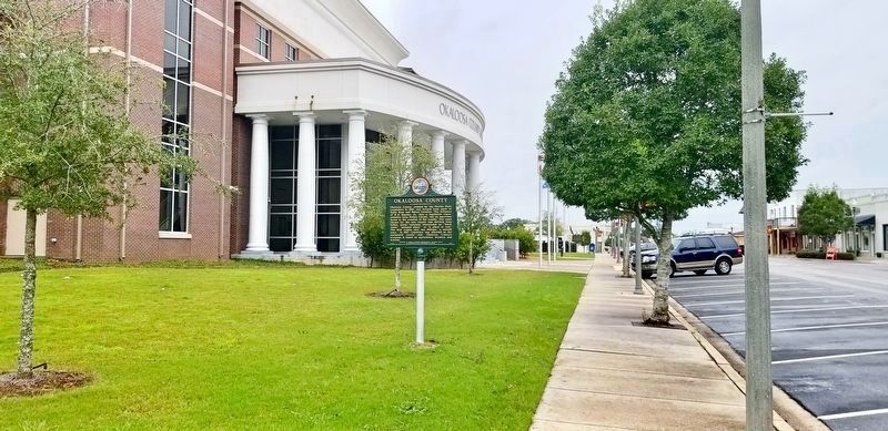
Near Main Street south of James Lee Boulevard (U.S. 90), on the left when traveling south.
Okaloosa County, created by the Florida State Legislature in 1915, was formed from parts of Santa Rosa and Walton Counties. The influence of W.H. Mapoles, Sr., then a legislative representative from Walton County, was an important factor in the . . . — — Map (db m72555) HM
Near Sunray Road 0.6 miles south of Mahan Drive (U.S. 90), on the right when traveling south.
If you were able to travel back in time over 1,100 years to the peak period of the Weeden Island civilization, you would witness the construction of one of the greatest feats of American Indian architecture in the region now known as Florida. You . . . — — Map (db m153298) HM
Near Main Street at West Pine Avenue, on the left when traveling south.
Okaloosa is one of the newer counties of northwest Florida. It was created by the State Legislature in 1915 from land taken from Santa Rosa and Walton Counties. The influence of State Senator W.H. Mapoles of Crestview was an important factor in the . . . — — Map (db m72554) HM
Near Miracle Strip Parkway, SE (U.S. 98) 0.8 miles east of Pier Road, on the right when traveling east.
• Created out of the frustrations of racial segregation, John C. Beasley State Park opened in 1960 as an area “For Colored Only,” as the Highway 98 gated entrance sign read. The Park resulted from the efforts of members of the Negro community and . . . — — Map (db m192251) HM
On Bayshore Drive at Armstrong Avenue, on the right when traveling south on Bayshore Drive.
Niceville was the center of the commercial fishing industry of the Choctawhatchee Bay region, the basis of the community’s prosperity. Mail service here was established in 1868. The schooner Bera Attious was built at the shipyard here in 1888. . . . — — Map (db m212245) HM
On 14th Street 0.1 miles east of Madison Street, on the right when traveling east.
The Town of Baker, a stop on the Florida, Alabama and Gulf Railroad, was platted in 1910 and grew up around the timber and turpentine industries. The site of the original Baker High School was owned by J.W. and Mollie McCart who sold the property . . . — — Map (db m73955) HM
On West John Sims Parkway at Evans Street on West John Sims Parkway.
This statue is dedicated to honor the enrollees of CCC Camp Bigby, established May 19, 1933. Company 1402 Forest-3 served from 1933-1939. Company 1413 Army-1 served from 1940-1942. A temporary camp was set up on the grounds of the old Niceville High . . . — — Map (db m192249) HM
On Courthouse Terrace at Main Street, on the right when traveling south on Courthouse Terrace.
In memory of those who
made the supreme sacrifice
in all wars, POW and MIA
World War I
Cain, William R. USA · Harris, George O. USA
Cederstrom, Oscar. USA · Henderson, Horace J. USA
Copeland, Ernest USA · Hooten, Ralph . . . — — Map (db m99255) WM
On Mc Griff Street Northeast at Carson Drive Northeast, on the right when traveling west on Mc Griff Street Northeast.
In 1938, members of Beulah Baptist Church established the only school
for Black students in Fort Walton Beach. For many years, due to racial
segregation, classes were held in private homes and later within the church.
In 1952, Fort Walton Beach . . . — — Map (db m308881) HM
On Florida 85 just north of Lewis Street, on the left when traveling north.
In May 1924, George Nathey conveyed seven acres to the Okaloosa County
Board of Public Instruction for a school site. Completed in 1925, the school
faced Niceville Avenue, but fire destroyed the building in 1926.
It was
rebuilt and ready for . . . — — Map (db m308879) HM
On 12th Avenue 0.2 miles south of 40th Street, on the right when traveling south.
While United States Lines focused their freight business at Pier 76, the company's transatlantic passenger service was based at Pier 86. Designed by naval architect William Francis Gibbs of Gibbs & Cox and completed in 1952, the S.S. United . . . — — Map (db m198926) HM
Thin black lines indicate changes in relevance. Between each pair of lines entries are ordered geographically but all have the same relevance.
* Inflectional forms of words are their plurals, singulars, and possessives as well as gramatical tenses and similar variations.