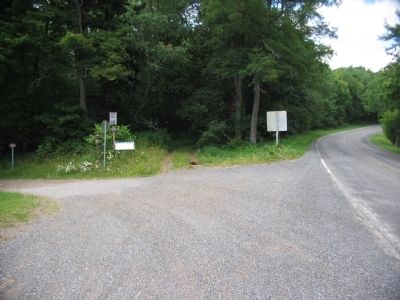
Two miles west on the former Staunton-to-Parkersburg Turnpike is Camp Allegheny, the highest Civil War fortification east of the Mississippi. Its rolling meadows and spectacular views belie a punishing winter climate. The turnpike was completed in . . . — — Map (db m32880) HM
Confederate forces led by Col. Edward Johnson held a fortified camp here in winter of 1861-62. Sharp attack occurred, Dec. 13, 1861, in which the Union troops under Gen. Robert Milroy were beaten off. — — Map (db m32890) HM
Camp Allegheny, also known as Camp Baldwin and Camp Johnson, was constructed in the summer of 1861 by Confederate forces in order to control the Staunton-Parkersburg Turnpike. (present day Pocahontas County Route 3). Following the October 3, 1861 . . . — — Map (db m32895) HM
Hugh "Squire" McGlaughlin skillfully built this cabin using simple hand tools. In 1850, Squire McGlaughlin built this log home in Marlin's Bottom for his family. A few years later, it would also welcome weary travelers along the . . . — — Map (db m251874) HM
Wherever you are, you are in a watershed. It is the land area and water that drains into a common stream, lake and river. This includes water flowing on the surface and water underground.
As above.. The people of the Greenbrier River . . . — — Map (db m298449) HM
Home of Anna Wallace (1867-1952), in 1922 the first woman elected as Superintendent of Schools for Pocahontas County. Ten women were elected county superintendents in 1922, the first year WV women were able to run for that office after passage of . . . — — Map (db m104285) HM
Marlinton
“There ain’t no G in MARLINTON!”…so wrote Andrew Price, the first mayor of Marlinton. The town gets its name from Jacob Marlin who arrived here in 1749 with Stephen Sewell and built a cabin near the mouth off the . . . — — Map (db m155089) HM
In the spring of 1861, Union forces rushed into northwestern Virginia to secure the vital Baltimore and Ohio Railroad, protect important turnpikes, and support Unionists against Confederates. The two sides fought numerous engagements . . . — — Map (db m259967) HM
West Virginia (Pocahontas County). "The Mountain State" ~ western part of the Commonwealth of Virginia until June 20, 1863. Settled by the Germans and Scotch-Irish. It became a line of defense between the English and French . . . — — Map (db m32908) HM
John D. Sutton, 10th West Virginia Infantry, wrote, "The army went into camp in the levels between Mill Point and Hillsboro." These fields were later owned by 2nd Lt. Matthew John McNeel, Company F, 19th Virginia Cavalry, and the Capt. . . . — — Map (db m34146) HM
West Virginia (Pocahontas County). "The Mountain State" ~ western part of the Commonwealth of Virginia until June 20, 1863. Settled by the Germans and Scotch-Irish. It became a line of defense between the English and French . . . — — Map (db m34233) HM
If you look closely, you can see the ruins of the vault of an old general store. This is the last large landmark remaining from the town of "Watoga.” In 1922, 51 African American coal miners and their families moved from Mercer County into an . . . — — Map (db m179270) HM
Pocahontas County. Formed from Bath, Pendleton and Randolph in 1821. Named for Pocahontas, Indian princess, friend of the Jamestown settlers. Site of Droop Mountain battle, November 6, 1863. The famous Cranberry Glades are in this county.
. . . — — Map (db m165104) HM
Nearly five months after West Virginia was admitted into the Union, the Confederate army of Brigadier General John Echols still occupied the prosperous Greenbrier Valley region of the new state. From its headquarters in Lewisburg, his army was . . . — — Map (db m34380) HM
Nearly five months after West Virginia was admitted into the Union, the Confederate army of Brigadier General John Echols still occupied the prosperous Greenbrier Valley region of the new state. From its headquarters in Lewisburg, his army was . . . — — Map (db m34382) HM
Nearly five months after West Virginia was admitted into the Union, the Confederate army of Brigadier General John Echols still occupied the prosperous Greenbrier Valley region of the new state. From its headquarters in Lewisburg, his army was . . . — — Map (db m34393) HM
We invite you to immerse yourself in the rich history, the incomparable
beauty and the warm hospitality of Pocahontas County, West Virginia
Splash in a cold mountain stream, fish in a pristine river, or sleep under the
stars. Glimpse the past at . . . — — Map (db m164965) HM
On April 20, 1863, Confederate Gens. William F. “Grumble” Jones and John D. Imboden began a raid from Virginia through present-day West Virginia on the Baltimore and Ohio Railroad. Taking separate routes, they later reported that they . . . — — Map (db m58229) HM
During the war, Union and Confederate forces crossed the Greenbrier River covered bridge many times to attack and counterattack through Pocahontas County. This area was then called Marlin's Bottom, on or near three turnpikes. Across the river, the . . . — — Map (db m179229) HM
River Formation
Prior to the glaciers (more than 780,000 years ago), the ancestral Monongahela River flowed from present day north central West Virginia across Pennsylvania and northwest Ohio. Extensive ice sheets dammed the old north . . . — — Map (db m230986) HM
Caldwell on Scribner's Magazine Cover
Caldwell, located two and a half miles east of Lewisburg, gets its name from James R. Caldwell, whose family owned and occupied the stately brick house, "Elmhurst," on the bank of the Greenbrier River. . . . — — Map (db m238237) HM
Over 300 milion years ago during the Carboniferous Period, the landscape of what is now West Virginia looked much different. During the Pennsylvanian sub-period (323.2-298.9) million years ago), vast forests of strange looking plants surrounded . . . — — Map (db m238305) HM
Thin black lines indicate changes in relevance. Between each pair of lines entries are ordered geographically but all have the same relevance.
* Inflectional forms of words are their plurals, singulars, and possessives as well as gramatical tenses and similar variations.