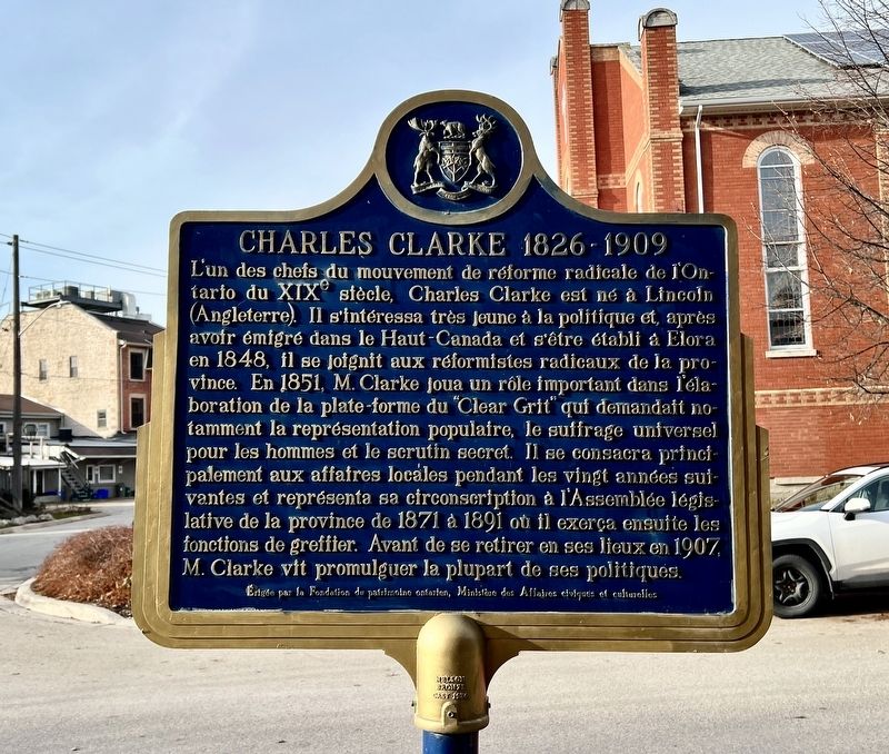
On Church Street at Geddes Street, on the right when traveling east on Church Street.
A leader in the radical reform movement in 19th-century Ontario, Clarke was born in Lincoln, England. In his youth he developed a keen interest in politics and, after emigrating to Upper Canada and settling in Elora in 1848, he joined . . . — — Map (db m289250) HM
On Metcalfe Street at Carlton Place, on the left when traveling north on Metcalfe Street.
Arthur A. Badley
Arthur A. Badley (1895-1972) served in WW1 and later worked at J. C. Mundell Furniture. Manufacturers located in the industrial buildings south and west of the Victoria Street bridge. Throughout his lifetime he was an active . . . — — Map (db m289124) HM
On Geddes Street at Henderson Street, on the right when traveling south on Geddes Street.
Born in Scotland, Boyle came to Canada in 1856 and settled in this area. As a local school teacher, he began an extensive collection of native artifacts and became an archaeological authority. Boyle moved to Toronto in 1883 and three years later was . . . — — Map (db m312201) HM
Although it is one of the main tourist attractions in our area, human impact on this section of the gorge has not always been a story we are proud to tell. To early pioneers, trees were an obvious impediment to farming and a nuisance obstructing . . . — — Map (db m289363) HM
On Geddes Street at Metcalfe Street, on the right when traveling south on Geddes Street.
[east side]
In Memoriam
The Glorious Dead
1939 - 1945
E. Grant Aitchison ·
Russell B. Beirnnes ·
Gordon C. Bricker ·
William Brown ·
Billie C. Duncan ·
William J. Kay ·
Thomson H. Rennie ·
John R. Runnells ·
John C. . . . — — Map (db m289531) WM
On Metcalfe Street 0.1 kilometers north of Water Street East, on the right when traveling north.
Elora Drill Shed
This handsome stone structure, built in 1865, is a rare surviving example of early drill hall architecture in Canada.
During the 1860s, the American Civil War and the Fenian raids raised fears for the defence of . . . — — Map (db m286564) HM
Near Mill Street West, on the left when traveling south.
The former Victoria Street bridge was built in
1842 and was the primary crossing over the Grand
River for over 100 years. It was reconstructed
several times and in 1871 the stone piers were built.
It was rebuilt again in 1899 as a four span . . . — — Map (db m289241) HM
On Geddes Street at Colborne Street, on the right when traveling south on Geddes Street.
Captain William Gilkison (1777-1833) was born in Ayrshire, Scotland, and emigrated to North America in
1796. He served with the British forces in the War of 1812 as an assistant quartermaster-general, and in 1832 purchased some 14,000 acres of land . . . — — Map (db m289333) HM
On Metcalfe Street at James Street, on the right when traveling south on Metcalfe Street.
James J. Kirby, an Irish immigrant and grocery clerk, constructed this building in 1877-1876 and opened a wholesale and retail liquor: store here, the first in Elora. Before this, liquor had been sold as a sideline in grocery stores. Later, Kirby . . . — — Map (db m289358) HM
The beauty of Elora's rivers and cliffs has long distinguished it from other villages. Lover's Leap was named by the village's 19th-century residents who came to terms with Ontario's long Indigenous history by conflating it with the natural . . . — — Map (db m289362) HM
On Geddes Street at Church Street, on the right when traveling north on Geddes Street.
For most of the 19th century, lower Geddes Street was primarily a residential neighbourhood.
Its most prominent family lived in a large brick dwelling with expansive gardens on the southeast corner of Geddes and Church Streets. The head of the . . . — — Map (db m289272) HM
On Metcalfe Street at Church Street West, on the right when traveling south on Metcalfe Street.
Enterprising businessmen began to locate on Metcalfe Street in the early 1860s. The lower section extended from the Mill Street intersection up the hill as far as Church Street. For more than a century, the street ended at the river (see photo) . . . — — Map (db m289407) HM
On Mill Street West at Metcalfe Street, on the right when traveling east on Mill Street West.
Shops along Mill Street began to compete with Elora's older business district, across the Grand River on Victoria Street, in the late 1850s. New buildings near Victoria Bridge here, mainly constructed of limestone from the riverbank, first appeared . . . — — Map (db m289211) HM
On Geddes Street at Henderson Street, on the right on Geddes Street.
When this part of Geddes Street was developed, its shops were built exclusively on the east side. During the 19th century, the west side of the street, from the Town Hall to the intersection of
Henderson Street, consisted of cattle pens and open . . . — — Map (db m289364) HM
On Metcalfe Street at James Street, on the right when traveling south on Metcalfe Street.
This section of Elora's main thoroughfare features three grand old hotel buildings.
Perched at the top of the hill, the eloquent Dalby House Hotel overlooks the village centre. This distinctive, two-tone brick flat iron building was erected by . . . — — Map (db m289390) HM
On James Crescent at Victoria Crescent, on the right when traveling south on James Crescent.
Welcome to Victoria Park.
This park provides some
of the best vantage
points from which you may
enjoy the natural beauty of the Elora Gorge.
Perched adjacent to the Gorge the park
offers you spectacular views of 25m (80ft)
limestone cliffs, . . . — — Map (db m289359) HM
On Mill Street West 0.1 kilometers west of Metcalfe Street, on the right when traveling east.
The original bridge at this site was constructed in 1842. The cut-stone piers that remain supported the third and fourth bridges built here in 1871 and 1899 respectively. With the completion of the Metcalfe Street bridge in 1954, the Victoria Street . . . — — Map (db m289238) HM
On Metcalfe Street (County Road 18) at Geddes Street, on the right when traveling south on Metcalfe Street.
This convergence of streets has, at various times, been called, “Business Corners”, “The Crescent” and “Market Square”. For most of the 19th century, the west side of Geddes Street was known as the Fair Grounds, home to the Monthly Cattle Fair and . . . — — Map (db m196210) HM
On Geddes Street at Colborne Street, on the right when traveling north on Geddes Street.
This drinking fountain was erected in
1954 A.D. and donated to the Village
of Elora by Norman Stafford in memory
of the founders of our village, those God
fearing men and women who have left
us a great heritage and of the Stafford
family, who . . . — — Map (db m289409) HM