Marker Logo HMdb.org THE HISTORICAL
MARKER DATABASE
“Bite-Size Bits of Local, National, and Global History”


26 entries match your criteria.  


Related Historical Markers

Markers related to the 1862 Antietam Campaign in Washington Co, Maryland, outside the Antietam Battlefield.
 
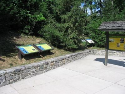
Washington Monument Marker Flanked by Interpretive Markers image, Touch for more information
By Craig Swain, July 21, 2007
Washington Monument Marker Flanked by Interpretive Markers
SHOWN IN SOURCE-SPECIFIED ORDER
1 Maryland, Washington County, Boonsboro — Washington MonumentSignal Station — Antietam Campaign 1862 —
On Washington Monument Road, on the right.
2 Maryland, Washington County, Boonsboro — Washington MonumentSignal Station — Antietam Campaign 1862 —
On North Main Street / Old National Road (Alternate U.S. 40), on the right when traveling south.
3 Maryland, Washington County, Boonsboro — BoonsboroLee's Headquarters — Antietam Campaign 1862 —
On Old National Pike (Alternate U.S. 40) 1.2 miles east of Gilardi Road, on the right when traveling east.
4 Maryland, Washington County, Hagerstown — Gen. Robert E. Lee
On Frederick Street (Historic National Road) (Alternate U.S. 40) near Kenly Avenue, on the right when traveling north.
5 Maryland, Washington County, Hagerstown — Antietam Battlefield
On South Potomac Street (Maryland Route 65) 0.1 miles south of Doub Way, on the right when traveling south.
6 Maryland, Washington County, Hagerstown — One of Lee’s Ammunition Trains
On Virginia Avenue (U.S. 11) at Bower Avenue, on the right when traveling south on Virginia Avenue.
7 Maryland, Washington County, Boonsboro — Stonewall Jackson's Way
On Old National Pike (Alternate U.S. 40) at Lappans Road (Maryland Route 68), on the left when traveling west on Old National Pike.
8 Maryland, Washington County, Boonsboro — The Battle of Antietam or Sharpsburg
On South Main Street (Alternate U.S. 40) west of Rohresville Road (Maryland Route 67), on the right when traveling west.
9 Maryland, Washington County, Funkstown — Civil War Hospital SiteAngela Kirkham Davis House
On Baltimore Street (Alternate U.S. 40), on the left when traveling west.
10 Maryland, Washington County, Hancock — Major James Breathed"Hardest artillery fighter the war produced"
On West Main Street (Maryland Route 144), on the left when traveling west.
11 Maryland, Washington County, Williamsport — Williamsport
On E. Potomac Street (U.S. 11) at Peachtree Lane, on the left when traveling east on E. Potomac Street.
12 Maryland, Washington County, Williamsport — C & O Canal AqueductStonewall Changes Course — Antietam Campaign 1862 —
13 Maryland, Washington County, Keedysville — KeedysvilleHeadquarters and Hospital Town — Antietam Campaign 1862 —
On Taylor Drive at North Main Street (Maryland Route 845), in the median on Taylor Drive.
14 Maryland, Washington County, Keedysville — Pry Mill
On Keedysville Road, 0.5 miles west of Shepherdstown Pike (Maryland Route 34), on the right when traveling east.
15 Maryland, Washington County, Keedysville — Civil War Hospital SiteSamuel Pry Mill
On Keedysville Road, 0.5 miles west of Shepherdstown Pike (Maryland Route 34), on the right when traveling east.
Paid Advertisement
16 Maryland, Washington County, Keedysville — Civil War Hospital SiteHoffman Farm
On Keedysville Road, on the right when traveling south.
17 Maryland, Washington County, Keedysville — Hitt-Cost House
On Keedysville Road, 0.5 miles west of Shepherdstown Pike (Maryland Route 34), on the right when traveling west.
18 Maryland, Washington County, Sharpsburg — Middle Bridge
On Boonsboro Pike (State Highway 34), on the right when traveling east. Reported missing.
19 Maryland, Washington County, Sharpsburg — 1862 Antietam CampaignLee Invades Maryland
On Shepherdstown Pike (Maryland Route 34), on the left when traveling north.
20 Maryland, Washington County, Sharpsburg — The Historic Grove House100 West Main Street
On North Main Street (County Road 34) at Mechanic Street, on the left when traveling west on North Main Street.
21 Maryland, Washington County, Sharpsburg — 1862 Antietam CampaignLee Invades Maryland
On Shepherdstown Pike (Maryland Route 34).
22 Maryland, Washington County, Sharpsburg — Antietam StationRailroad to Reunion — Antietam Campaign 1862 —
On Shepherdstown Pike (Maryland Route 34), on the left when traveling north.
23 Maryland, Washington County, Sharpsburg — Grove FarmA Visit from the President — Antietam Campaign 1862 —
On Shepherdstown Pike (Maryland Route 34), on the right when traveling north.
24 Maryland, Washington County, Sharpsburg — Ferry Hill Place(Built in 1812)
On Shepherdstown Pike (State Highway 34) east of Canal Road, on the left when traveling south.
25 Maryland, Washington County, Sharpsburg — Blackford’s Ford
On Shephardstown Pike (Maryland Route 34) at Canal Road, on the left when traveling south on Shephardstown Pike.
26 Maryland, Washington County, Sharpsburg — Packhorse Ford
Near Canal Road, on the right when traveling east.
 
 
CeraNet Cloud Computing sponsors the Historical Marker Database.
This website earns income from purchases you make after using our links to Amazon.com. We appreciate your support.
Paid Advertisement
May. 17, 2024