During the First and Second Battles of Fredericksburg, the Confederates occupied Marye’s Heights, a defensive position enhanced by a sunken road and stone wall on the eastern slope. On 13 Dec. 1862, during the first battle, Lt. Gen. James . . . — — Map (db m1672) HM
On December 13, 1862, Union troops poured out of Fredericksburg to attack Confederate forces behind the town. The heaviest blows fell here at Marye's Heights. For eight hours Union troops repeatedly charged the heights only to be slaughtered by the . . . — — Map (db m217992) HM
This photograph, taken from the heights to your right-rear, shows the landscape in front of you as it appeared the year after the Battle of Fredericksburg. The town of Fredericksburg sits atop the ridge in the distance; the spire of St. George's . . . — — Map (db m215580) HM
In 1862 the ground in front of you was an open plain stretching from here to the outskirts of Fredericksburg, one-half mile away. As Union troops left the town to attack Marye's Heights, they had to break ranks to cross a canal ditch, then knock . . . — — Map (db m8502) HM
You are now standing beside the Sunken Road, part of a heavily used 19th-century road system that linked Washington, D.C. and Richmond. In 1862, Confederate riflemen fired from the road upon line after line of Union troops advancing across open . . . — — Map (db m8510) HM
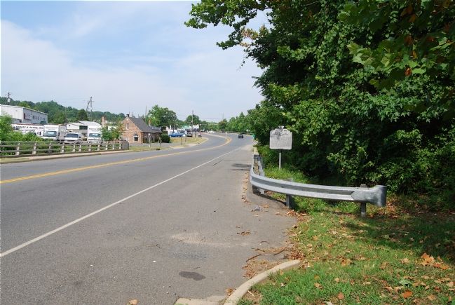
The monument across the road marks the spot where General Thomas R. R. Cobb suffered a mortal wound. A brilliant Constitutional lawyer prior to the war, he left his practice to take up arms for the South. At Fredericksburg Cobb fought his first . . . — — Map (db m8522) HM
The foundation outlined before you marks the wartime home of Edward and Martha Stephens. On December 13, 1862, the house was caught in the vortex of Union attacks against the Sunken Road. Confederate sharpshooters fired from the house windows and . . . — — Map (db m8550) HM
Buried here are eight members of the Innis, Mazeen, and Stephens families, including the most famous of them all: Martha Stephens. Local children knew Martha Stephens as "Granny." They also remembered her ever-present apron, the pipe often clenched . . . — — Map (db m8568) HM
9 ► Virginia, Fredericksburg — Innis House — The Battle of Fredericksburg — Fredericksburg and Spotsylvania National Military Park — Reported permanently removed
This frame building, known as the Innis (or "Ennis") house, stands as a mute witness to the terrible combat that engulfed this spot. Located along the Confederate line of battle, the small structure was marred by soldier graffiti and perforated . . . — — Map (db m8569) HM
The house and grounds are not open to the public. "The pillars of the porch...were speckled with the marks of bullets. Shells and shot had made sad havoc with the walls and the woodwork inside. The windows were shivered, the partitions torn . . . — — Map (db m8635) HM
December 13, 1862. The Washington Artillery of New Orleans was posted around the Marye House here on Marye's Heights. Col. J. B. Walton, the commanding officer, had his headquarters in the house. This unit and Alexander's Reserve Battalion, which . . . — — Map (db m110491) HM
Standing here you can clearly see how the Sunken Road got its name. Cut into the base of Marye's Heights, the roadbed sits several feet below the grade of the surrounding hill slope. Stone retaining walls on either side of the road hold the banks . . . — — Map (db m8638) HM
You could smell the gingerbread and candy when you went into the store. It was utterly quiet, the only noise was the ticking of a clock...and an elderly lady knitting and rocking. A local resident On this corner stood the home of the Ebert . . . — — Map (db m8640) HM
While the Civil War entailed immense destruction and tragedy, it did not always engender hate. For two days following the battle, wounded Union soldiers, caught between the lines, cried out for water. Though exposure to enemy fire even for a . . . — — Map (db m8661) HM
In memoriam •
Richard Rowland Kirkland •
Co. G, 2nd South Carolina Volunteers • C.S.A.
At the risk of his life, this American soldier of sublime compassion, brought water to his wounded foes at Fredericksburg. The fighting men on both sides . . . — — Map (db m86772) HM
This view, taken a mile behind you, shows the vast open space in front of Marye's Heights only months after the December 1862 battle. Union troops crossed the plain between the town (in the foreground) and Marye's Heights. Some attackers advanced . . . — — Map (db m8663) HM
December 13, 1862 the Confederates under Lee defeated the Federals under Burnside in a sanguinary conflict marked by extraordinary bravery on both sides. In a series of gallant charges the Federal army sustained heavy losses and Burnside was forced . . . — — Map (db m4762) HM
"What chance had flesh and blood to carry by storm such a position, garrisoned too as it was with veteran soldiers? Not one chance in a million."
Alexander Hunter, 17th Virginia Infantry.
Artillery was an effective weapon, particularly when used in defensive combat. Nowhere was that demonstrated more clearly than here on Marye's Heights, where nine guns of the Washington Artillery shattered the ranks of the oncoming Union army. "The . . . — — Map (db m8690) HM
In December 1862 Confederate artillery on this hill rained shot and shell on attacking Union soldiers advancing out of Fredericksburg. Next to the guns was a small brick building, one of three that then occupied this part of the heights. "The . . . — — Map (db m8712) HM
"There is a private cemetery on the crest, surrounded by a brick wall. Burnside's artillery had not spared it. I looked over the wall, which was badly smashed in places, and saw the overthrown monuments and broken tombstones lying on the . . . — — Map (db m8718) HM
Approximately 20,000 soldiers died in this region during the Civil War, their remains scattered throughout the countryside in shallow, often unmarked, graves. In 1865 Congress established Fredericksburg National Cemetery as a final resting place for . . . — — Map (db m8740) HM
December 13, 1862. On this ridge, called Marye's Heights, blazed the cannon of Col. J.B. Walton's Louisiana battalion, the Washington Artillery. Late in the day, out of ammunition, it yielded the post to Col. E.P. Alexander's Reserve Artillery. Gen. . . . — — Map (db m110492) HM
Five months after the Battle of Fredericksburg the Union army finally captured Marye's Heights. On May 5, 1863, General John Sedgwick's Sixth Corps streamed out of Fredericksburg to attack this ridge. Twice Confederates on the Sunken Road repulsed . . . — — Map (db m217989) HM
In this vicinity the men of Parker's Confederate Battery (the "Boy Company") under Lt. J. Thompson Brown fought two guns, twice gallantly assisting in repulsing the Union VI Corps before being outflanked and overwhelmed. — — Map (db m215578) HM
To commemorate the valor of the Fifth Corps, Army of the Potomac, and in loving memory of its heroic dead this monument has been erected by Major General Daniel Butterfield, U.S.V., its commander on this field December 13th 1862.
. . . — — Map (db m1677) HM
For 130 years, this was a road like thousands of others. First called the County Road, then Telegraph Road, it carried farmer's wagons into Fredericksburg or townsfolk to visit relatives in the country. During the 1830s an adjacent landowner built . . . — — Map (db m215579) HM
Approximately 20,000 soldiers died in this region during the Civil War, their remains scattered throughout the countryside in shallow, often unmarked, graves. In 1865 Congress established Fredericksburg National Cemetery as a final resting place . . . — — Map (db m8851) HM
With Richmond as his objective, Gen. Ambrose Burnside started the Federal Army of the Potomac from Warrenton on November 15, 1862. Forcing a crossing of the Rappahannock on December 11, he occupied Fredericksburg and the plain south of town along . . . — — Map (db m110490) HM