Lake Pepin occupies the Mississippi Valley above this point for a distance of 22 miles. The lake is formed by the delta of the Chippewa River which enters the Mississippi directly east of this site.
The Chippewa, a relatively small river, has a . . . — — Map (db m45700) HM
Minnesota Territory 1849-1858 (marker side 1) On March 3, 1849, during his last hours in office. President James K. Polk signed a bill adding a new name to the American political landscape — Minnesota Territory. A vast land, it . . . — — Map (db m164188) HM
Railroads were charted in Minnesota as early as 1853, but it was not until 1862 that Minnesota's first railroad began to operate on ten miles of track connecting St. Paul with St. Anthony (now part of Minneapolis). In 1870, the Northern Pacific . . . — — Map (db m5289) HM
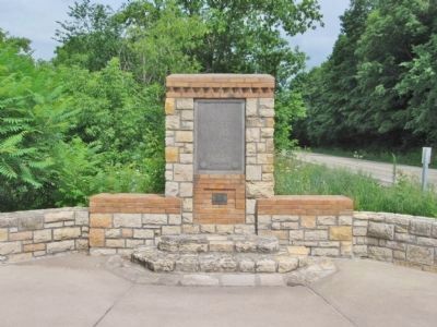
The St. Croix River Valley Forming a long stretch of the border between Minnesota and Wisconsin, the St. Croix is one of America's most scenic Wild Rivers. Its valley is sometimes referred to as the "New England of the West."
Along with . . . — — Map (db m233414) HM
"From here, the first log in the race,
Went forth to seek a dwelling place."
Harriet Bishop, Minnesota, Then and Now, 1869
The St. Croix River ranked second only to the Mississippi as a carrier of logs and . . . — — Map (db m54391) HM
In 1857 these millstones were installed at Marine in one of the early flour and grist mills of Minnesota Territory. Water from a stream south of this site was conveyed by a race or flume to furnish power for the overshot mill wheel. Later, rollers . . . — — Map (db m28509) HM
The first commercial sawmill in Minnesota was erected 300 feet east of here in 1838. The lumbering industry, which monopolized the minds and talents of men in the St. Croix Valley for three-quarters of a century, was born with the erection of this . . . — — Map (db m28535) HM
One of Minnesota's first major industries was born here on August 24, 1839, when the slow, cumbersome up-and-down saw of the Marine Lumber Company cut the first commercial lumber in the state from trees felled in the rich white pine forests of the . . . — — Map (db m45392) HM
Sawmilling began here on August 24, 1839, when the Marine Lumber Company cut its first pine log.
In the autumn of 1838 two lumbermen from Marine,
Illinois, David Hone and Lewis Judd, arrived in the St. Croix River valley, attracted by it's . . . — — Map (db m51703) HM
Sawmills cut logs into rough boards. The boards were then planed and smoothed to emerge as finished lumber.
To your left are the remains of the planing-mill powerhouse. The square stone at the bottom of the ruin once supported a 50-horsepower . . . — — Map (db m54832) HM
"... a lonely and forgotten reminder of the hopes of men and of the lusty lumber industry which did much to build an expanding America."
James Taylor Dunn, The St. Croix:
Midwest Border River, 1979
The stone ruins . . . — — Map (db m54137) HM
The Marine Township Hall was constructed in 1872 as a meeting hall and jail. The building was erected on property donated by Orange Walker. Its construction was financed by Morgan May who took the town's bonds for the necessary $2,000. Members of . . . — — Map (db m45939) HM
A Great Pine Forest
The St. Croix River valley's sandy loam soil is ideal for growing pine. In the 19th century its forests were filled with white pines. Many of them were two to three hundred years old, four to five feet in . . . — — Map (db m55015) HM
Waters from merging glaciers several thousand years' ago carved deep valleys for the St. Croix and Mississippi Rivers. Deprived of the glacial waters the rivers were so reduced in volume and carrying power that they were unable to maintain clear . . . — — Map (db m233489) HM
Minnesota Territory 1849 – 1858
On March 3, 1849, during his last hours in office, President James K. Polk signed a bill adding a new name to the American political landscape – Minnesota Territory. A vast land, it stretched from . . . — — Map (db m43908) HM
Here in 1839, in Crawford County, Wisconsin Territory, Joseph R. Brown, first settler of this valley, laid out the town of Dahcotah. The following year as a member of the Wisconsin Territorial Legislature, Brown secured passage of a bill setting up . . . — — Map (db m233073) HM
In 1849, the Governor of the new Territory of Minnesota, Alexander Ramsey, urged the Territorial Legislature to provide for a "proper and safe place of confinement" for prisoners of the territory. Because of Ramsey's request, the Legislature . . . — — Map (db m43747) HM
Minnesota's first courthouse, a three-room frame structure erected at the corner of 4th and Chestnut Street in Stillwater in 1849, had become inadequate by 1866. On November 6 of that year, Washington County voters approved funds for the . . . — — Map (db m171962) HM
Center of log and lumbering activities in this region for over half a century prior to 1914.
Here millions of logs from the upper St. Croix and tributaries were halted, sorted, and rafted, later to be sawed into lumber and timber products. . . . — — Map (db m233571) HM
Minnesota’s “Fashionable Tour.” In the years between 1835 and 1860, steamboats from St. Louis and the Illinois river towns of Rock Island and Galena carried hundreds of tourists up the Mississippi River past “a thousand bluffs . . . — — Map (db m8617) HM
The face of Minnesota has undergone many changes over the centuries as a result of the forces of nature. Its present appearance is the result of modification over four glacial periods that have created the landscape you see along the roadways. . . . — — Map (db m178489) HM
"The crown of the majestic Sugar Loaf Bluff is disappearing before the strokes of the utilitarian quarrymen," editorialized the Winona Daily
Republican in 1886. "In a very few years that widely known landmark will be but a homely . . . — — Map (db m43176) HM
A state of terror prevailed on the Minnesota western frontier for many months after the Sioux Uprising of 1862. Roving bands of Sioux continued to elude pursuers and attack settlers. The Dustin massacre occurred on June 29, 1863, one third mile . . . — — Map (db m69855) HM
In mid-September, 1862, more than 1,600 soldiers commanded by Colonel Henry Sibley marched northwest from Fort Ridgely into the Minnesota River Valley with an aim to end the U.S.-Dakota War. Word of that movement reached the Dakota soldiers’ lodge . . . — — Map (db m69099) HM
224 entries matched your criteria. Entries 201 through 224 are listed above. ⊲ Previous 100