49 entries match your criteria.
Mormon Battalion Historical Markers
Marker series co-sponsored by the Latter Day Saints highlighting the exploits of the Mormon Battalion during the Mexican American War.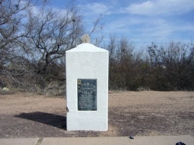
By Bill Kirchner, February 19, 2010
Mormon Battalion Marker
| 1 ► Arizona, Cochise County, Benson — Mormon Battalion — LDS Church — |
| On 4th Street (Business U.S. 10) near Ocotillo Avenue, on the right when traveling west. | |||
| 2 ► Arizona, Cochise County, Douglas — Mormon Battalion — LDS Church — |
| On Arizona Route 80 at milepost 356, on the right when traveling east. | |||
| 3 ► Arizona, Cochise County, Douglas — Mormon Battalion — LDS Church — |
| 4 ► Arizona, Cochise County, Douglas — Mormon Battalion — LDS Church — |
| On Geronimo Trail, on the right when traveling east. | |||
| 5 ► Arizona, Cochise County, Douglas — Mormon Battalion — |
| On Geronimo Trail, on the right when traveling east. | |||
| 6 ► Arizona, Cochise County, Palominas — Mormon Battalion — |
| Near Arizona Route 92 at milepost 340. | |||
| 7 ► Arizona, Cochise County, Sierra Vista — Mormon Battalion — LDS Church — |
| On East Charleston Road, on the right when traveling east. | |||
| 8 ► Arizona, Cochise County, Sierra Vista — Mormon Battalion Campsite — |
| On Arizona Route 90 at milepost 329, on the left when traveling east. | |||
| 9 ► Arizona, Cochise County, St. David — Mormon Battalion — LDS Church — |
| On West Patton Street (Arizona Route 80 at milepost 301) at South Church Street, on the right when traveling east on West Patton Street. | |||
| 10 ► Arizona, Pima County, Tucson, Armory Park — To The Mormon Battalion — |
| On South 6th Avenue, on the right when traveling north. | |||
| 11 ► Arizona, Pima County, Tucson, Downtown — Commemorating the Raising of the First American Flag within the Walled City of Tucson — |
| Near West Alameda Street. | |||
| 12 ► Arizona, Pima County, Tucson, Downtown — Exchange at the Presidio — The Mormon Battalion Enters Tucson, 16 December 1846 — |
| Near West Alameda Street. | |||
| 13 ► Arizona, Pinal County, Casa Grande — In Honor of Mormon Battalion — |
| On North Pinal Avenue, on the right when traveling south. | |||
| 14 ► Arizona, Pinal County, Picacho — 71 — Mormon Battalion Trail — |
| Near Interstate 10. | |||
| 15 ► Arizona, Yuma County, Roll — Antelope Hill Campsite — |
| Near County 8th Street, 0.3 miles east of Mohawk Valley Road. | |||
| 16 ► Arizona, Yuma County, Yuma — Mormon Battalion Crossing / Colorado River Crossing — |
| Near West 8th Street, 0.5 miles west of Somerton Avenue. | |||
| 17 ► Arizona, Yuma County, Yuma — U.S. Army of the West — Mormon Battalion — Longest Sustained March in U.S. Military History, 1846-1847 — |
| Near 12th Avenue, 0.8 miles west of Water Street. | |||
| 18 ► California, Amador County, Kit Carson — 338 — Tragedy Spring — No 338 — Erected 1967 — |
| On Tragedy Springs Road near Carson Pass Scenic Byway (California Highway 88). | |||
| 19 ► California, El Dorado County, Coloma — Mormon Cabin — Replica |
| Near State Highway 49. Reported permanently removed. | |||
| 20 ► California, Los Angeles County, Los Angeles, Downtown Los Angeles — Fort Moore — Pioneer Memorial and Park — |
| On North Hill Street, on the right when traveling north. | |||
| 21 ► California, Orange County, Mission Viejo — Mormon Battalion Marker — |
| Near Charlinda Drive. | |||
| 22 ► California, Riverside County, Aguanga — U.S. Mormon Battalion Trail — 1847 — Temecula Valley — |
| On California 79, 1.5 miles south of Sage Road, on the right when traveling south. | |||
| 23 ► California, San Bernardino County, Lytle Creek — 147 — Lytle Creek Canyon — |
| On Lytle Creek Road, on the right when traveling west. | |||
| 24 ► California, San Diego County, Anza-Borrego Desert State Park — 472 — Box Canyon — |
| On Great Southern /Overland Stage Route of 1849 (County Route S2), on the right when traveling east. | |||
| 25 ► California, San Diego County, Anza-Borrego Desert State Park — 639 — Palm Spring — |
| On Vallecito Creek Road south of County Road S2. | |||
| 26 ► California, San Diego County, Blair Valley — 647 — Butterfield Overland Mail Route — |
| Near an un-named desert road, 0.5 miles east of Great Overland Stage Route (County Route S2). | |||
| 27 ► California, San Diego County, San Diego — 7 — Mormon Battalion — |
| On Jackson Street. | |||
| 28 ► California, San Diego County, San Diego — Services of the Mormon Battalion — |
| Near Presidio Drive. | |||
| 29 ► California, San Diego County, San Diego — 257 — Women of the Mormon Battalion — |
| Near Presidio Drive. | |||
| 30 ► California, San Diego County, Warner Springs — 311 — Warner Ranch House — |
| On San Felipe Road (County Highway 52) 0.7 miles east of Highway 79, on the left when traveling east. | |||
| 31 ► California, Tuolumne County, Columbia — Mormon Battalion Monument — |
| On State Highway 49 at Rawhide Road (County Highway E5), on the right when traveling north on State Highway 49. | |||
| 32 ► Colorado, Douglas County, Parker — 559 — Cherry Creek Camp — Douglas County 20 Mile Camp — |
| Near East Valley Hi Drive at South Parker Road (State Highway 83). | |||
| 33 ► Colorado, Pueblo County, Pueblo — 60 — The Mormon Battalion — |
| On Stanton Avenue at Locust Street, on the right when traveling north on Stanton Avenue. | |||
| 34 ► Idaho, Bannock County, Downey — 119 — Captain Jefferson Hunt, Soldier, Pioneer, Churchman — Born January 20, 1804 in Kentucky - Died May 11, 1879 in Idaho — |
| On State Highway 91, on the right when traveling north. | |||
| 35 ► Iowa, Pottawattamie County, Council Bluffs — Mormon Battalion Mustering Grounds — |
| Near U.S. Highway 275 (U.S. 275) 0.1 miles Iowa Highway 92 (State Highway 92). | |||
| 36 ► Kansas, McPherson County, McPherson — The Mormon Battalion at McPherson, Kansas — |
| On Interstate 135, 4 miles south of Exit 72 (Interstate 135), on the left when traveling south. | |||
| 37 ► Kansas, Morris County, Council Grove — The Mormon Battalion at Council Grove, Kansas — |
| 38 ► Kansas, Pawnee County, Larned — The Mormon Battalion at Larned, Kansas — |
| On State Highway 156, on the left when traveling west. | |||
| 39 ► Nevada, Clark County, Las Vegas, West Sahara — The Mormon Battle & The Old Spanish Trail — |
| Near Tara Avenue. | |||
| 40 ► New Mexico, Hidalgo County, Animas — 7 — Historical Marker No. 7 — U.S. Mormon Battalion Trail — |
| On Geronimo Trail, 1.5 miles east of Arizona / New Mexico State line, on the right when traveling west. | |||
| 41 ► New Mexico, Luna County, Deming — Cooke’s Wagon Road — Basin and Range Country — |
| Near Interstate 10 at milepost 61. | |||
| 42 ► New Mexico, Luna County, Deming — First Road to Southern California — |
| On U.S. 180 at milepost 145 at Butterfield Trail, on the right when traveling north on U.S. 180. | |||
| 43 ► New Mexico, Sandoval County, Santo Domingo Pueblo — 99 — The Mormon Battalion — |
| On West Frontage Road (U.S. 85), on the left when traveling north. | |||
| 44 ► New Mexico, Sierra County, Hillsboro — Mormon Battalion Historical Marker — |
| On State Road 27 at milepost 8.1, on the right when traveling north. | |||
| 45 ► Oklahoma, Cimarron County, Boise City — The Mormon Battalion in the Oklahoma Panhandle — |
| On Main Street (State Highway 325) at Cimarron Avenue (U.S. 385), on the left when traveling west on Main Street. | |||
| 46 ► Utah, Salt Lake County, Salt Lake City, Capitol Hill — 392 — The Constitution Revered — |
| On Columbia Street at 300 North, on the right when traveling north on Columbia Street. | |||
| 47 ► Utah, Salt Lake County, Salt Lake City, Capitol Hill — The Mormon Battalion — |
| On 300 North at East Capitol Blvd., on the right when traveling east on 300 North. | |||
| 48 ► Utah, Salt Lake County, Salt Lake City, Capitol Hill — Thomas L. Kane — |
| Near East Capitol Boulevard north of East 300 North, on the left when traveling north. | |||
| 49 ► Utah, Weber County, Ogden — 112 — Captain James Brown — |
| Near Washington Boulevard. | |||