By Cajun Scrambler, September 2, 2016
Marksville Mounds Marker
| On Martin Luther King Drive at Taensas Street, on the left when traveling east on Martin Luther King Drive. |
| On Route 559, 0.3 miles south of Highway 4, on the right when traveling south. |
| On State Highway 133, 0.2 miles south of Shipp Road, on the right when traveling south. |
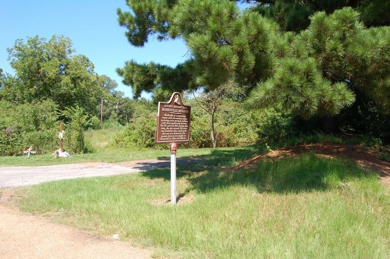
| On Louisiana Route 124, 0.5 miles north of Jugbend Road, on the right when traveling south. |
| On Little Boy Lane, 0.4 miles east of State Route 124. |
| On Brushley Street (State Highway 8) at Taliaferro Street, on the left when traveling west on Brushley Street. |
| On 124, 1 mile south of Bushley Street (State Highway 8), on the left when traveling south. |
| On Estate Drive, 0.4 miles south of Routon Road, on the left when traveling south. |
| On Routon Road, 0.3 miles State Highway 124, on the right when traveling east. |
| On Second Street near Willow Street, on the right when traveling west. |
| On Willow Street near Third Street, on the right when traveling south. |
| On Peck Road (State Highway 1017) 1.4 miles south of State Highway 8, on the right when traveling south. |
| On Peck Road (State Highway 1017) 1.4 miles south of State Highway 8, on the right when traveling south. |
| On Dunbarton Road (State Highway 566) 2 miles north of Louisiana Avenue (U.S. 84), on the right when traveling north. |
| On Dunbarton Road (State Highway 566) 5.1 miles north of Louisiana Avenue (U.S. 84), on the right when traveling north. |
| On Louisiana Avenue (U.S. 84) 0.1 miles west of Parish Road 5A-69, on the right when traveling west. |
| On Dunbarton Road (State Highway 566) 0.9 miles north of Louisiana Avenue (U.S. 84), on the right when traveling north. |
| On Dunbarton Drive (State Highway 566) south of Lamarque Road, on the left when traveling south. |
| On Highway 84 at Frogmore Plantation Road on Highway 84. |
| On State Highway 581, 0.2 miles west of State Highway 881, on the right when traveling west. |
| On State Highway 581 at Mound Road, on the right when traveling east on State Highway 581. |
| On Crooks Site Road, 0.2 miles east of State Highway 28, on the right. |
| On State Highway 602 at Busby Road, on the right when traveling east on State Highway 602. |
| On Mississippi Street at Depot Street, on the right when traveling east on Mississippi Street. |
| On U.S. 80 at Tendal North Road, on the right when traveling west on U.S. 80. |
| On U.S. 165, 0.3 miles south of Logtown Loop Road, on the right when traveling south. |
| On Frankie Loftin Road, 1.4 miles south of Military Road, on the right when traveling south. |
| On Poverty Creek Parkway, 0.4 miles east of State Route 17, on the right when traveling east. |
| On Route 892, 0.2 miles south of Route 573, on the right when traveling south. |
| On Mayflower Road (Road 3252) 0.5 miles north of Sundown Road (Parish Road 422), on the left when traveling north. |
| On U.S. 65 at Garden Road (State Highway 888), on the right when traveling north on U.S. 65. |
| On State Highway 4, 0.3 miles east of State Route 128, on the right when traveling east. |
| On State Road 575 north of Beeks Bayou Road, on the right when traveling north. |
| On Plank Road (State Road 128) 0.6 miles east of U.S. 65, on the left when traveling east. |
| On U.S. 65, 0.6 miles south of State Highway 128, on the left when traveling south. |
| On Scotts Hideaway Road, 0.3 miles east of Green Bay Road, on the right when traveling east. |
| On Louisiana Route 134 at Walnut Grove Lane, on the right when traveling east on State Route 134. |
| On Parish Road 585, 0.1 miles west of Parish Road 543, on the right when traveling west. |