Marker Logo HMdb.org THE HISTORICAL
MARKER DATABASE
“Bite-Size Bits of Local, National, and Global History”


25 entries match your criteria.  


Maryland, Gwynns Falls Trail Historical Markers

 
Carroll Park Marker image, Touch for more information
By Beverly Pfingsten, October 20, 2007
Carroll Park Marker
1 Maryland, Baltimore, Carroll Park — Carroll Park
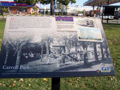
Near Washington Boulevard at Monroe Street.
2 Maryland, Baltimore, Carroll Park — Carroll Park at the Golf CourseGwynns Falls Trail
On Gwynns Falls Trail (Trailhead 6) west of Washington Blvd., on the left when traveling west.
3 Maryland, Baltimore, Carroll Park — Carroll Park at the Historic Pigtown NeighborhoodGwynns Falls Trail
On Washington Boulevard at Bush Street, on the right when traveling south on Washington Boulevard.
4 Maryland, Baltimore, Carroll Park — Mount Clare, the Georgia PlantationGwynns Falls Trail
Near Washington Boulevard, on the right when traveling south.
5 Maryland, Baltimore, Carroll Park — Of Fords, Felles, and FallsGwynns Falls Trail
Near Washington Boulevard.
6 Maryland, Baltimore, Carroll Park — Restoring Water QualityGwynns Falls Trail
Near Washington Boulevard. Reported permanently removed.
7 Maryland, Baltimore, Carroll Park — The Baltimore Ecosystem StudyGwynns Falls Trail
On Washington Boulevard (Alternate U.S. 1) south of Western Avenue, on the right when traveling south.
8 Maryland, Baltimore, Carroll-South Hilton — Bridging Gwynns Falls
On West Baltimore Street, on the right when traveling west.
9 Maryland, Baltimore, Carroll-South Hilton — Ellicott Flour Mills
Near Frederick Avenue (Maryland Route 144), on the right when traveling west.
10 Maryland, Baltimore, Cherry Hill Park — Cherry Hill
On South Hanover Street (Maryland Route 2), on the right when traveling north.
11 Maryland, Baltimore, Franklin — Carrollton Viaduct
Near Washington Boulevard.
12 Maryland, Baltimore, Franklintown — Crimea Estate
Near North Franklintown Road.
13 Maryland, Baltimore, Gwynns Falls — Early Industries
On Hurley Avenue, 0 miles north of Wilkens Avenue (U.S. 1), on the right when traveling north.
14 Maryland, Baltimore, Gwynns Falls/Leakin Park — A Name Before a Place
Near North Franklintown Road.
15 Maryland, Baltimore, Gwynns Falls/Leakin Park — An Old Mill Stream
Near Windsor Mill Road.
Paid Advertisement
16 Maryland, Baltimore, Gwynns Falls/Leakin Park — Leon Day Park
Near North Franklintown Road.
17 Maryland, Baltimore, Middle Branch Park — John Smith Explores Patapsco
Near Waterview Avenue.
18 Maryland, Baltimore, Middle Branch Park — Reviving the Waterfront
Near Waterview Avenue. Reported missing.
19 Maryland, Baltimore, Otterbein — Federal Hill and Otterbein
On South Sharp Street at West Hill Street, on the right when traveling south on South Sharp Street.
20 Maryland, Baltimore, Sharp-Leadenhall — Solo Gibbs Park
Near West Hamburg Street, on the right when traveling west.
21 Maryland, Baltimore, Sharp-Leadenhall — Struggling For Equality
On West Hamburg Street, on the right when traveling east.
22 Maryland, Baltimore, Shipley Hill — Early Transportation Routes
On West Baltimore Street at Ellicott Driveway, on the left when traveling west on West Baltimore Street.
23 Maryland, Baltimore, Shipley Hill — Rowhouses: a Baltimore Tradition
On Frederick Avenue (Maryland Route 144).
24 Maryland, Baltimore, Wakefield — Dickeyville's Historic Legacy
On Windsor Mill Road at Weatheredsville Road, on the right when traveling west on Windsor Mill Road.
25 Maryland, Baltimore County, Gwynn Oak — Franklintown's Historic Roots
On Security Boulevard (Maryland Route 122) at Old Ingleside Avenue, on the right when traveling north on Security Boulevard.
 
 
CeraNet Cloud Computing sponsors the Historical Marker Database.
This website earns income from purchases you make after using our links to Amazon.com. We appreciate your support.
Paid Advertisement
May. 4, 2024