This battle, also known as the "Gettysburg of the West", took place in modern-day Kansas City, Missouri on October 23, 1864. The battle was one of the largest to take place west of the Mississippi River, and it ended the last major Confederate offensive west of the Mississippi River.
On Meyer Blvd at Wabash Avenue, on the right when traveling east on Meyer Blvd.
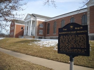
This was the main road to Harrisonville. Fagan’s Confederate Division was posted here at noon on Oct.23, 1864. At daylight that day Gen. Price’s huge wagon train moved south on this road. After his defeat at Byram’s Ford Gen. Marmaduke retreated . . . — — Map (db m28709) HM
On Wornall Road at 53rd Terrace, on the left when traveling north on Wornall Road.
On Oct. 23, 1864 near noon Col. McGhee's mounted Arkansans charged north on Wornall Lane to capture McLain's Colorado Battery. Capt. Johnson of the 15th Kas. Cavalry attacked saving the guns. McGhee was killed in a hand-to-hand fight with the . . . — — Map (db m29658) HM
On 63rd Street at The Paseo, on the right when traveling east on 63rd Street.
On Oct. 22, 1864, after the Union line along the Big Blue was flanked, Jackman's Confederate Brigade overran the militia at the Mockbee Farm, 78th & Holmes, and drove Jennison's Union Brigade back to the state line. Jennison and Moonlight's . . . — — Map (db m30291) HM
On 63rd Street at Walnut Street, on the right when traveling east on 63rd Street.
At about 1:00 P.M., October 23, 1864 Confederate Gen. Shelby was withdrawing slowly from his position near the Wornall House. He had been ordered to pull back by Gen. Price because of the collapse of Marmaduke's Confederate line at Byram's Ford. . . . — — Map (db m30294) HM
Near Troost Avenue, 0.2 miles 71st Street, on the right when traveling north.
On Oct. 23, 1864, Confederate Gen. Shelby being forced back from Westport by Gen. Curtis and flanked on the east by Gen. Pleasonton formed a defensive line here behind stone fences running east and west to the state line. Jackman's Brigade of . . . — — Map (db m26692) HM
On 98th Terrace, 0.1 miles Grandview Road, on the right when traveling east. Reported missing.
In 1864, the New Santa Fe Rd. joined the Harrisonville Rd. (now Grandview Rd.) here and went south across I-435 then to the southwest. McNeil's Union Brigade had been ordered by Gen. Pleasonton to be here by daylight on October 23, 1864 and block . . . — — Map (db m20576) HM
On Pennsylvania Avenue at Westport Road, on the right when traveling north on Pennsylvania Avenue.
(Front of Marker):
Price's Raid
Confederate General Sterling Price brought three mounted divisions from Arkansas into Missouri, September 19, 1864. Fighting several small battles he marched slowly north toward St. Louis, then struck . . . — — Map (db m20868) HM
On Blue River Road just north of Grandview Road, on the left when traveling north.
In 1864 the ford across the Blue River was near where the bridge to the north now stands. Blue River road did not exist the. On October 22, 1864. Kansas Militia, defending this ford to prevent crossing by Confederate General Price, withdrew to the . . . — — Map (db m19731) HM
On 96th Terrace at Wornall Road, on the right on 96th Terrace.
About 4 p.m. Oct. 23, 1864 after their victory at Westport the Union leaders met here for consultation. Included were Generals Curtis, Blunt, Pleasonton and Dietzler; Gov. Carney and Sen. Jim Lane of Kansas. The Confederates had lost over 1,000 men . . . — — Map (db m20598) HM
On 61st Terrace, 0.1 miles east of Wornall Road, on the left when traveling east.
Built in 1858 by John Wornall on his 640-acre farm, this house was in the center of heavy fighting on October 23, 1864. After the last Confederate charge to the north toward Westport was repulsed, this house was used as a field hospital for both . . . — — Map (db m28072) HM
On Sunset Drive at 51st Street, in the median on Sunset Drive.
Here just before noon on Sunday, October 23, 1864, Major General Samuel Ryan Curtis, commanding the Federal Army of the Border, began his flanking movement of Brigadier General Joseph Orville Shelby's Division of the Confederate Army of Missouri. . . . — — Map (db m21702) HM
On 55th Street, 0.1 miles east of Ward Parkway, on the left when traveling east.
The brick house in the rear was owned by Wm. Bent, fur trader. On Sun., Oct. 23, 1864 heavy fighting occurred here. After Union Gen. Curtis flanked the Confederate line by coming up a ravine (Rockwell Lane) his troops were a few rods north of the . . . — — Map (db m21722) HM
At 8:30 A.M. Sun., Oct. 23, 1864, Gen. Shelby's Division moved north and struck Union troops near the Wornall House. Gen. Blunt's Union cavalrymen were driven across Brush Creek. Shelby stopped to bring up ammunition. About 3,000 Confederate men . . . — — Map (db m21705) HM
On Pennsylvania Avenue, 0 miles Wornall Road, on the right when traveling west.
When Gen. Curtis moved up the hill to the west Gen. Blunt moved south from Brush Creek through the woods to Loose Park. He drove the Confederates from a stone fence along 51st St. and formed a line there at 11:00 a.m., Oct. 23, 1864. running east . . . — — Map (db m21708) HM
On Sunset Drive, 0.1 miles west of Ward Parkway, on the right when traveling west.
At 9:30 a.m., Oct. 23, 1864, Gen. Curtis's troops from Blunt's Division formed a line along Brush Creek facing south. Jennison's Brigade was west of Wornall; Ford's Brigade east of Jennison's to Oak St.; and Moonlight's Brigade along State Line . . . — — Map (db m21725) HM
Confederate Gen. Price made his headquarters here the night of Oct. 22, 1864. His generals convinced him to start south but he refused to abandon his 500-wagon train of war booty. Gen. Shelby's Division camped near Forest Hill cemetery. . . . — — Map (db m30324) HM
On Manchester Trafficway, on the left when traveling north on Manchester Trafficway.
left marker
Oct. 22, 1864
Union General Curtis set up a defensive line on the west side of the Big Blue River from the Missouri River upstream for 15 miles to stop Confederate General Price advancing from the east. A Battalion of . . . — — Map (db m28694) HM
On Elmwood Avenue at 63rd Street, on the right when traveling north on Elmwood Avenue.
On the morning of October 23, 1864 Federal cavalry under General Alfred Pleasonton forced a crossing of the Big Blue at Byram's Ford and assaulted this hill which was defended by General Marmaduke's Confederate division. After three hours of heavy . . . — — Map (db m28313) HM
On Manchester Trafficway, 0.2 miles north of East 63rd Street, on the right when traveling east.
At 8 A. M. on October 23, 1864, Federal cavalry under General Alfred E. Pleasonton forced a crossing of the Blue River at Byram’s Ford and attacked the stone ridge, which was defended by Confederate troops under John S. Marmaduke. After 3 hours . . . — — Map (db m28705) HM
On 59th Street, 0.1 miles east of Lister Avenue, on the right when traveling east.
This log house hiding Confederate snipers was in front of the defensive line 250 yards to the south. Heavy fighting took place there on Oct. 23, 1864 between Marmaduke's Confederates and Pleasonton's Cavalrymen. Clarke's Confederate Brigade was in . . . — — Map (db m30304) HM
On 63rd Street, 0.1 miles west of Manchester Trafficway, on the left when traveling east.
On the morning of Oct. 23, 1864 Clarke's Confederate Brigade of Marmaduke's Div. was in line on this hill from 63rd St. Trafficway north across 59th St. facing east to stop Pleasonton's Cavalry. Pratt's two Batteries, Harris' Mo. and Hynson's Tx. . . . — — Map (db m28381) HM
On Holmes Road, 0.1 miles north of 79th Street, on the right when traveling south.
The Thos. Mockbee Farmhouse stood here. On Oct. 22, 1864 when, after the Confederates had forced a crossing of the Big Blue to the east 300 men of the 2nd Kas. Militia were north of the farmhouse where they formed a line facing north. Jackman's . . . — — Map (db m26577) HM
On Santa Fe Trail, 0.1 miles west of Belleview Road, on the right when traveling west.
In 1864 this village straddled the state line. The military road running north and south was ¼-mile west of the line. On October 23, 1864, General Sterling Price's wagon train moving southwest on this road turned south on the military road at 2 . . . — — Map (db m20580) HM
On West 55th Street, 0.1 miles north of Pennsylvania Avenue, on the right when traveling east.
Gen. Sterling Price was on this spot at 11:00 a.m. but retired before the armies had reached this disposition.
Positions after the Union flank attack. Lines moved back and forth with charges and countercharges, although cavalry, most were . . . — — Map (db m28114) HM
On West 56th Street at Pennsylvannia Avenue, on the right when traveling east on West 56th Street.
Near this point on the morning of October 23, 1864, Capt. Richard A. Collins' Confederate battery of Shelby's Brigade went into action, supported by two cavalry battalions. for two hours this battery dueled with the 9th Wisconsin battery, covering . . . — — Map (db m28110) HM