25 entries match your criteria.
Missouri – Battle of Westport Historical Markers
This battle, also known as the "Gettysburg of the West", took place in modern-day Kansas City, Missouri on October 23, 1864. The battle was one of the largest to take place west of the Mississippi River, and it ended the last major Confederate offensive west of the Mississippi River.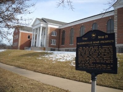
By Thomas Onions, February 28, 2010
Harrisonville Road (Prospect) Marker
| 1 ► Missouri, Jackson County, Kansas City, Blenheim Square - Research Hospital — 15 — Harrisonville Road (Prospect) — |
| 2 ► Missouri, Jackson County, Kansas City, Countryside — 7 — McGhee's Charge — |
| 3 ► Missouri, Jackson County, Kansas City, Eastern 49-63 — 12 — Battle of the Big Blue — |
| 4 ► Missouri, Jackson County, Kansas City, Morningside — 11 — Hinkle's Grove — |
| 5 ► Missouri, Jackson County, Kansas City, Neighborhood United for Action — 13 — Shelby's Last Stand — |
| 6 ► Missouri, Jackson County, Kansas City, Oakwood — 21 — New Santa Fe Road — Reported missing |
| 7 ► Missouri, Jackson County, Kansas City, Old Westport — 1 — Action Before Westport — |
| 8 ► Missouri, Jackson County, Kansas City, South Kansas City — 20 — Russell's Ford — |
| 9 ► Missouri, Jackson County, Kansas City, South Kansas City — 23 — Thomas Farmhouse — |
| 10 ► Missouri, Jackson County, Kansas City, South Kansas City — 10 — Wornall Homestead — Battle of Westport — |
| 11 ► Missouri, Jackson County, Kansas City, Sunset Hill — 3 — Battle of Westport — Union Flanking Movement — |
| 12 ► Missouri, Jackson County, Kansas City, Sunset Hill — 4 — Bent & Ward Houses — |
| 13 ► Missouri, Jackson County, Kansas City, Sunset Hill — 5 — Confederate Position — |
| 14 ► Missouri, Jackson County, Kansas City, Sunset Hill — 6 — Union Artillery — |
| 15 ► Missouri, Jackson County, Kansas City, Sunset Hill — 2 — Union Position — |
| 16 ► Missouri, Jackson County, Kansas City, Swope Park Campus — 19 — "Boston" Adams' House — |
| 17 ► Missouri, Jackson County, Kansas City, Swope Parkway - Elmwood — 17 — Battle of the Big Blue — |
| 18 ► Missouri, Jackson County, Kansas City, Swope Parkway - Elmwood — 18 — Battle of Westport — |
| 19 ► Missouri, Jackson County, Kansas City, Swope Parkway - Elmwood — 16 — Byram's Ford Battlefield — |
| 20 ► Missouri, Jackson County, Kansas City, Swope Parkway - Elmwood — 17B — Log House and Defensive Line — |
| 21 ► Missouri, Jackson County, Kansas City, Swope Parkway - Elmwood — 17A — Pratt's Artillery — |
| 22 ► Missouri, Jackson County, Kansas City, Tower Homes — 14 — Mockbee Farm — |
| 23 ► Missouri, Jackson County, Kansas City, Verona Hills — 22 — New Santa Fe — |
| 24 ► Missouri, Jackson County, Kansas City, Ward Estates — 8 — Battle of Westport — Position of Opposing Forces - 11a.m. Oct. 23, 1864 — |
| 25 ► Missouri, Jackson County, Kansas City, Ward Estates — 9 — Battle of Westport — Action on the Third Day — |