Canada, Sharbot Lake ON Railway Heritage Walkway Historical Markers
Twelve markers placed by the Central Frontenac Railway Heritage Society highlighting the Kingston & Pembroke and Ontario and Quebec (later part of the Canadian Pacific) Railways, whose lines intersected in the village of Sharbot Lake, and their impact on the village's growth.
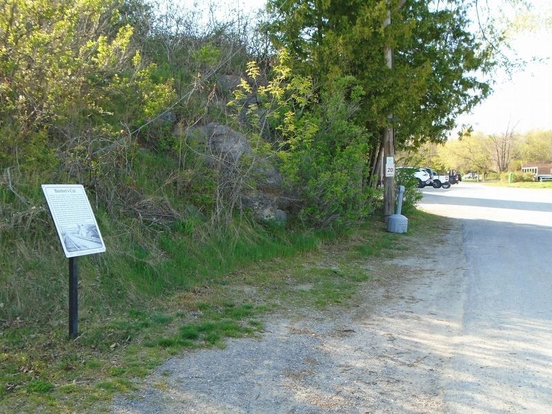
Benton's Cut was named by local railroaders in memory of K&P foreman Chancy Benton. When Colonel George Flower of New York took over the building of the railway, he was faced with the need of experienced men to supervise the work. He brought . . . — — Map (db m273963) HM
On Medical Center Road just south of Mathew Street, on the left when traveling south.
The building on the right in the photo with the wooden steps and porch is Sharbot Lake's first railway station. It was located here. The station was built by the Kingston and Pembroke Railway shortly after its track was laid through in 1876. . . . — — Map (db m273952) HM
On Government Dock & Boat Launch Parking Lot just south of Cannon Street, on the right when traveling south.
Before the days of radio communication, train movement was controlled by a timetable and train order system. Orders were issued by a centralized dispatcher and sent to outlying station operators or agents via telegraph or telephone. The order . . . — — Map (db m273913) HM
On Elizabeth Street at Robert Street, on the left when traveling north on Elizabeth Street.
During the steam era of the railway, the Pump House and its machinery played a pivotal role in ensuring the essential resource of water was available to the steam locomotives. Steam locomotives consumed large amounts of coal and water to produce . . . — — Map (db m286035) HM
On Elizabeth Street just north of Robert Street, on the left when traveling north.
Before large trucks, reliable, refrigeration and the ability to freeze meat for transport existed, livestock was shipped by rail, in cattle cars. To facilitate this, stock pens for receiving and shipping the livestock were built in small . . . — — Map (db m273811) HM
On the K&P Trail, on the right when traveling south.
On May 8, 1876, the Kingston and Pembroke Railway crossed The Narrows of Sharbot Lake on this rock-filled causeway. In 1882, as the construction of the Ontario and Quebec Railway (later the Canadian Pacific Railway) pushed through Sharbot Lake, . . . — — Map (db m273971) HM
On Elizabeth Street at Robert Street, on the left when traveling north on Elizabeth Street.
From here, the Kingston and Pembroke Railway headed
north. Incorporated in 1871, the Kingston and Pembroke
Railway Company was chartered to run between the two
towns with the purpose of gaining access to the forests and
minerals found in the . . . — — Map (db m273759) HM
On Elizabeth Street at Robert Street, on the left when traveling north on Elizabeth Street.
The station was built circa 1884 by the Canadian Pacific Railway. The William C. Van Horne inspired
design was a simple two-storey building with the Agent's quarters on the second floor and a waiting
room, ticket office (the protruding windows) . . . — — Map (db m273738) HM
On Cannon Street just west of Elizabeth Street, on the left when traveling west.
Known locally as the "fisherman's hotel", the Union Hotel
was built circa 1889 and named to reflect the junction of the
K&P, Ontario and Quebec Railways. Built by the Kingston
and Pembroke Railway, it was later called the Sharbot
Lake Hotel, . . . — — Map (db m273912) HM
On Elizabeth Street just north of Robert Street, on the left when traveling north.
This is the former site of a 40,000 gallon water tower which was removed in 1964. The original wooden one (inset) was replaced with a more modern steel version. Lake water was pumped to the tower and flowed through underground piping to . . . — — Map (db m273817) HM