After filtering for North Dakota, 25 entries match your criteria.
Environment Topic
By Bill Coughlin, July 20, 2015
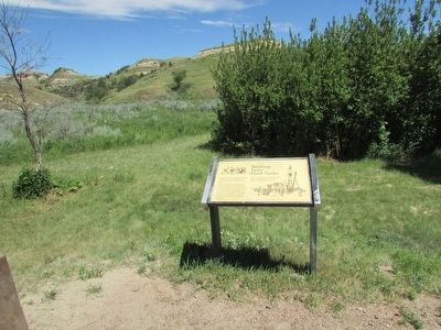
Building From Hard Times Marker
| 1 ► North Dakota, Billings County, Medora — Building From Hard Times — |
| On E River Road, on the right when traveling north. | |||
| 2 ► North Dakota, Billings County, Medora — In honor of a President . . . and His Conservation Legacy — |
| On Easy River Road, on the left when traveling north. | |||
| 3 ► North Dakota, Billings County, Medora — Stephen Tyng Mather — July 4, 1887 - Jan. 22, 1930 — |
| On East River Road, on the left when traveling north. | |||
| 4 ► North Dakota, Cass County, Fargo, Downtown — Wildlife in the Red River Valley — |
| On 2nd Avenue North at Broadway North, on the right when traveling east on 2nd Avenue North. | |||
| 5 ► North Dakota, Dunn County, Dunn Center — Chelsey and Polly Dinkins Memorial Dam — Refuge Manager and Wife — 1936-1983 — |
| On 5th Street SW, 0.3 miles south of 4th Street SW, on the right when traveling south. | |||
| 6 ► North Dakota, Grand Forks County, Grand Forks — A Brutal Winter — |
| On North 3rd Street at 1st Avenue North on North 3rd Street. | |||
| 7 ► North Dakota, Grand Forks County, Grand Forks — Blizzard "Hannah" — |
| On North 3rd Street at 1st Avenue North on North 3rd Street. | |||
| 8 ► North Dakota, Grand Forks County, Grand Forks — Evacuating Two Cities — |
| On North 3rd Street at 1st Avenue North on North 3rd Street. | |||
| 9 ► North Dakota, Grand Forks County, Grand Forks — Grand Forks Flood Protection Project — Dedicated April 22, 2007 — |
| On Demers Avenue at North 3rd Street on Demers Avenue. | |||
| 10 ► North Dakota, Grand Forks County, Grand Forks — The Flood Fight Begins — |
| On North 3rd Street at 1st Avenue North on North 3rd Street. | |||
| 11 ► North Dakota, Grand Forks County, Grand Forks — The River Wins — |
| On North 3rd Street at 1st Avenue North on North 3rd Street. | |||
| 12 ► North Dakota, Kidder County, Steele — The World's Largest Sandhill Crane — |
| On 5th Street North East, 0.1 miles east of Mitchell Avenue North. | |||
| 13 ► North Dakota, McKenzie County, Watford City — Building From Hard Times — |
| On Scenic Drive, on the left when traveling north. | |||
| 14 ► North Dakota, McKenzie County, Watford City — Man and Grass — |
| On Scenic Drive, on the right when traveling north. | |||
| 15 ► North Dakota, McKenzie County, Watford City — North Dakota Badlands — |
| On Scenic Drive. | |||
| 16 ► North Dakota, Morton County, Mandan — Cannonball Concretions — |
| On Fort Lincoln Road, on the left when traveling north. | |||
| 17 ► North Dakota, Ransom County, Eastedge — Standing Rock / Wonderful Wetlands — |
| Near North Dakota Route 46 west of 122nd Avenue Southeast. | |||
| 18 ► North Dakota, Ransom County, Fort Ransom — An Ancient Sea / Glacial Meltwater Trench — |
| On 119th Avenue SE north of Mill Road, on the left when traveling north. | |||
| 19 ► North Dakota, Ransom County, Fort Ransom — Native Prairies / Ecosystem Under Siege — |
| Near Mill Road near Walt Hjelle Parkway. | |||
| 20 ► North Dakota, Stark County, Belfield — Invader on the Badlands — Theodore Roosevelt National Park — |
| Near Interstate 94, on the right when traveling west. | |||
| 21 ► North Dakota, Stark County, Belfield — Invasion Confronted — Theodore Roosevelt National Park — National Park Service, U.S. Department of the Interior — |
| Near Interstate 94, on the right when traveling west. | |||
| 22 ► North Dakota, Stutsman County, Crystal Springs — Chase Lake NWR and the American White Pelican — |
| On Interstate 94 at milepost 223 near 47th Avenue Southeast, on the right when traveling west. | |||
| 23 ► North Dakota, Stutsman County, Crystal Springs — Chase Lake Prairie Project — |
| Near Interstate 94 at milepost 223 near 47th Avenue Southeast, on the right when traveling west. | |||
| 24 ► North Dakota, Stutsman County, Crystal Springs — The Missouri Coteau - North America's Duck Factory. — |
| Near Interstate 94 at milepost 223 near 47th Avenue Southeast, on the right when traveling west. | |||
| 25 ► North Dakota, Stutsman County, Crystal Springs — Welcome to Crystal Springs WPA — |
| On Interstate 94 at milepost 223 near 47th Avenue Southeast, on the right when traveling west. | |||