Marker Logo HMdb.org THE HISTORICAL
MARKER DATABASE
“Bite-Size Bits of Local, National, and Global History”


After filtering for New Mexico, 37 entries match your criteria.  


Notable Places Topic

 
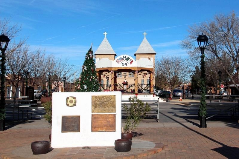
Mesilla Plaza Marker image, Touch for more information
By cmh2315fl via Flickr (CC BY-NC 2.0), December 27, 2016
Mesilla Plaza Marker
1 New Mexico, Doña Ana County, Mesilla — 14 — Mesilla Plaza
On Calle De Parian at Calle De Guadalupe, on the left when traveling east on Calle De Parian.
2 New Mexico, Lincoln County, Capitan — 480 — Smokey Bear Historical Park
On Smokey Bear Boulevard (U.S. 380 at milepost 85), on the left when traveling east.
3 New Mexico, Lincoln County, Hondo — Historic Lincoln, New Mexico
On U.S. 380 at U.S. 70, on the left when traveling west on U.S. 380.
4 New Mexico, Lincoln County, Hondo — San Patricio
On U.S. 70 at milepost 281.2, on the right when traveling east.
5 New Mexico, Lincoln County, Lincoln — Lincoln Historic DistrictNational Historic Landmark
On Billy the Kid Trail (U.S. 380), on the right when traveling west.
6 New Mexico, Lincoln County, Lincoln — Raton RanchBaca Campground
On Billy the Kid Trail (New Mexico Route 380) at County Road 002, on the left when traveling east on Billy the Kid Trail.
7 New Mexico, Lincoln County, Ruidoso — Old Dowlin Mill
On Sudderth Drive, 1.4 miles west of U.S. 70, on the left when traveling west.
8 New Mexico, Luna County, Columbus — Columbus
On State Road 11 at milepost 5.3, on the right when traveling south.
9 New Mexico, Luna County, Columbus — Columbus
On State Road 11 at milepost 2.5, on the right when traveling north.
10 New Mexico, Luna County, Deming — Rockhound State Park
On Stirrup Road SE, on the right when traveling east.
11 New Mexico, McKinley County, Gallup — GallupPopulation 18,161 - Elevation 6600 ft
On Interstate 40 Frontage Road (State Road 118), on the right when traveling west.
12 New Mexico, Otero County, Alamogordo — Dog Canyon(Cañon Del Perro)
On State Road 54 at Dog Canyon Road, on the right when traveling south on State Road 54.
13 New Mexico, Otero County, Tularosa — Three Rivers
On U.S. 54 at milepost 96.6 at County Road B030, on the right when traveling north on U.S. 54. Reported missing.
14 New Mexico, Otero County, Tularosa — Three Rivers Petroglyph Site
Near County Road B030, 4.5 miles east of U.S. 54.
15 New Mexico, Otero County, Tularosa — Three Rivers Petroglyphs
On U.S. 54 at milepost 96.6 at County Road B030, on the right when traveling north on U.S. 54. Reported missing.
Paid Advertisement
16 New Mexico, Otero County, Tularosa — Tularosa
On U.S. 54 at milepost 78, on the right when traveling north.
17 New Mexico, Rio Arriba County, San Juan Pueblo (Ohkay Owingeh) — San GabrielOn the Camino Real
On State Road 68, on the right when traveling north.
18 New Mexico, San Juan County, Aztec — AztecPopulation 5512 - Elevation 5460 ft.
On U.S. 550 at milepost 158.5, on the right when traveling north.
19 New Mexico, San Juan County, Bloomfield — City of Bloomfield
On West Broadway Avenue (U.S. 64 at milepost 62), on the right when traveling east.
20 New Mexico, San Juan County, Bloomfield — Salmon Ruin
Near U.S. 64 at milepost 61.
21 New Mexico, San Juan County, Farmington — FarmingtonPopulation 30,792 Elevation 5395 ft
On West Main Street (U.S. 64 at milepost 46.1), on the right when traveling east.
22 New Mexico, San Juan County, Shiprock — New Mexico(Four Corners)
Near 4 Corners Road, 0.5 miles west of U.S. 160.
23 New Mexico, San Miguel County, Las Vegas — Temple Montefiore, Las Vegas, New Mexico
On 8th Street.
24 New Mexico, San Miguel County, Sapello — Hermit’s PeakElevation– 10,212
On State Road 518 south of State Road 94, on the right when traveling north.
25 New Mexico, San Miguel County, Sapello — Strike Valleys
On State Road 518 north of State Road 94.
26 New Mexico, San Miguel County, Trujillo — Canadian Escarpment
On New Mexico 104, 0.4 miles south of Highway 419, on the right when traveling north.
27 New Mexico, Sandoval County, Algodones — La Angostura
On State Road 313, 1.5 miles south of I-25 (State Road 313), on the right when traveling south.
28 New Mexico, Sandoval County, Bernalillo — Pueblo of Santa Ana
On U.S. 550 at State Road 74, on the right when traveling west on U.S. 550.
29 New Mexico, Sandoval County, Cuba — Continental DivideElevation - 7,379 feet
On Highway 550 (State Road 550), on the right when traveling south on Highway 550.
30 New Mexico, Santa Fe County, Santa Fe — 19 — 1985 — Commemorative Walkway Park —
On Paseo de Peralta near Otero Street.
31 New Mexico, Santa Fe County, Santa Fe — 20 — To the Future — Commemorative Walkway Park —
Paid Advertisement
32 New Mexico, Sierra County, Lake Valley — Lake ValleyNational Back Country Byway — From Riches to Ruins —
On Road 27, on the right when traveling west.
33 New Mexico, Torrance County, Abó — Mystery in Ruins/Ruinas misteriosas — Salinas Pueblo Missions National Monument —
Near Abó Ruins Road (State Road 513) 0.7 miles north of U.S. 60, on the left when traveling north.
34 New Mexico, Torrance County, Willard — Laguna Del PerroElevation 6,110 FT
On Road 60.
35 New Mexico, Union County, Capulin — Making A Monument
On Volcano Road, 2.6 miles State Road 325, on the right when traveling south.
36 New Mexico, Union County, Capulin — The Raton-Clayton Volcanic Field
On Volcano Road, 2.6 miles east of State Road 325, on the right when traveling south.
37 New Mexico, Union County, Capulin — Welcome to Capulin Volcano National Monument
On Volcano Road, 0.5 miles east of State Road 325, on the right when traveling south.
 
 
CeraNet Cloud Computing sponsors the Historical Marker Database.
This website earns income from purchases you make after using our links to Amazon.com. We appreciate your support.
Paid Advertisement
May. 17, 2024