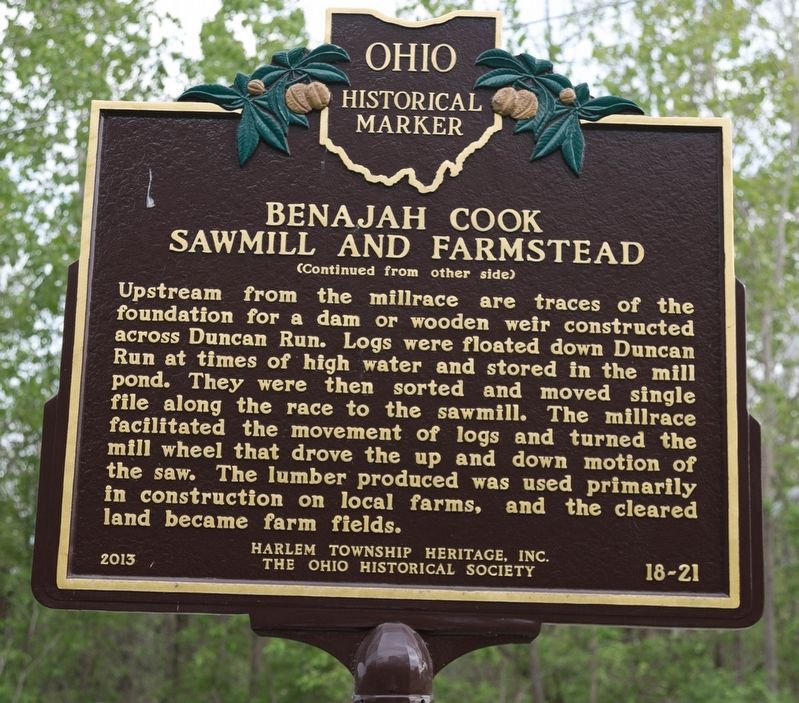
Benajah Cook and the families who settled in Harlem
Township, Delaware County are honored for creating
a community of productive farms. The Benajah
and Cassandra Cook family arrived when the land
was forested and settled on 500 acres of the . . . — — Map (db m117443) HM
Near this site, the Union army established two camps on either side of the Olentangy River during the Civil War. Both were known as Camp Delaware. The first camp, situated on the west side of the river in the summer of 1862, was where the white . . . — — Map (db m12816) HM
George W. Campbell originally built this highly picturesque structure in 1854. Designed with Romanesque and Norman Revival architectural features - a round tower, arched windows and doorways - and constructed of locally mined blue limestone, the . . . — — Map (db m12817) HM
Lucy Depp Park was a 102-acre development named for Lucinda Depp (1844-1929). She had inherited the land from her father, Abraham (1791-1858), an emancipated African American man and central Ohio pioneer from Powhattan County, Virginia. Known . . . — — Map (db m108066) HM
Major General William Starke Rosecrans
W.S. Rosecrans, soldier, engineer, architect and inventor, was born in Kingston Township in 1819. After graduation from West Point in 1842, he served in the Engineering Corps then taught at . . . — — Map (db m117341) HM
Side A:
Sunbury, Ohio
“An Ohio Stagecoach Town from 1820-1873”
From its beginning in 1816, Sunbury was destined to be a stagecoach town. Anticipating large numbers of stagecoach travelers in Sunbury, the town's founder, Lawrence . . . — — Map (db m18304) HM
(Front):4th Ohio Infantry. 1st Brigade, 3rd Division, 2nd Corps. Carroll's Brigade. Ohio's Tribute. (Left):On the evening of July 2, 1863. Carroll's Brigade was sent from its position with the 2nd Corps to re-enforce this position of . . . — — Map (db m16945) HM
In memory of the soldiers and sailors of Delaware County, Ohio, who served in the War of 1861 to 1865 “Their heroic valor ensured our lasting peace” — — Map (db m18227) HM
(Front): Companies G and I, 4th Ohio Infantry, 1st Brigade, 3d Division, 2d Corps, July 2, 1863. (Left): At 3 p.m., July 2, 1863, while the regiment was lying on Cemetery Ridge, Companies G and I, 4th Ohio Infantry, detached under . . . — — Map (db m12189) HM
The Indiana General Assembly authorized the formation of Randolph County from Wayne County in January 1818 to take effect in August 1818. Early historians contend that the county's name came from settlers who relocated from Randolph County, North . . . — — Map (db m225004) HM
Marker Front:
James Kilbourne
and
The Columbus and Sandusky Turnpike
James Kilbourne, an Ohio pioneer who led settlers to the Worthington area in 1803, was born in Connecticut in 1770 and died in Ohio in 1850. In 1805 he was . . . — — Map (db m18251) HM
The Union Land Company and the Case Family
Congress established the United States Military District in 1796 by an act to provide bounty land for Revolutionary War officers and soldiers. District lands consisted of 2.6 million acres in twelve . . . — — Map (db m12820) HM
Rosencrans, born in Delaware County, Ohio, graduated from West Point in 1842 and joined the engineers. He resigned from the U.S. Army in 1845 and became an architect and civil engineer. He commanded the Army of the Cumberland, which was defeated at . . . — — Map (db m82727) HM
In recognition of the patriotism of the people of Delaware County who oversubscribed their War Saving Quota in 1918 this tablet is gratefully erected by the Ohio War Savings Committee — — Map (db m18239) HM
Alum Creek & The Underground Railroad
The fifty-eight miles of Alum Creek run north to south originating in Morrow County and continues through Delaware County into Franklin County, where it empties into the Big Walnut Creek, draining into . . . — — Map (db m103301) HM
On August 10, 1819, Samuel W. Culbertson (1780-1840), a Zanesville lawyer, established Marysville at the convergence of Mill Creek and the road connecting Delaware to Urbana. Culbertson purchased 450 acres of land on July 10, 1817 and . . . — — Map (db m304852) HM
Edwards Gymnasium
The gym was dedicated February 22, 1906. It is named in memory of OWU Trustee John Edwards whose initial gift made its construction possible. At the time of its completion it was considered the largest and finest basketball . . . — — Map (db m12854) HM
Delaware County: Anti-Slavery Stronghold
A unique combintation of strong-principled religous communities, free black settlements, and tightly knit extended families fostered a wide-spread attitude of willful defiance that made Delaware one of . . . — — Map (db m12829) HM
Liberty Presbyterian Church
Founded in 1810
The first religious society organized in Liberty Township was formed in 1810 by Elders Thomas Cellar, Josiah McKinnie, and Leonard Monroe. Cellar and McKinnie came to Delaware in 1802. In 1820, The . . . — — Map (db m179476) HM
Side A The Delaware County Fairground June 28, 1833 a meeting of the citizens of Delaware County convened under an act of the Ohio Legislature to establish The Delaware County Agricultural Society. Officers were elected with Milo Pettibone . . . — — Map (db m18301) HM
Bellpoint Buccaneers
In the early part of the twentieth century, most small villages in Ohio focused community pride on the accomplishments of their high school's athletic teams. The Bellpoint basketball teams of the 1920s were a great example. . . . — — Map (db m12812) HM
Kosciuszko Timeline
February 4, 1746
Andrzej Tadeusz Bonawentura Kosciuszko was born in the town of Mereczowszczyzna, near the present-day town of Kosava, Belarus.
1776 – 1783
Kosciuszko arrived in Massachusetts and . . . — — Map (db m258316) HM
Side A Runaway slaves used a web of routes through Crawford County, most going through the city of Bucyrus. Present-day State Route 98 to State Route 4, laid out in 1822 from Norton in northern Delaware County through Bucyrus to Sandusky in . . . — — Map (db m107079) HM
Jeremiah Patrick O’Shaughnessy (1853-1921) began working for the City of Columbus in 1870 as a ditchdigger, digging the foundation for what was to be the new Columbus waterworks. He worked his way up to become superintendent of waterworks for . . . — — Map (db m310720) HM
This old Scheidler sawmill was found in the woods of western Delaware County, Ohio on the property of Vaughn DeWitt. The sawmill belonged to Vaughn's uncle, Walter DeWitt, who had been a sawyer for most of his life. Walter began learning the . . . — — Map (db m206048) HM
This half-faced camp, built by Joe Sukle of logs cut from the Aux Sable timber, is a replica of the one built by Henry Cryder, Nathaniel Tabler, and Zachariah Walley when they arrived at Aux Sable Creek on October 23, 1833. The original camp . . . — — Map (db m298014) HM
1. Robert Adams 1783-1854 Reared in Putnam County, New York. Raised family in Delaware County, Ohio; moved to Whitley County in 1838, buying land for $2.50 an acre. Seven children Lewis, Allen, Levi, Rachel, Eliza (Hartstock), Zillah (Thinkham), . . . — — Map (db m226588) HM
Delaware, 1st State
December 7, 1787
1609 • Henry Hudson visited Delaware Bay
1638 • Swedish colonists established Fort Christina, Delaware's first permanent settlement, and founded the colony of New Sweden
1655 • Dutch captured New . . . — — Map (db m47214) HM
This site marks the northern boundary of "The Kosciusko Lands." When General Kosciusko visited the United States in 1797, Congress appropriated over $15,000 to him and a land grant of 500 acres. This land was part of his reward and pay for services . . . — — Map (db m36754) HM
The Kosciuszko Lands
In 1797 the Continental Congress appropriated a grant of land totaling 500 acres to
Thaddeus Kosciuszko as payment for his services to the United States during the Revolutionary
War. Lying on the east side of the Scioto . . . — — Map (db m258314) HM