On Glencoe Street, on the left when traveling west.
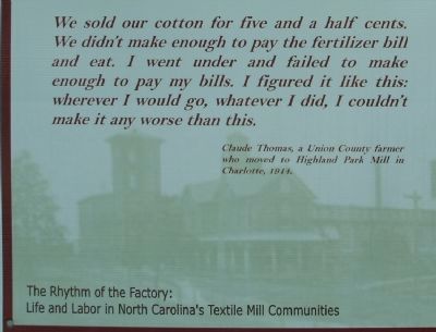
In the decades following the Civil War, the textile industry thrust the South into a period of rapid industrialization. In North Carolina, construction of railroads began through Piedmont “backcountry,” and cities sprung up in their paths. Piedmont . . . — — Map (db m222805) HM
On Jeb Seagle Drive at Linwood Drive, on the left when traveling west on Jeb Seagle Drive.
After several years of war and a military stalemate in the northern colonies, the British took the war to the South. After capturing Charleston, South Carolina, on May 12, 1780, Lieutenant-General Charles, 2nd Earl Cornwallis eyed North Carolina as . . . — — Map (db m231949) HM
Sacred to the Memory of
Major William Chronicle, Captain John Mattocks
William Rabb and John Boyd
Who Were killed at this place on the 7th.
of October 1780. Fighting in Defense of America.
Colonel Ferguson an officer of his Britannic . . . — — Map (db m231571) HM
On This square was located the Courthouse of Gaston County from 1847 until the County seat was moved to Gastonia in 1911. The first structure, built of logs, was replaced by a brick building in 1848. The interior of this latter building, together . . . — — Map (db m18582) HM
On East North Street at Broad Street, on the left when traveling east on East North Street.
A stately oak stood here for nearly 300 years. It symbolized the patriots' yearning for freedom and the bitterness of their conflict with the British crown. In 1779, two tories (Americans loyal to Britain) plundered the home of George Wilfong in . . . — — Map (db m183068) HM
The General and Statesman
Isaac Shelby’s military decisions at the Battle of King’s Mountain in 1779 secured a critical victory for America during the Revolutionary War. Before war’s end, Shelby had also served in the North Carolina . . . — — Map (db m120217) HM
On Spring Street, on the right when traveling west.
John (1776-1823) and Elizabeth Plemmons (1778-1829) Tumlinson were born in Lincoln County, North Carolina and lived in Tennessee, Illinois, and Arkansas before coming to Texas with their seven children as members of Austin's Old Three Hundred . . . — — Map (db m29965) HM
On North Main Street at Virginia Street, on the left when traveling north on North Main Street.
Peter Tumlinson was 19 years old when his family moved to Texas in 1821. During an 1823 skirmish with Waco Indians, his father, John Jackson Tumlinson, became the first Texas Ranger to die in the line of duty. Peter followed his father into the . . . — — Map (db m260099) HM
On Court Square (State Highway 27) at West Main Street, on the right when traveling south on Court Square.
On this exact site a three story brick building was erected in 1852 by John Motz and known as Motz Hotel, Leading hotel in western North Carolina. Fulfilling need, as Lincolnton was the most important town west of Salisbury. Purchased 1862 by Dr. . . . — — Map (db m44388) HM
On Wilkinson Boulevard (U.S. 74) west of Mason Street, on the right when traveling west.
This marker commemorates the Lincoln
County Regiment, a local militia in Lincoln County, North Carolina, during the
American Revolution. On October 7th, 1780,
these patriots participated in a major
strategic victory at the Battle of . . . — — Map (db m282492) HM
Near Elm Road 0.3 miles east of Belton Drive, on the right when traveling east.
Established about 1785, Cleveland County's oldest and most historic church cemetery contains remains of the earliest settlers from nearby communities and their descendants. Among those buried here are heroes of the Revolutionary War, the Indian . . . — — Map (db m285815) HM
On River Highway (North Carolina Route 150) at Mariner Pointe Lane, on the right when traveling west on River Highway.
Among the original pioneers from Pennsylvania, New Jersey, and Maryland who settled on the east side of the Catawba River were George Davidson (1-home destroyed), Reverend John Thomson, Moses White, Hugh Lawson, John Oliphant, John Brevard, . . . — — Map (db m283194) HM
Near Jeb Seagle Drive 0.2 miles north of Linwood Drive, on the left when traveling north.
By the spring of 1780 the war for America's independence, begun five years earlier in Massachusetts, had moved south. Following decisive victories in Georgia and South Carolina, the British army under the command of Lord Cornwallis was poised to . . . — — Map (db m44428) HM
On State Highway 73 at Eastlake Lane, on the right when traveling west on State Highway 73.
In 1747 Adam Sherrill and his 8 sons migrated from Pennsylvania and settled west of the Catawba River. By July, 1749, John Beatty had also crossed the Catawba. Sherrill’s Ford (site underwater) and Beatty’s Ford (underwater) were named for them. . . . — — Map (db m156502) HM
On Malcolm Boulevard (County Route 1001) just north of Campus Street.
Evolved from private school opened c. 1853 by R.L. Abernethy. Operated 1900-1933 by Methodist Church. Closed 1935. The original site 1.3 mi N. — — Map (db m20391) HM
On Malcolm Boulevard (County Route 1001) 0.1 miles south of Campus Street, on the right when traveling north.
Evolved from private school opened c. 1853 by R.L. Adernethy. Operated 1900-1933 by Methodist Church. Closed 1935. The original site 8/10 mi N. — — Map (db m20393) HM
On Hickory Lincolnton Highway south of Grace Church Road, on the right when traveling south.
Juror, soldier, and patriot in the cause of American independence during the Revolutionary War. Served under Colonel Frederick Hambright in the history making
Battle of King's Mountain on Oct. 7, 1780. — — Map (db m261718) HM WM
On Jeb Seagle Drive at Linwood Drive, on the left when traveling west on Jeb Seagle Drive.
After two hours, fighting ceased. As the fog lifted, the scene revealed the dead and wounded scattered on the ridge and flanks. About 100 men on each side were wounded and 50 Tories were taken prisoner. Casualties were heavy among officers. By . . . — — Map (db m231959) HM
Near Gilead Road 0.1 miles west of Old Store Road, on the right when traveling west.
Hugh Torance House and Store, originally a simple log cabin dating to 1779, is the oldest standing store in North Carolina, and one of the few remaining 18th-century structures in Mecklenburg County.
Who was Hugh Torence
In 1763, Hugh . . . — — Map (db m307354) HM
Near Organ Church Road at Shive Road, on the right when traveling north.
Arends
Johann Gottfried Arends
December 11, 1740-July 9, 1807
He came here as a teacher in 1773, German church leaders complied with the request from sixty Rowan families carried by Christopher Lyerly and Christopher Rendleman, . . . — — Map (db m181950) HM
On East Court Street (Ohio Route 29) at South Ohio Street ( Route 47), on the right when traveling west on East Court Street.
General Isaac Shelby
December 11, 1750 – July 18, 1826
Husband, Father, Farmer, and
Namesake of Shelby County
First Governor of Kentucky (1792-1796)
Fifth Governor of Kentucky (1812- 1816)
Hero of Dunmore’s War,
American . . . — — Map (db m211070) HM WM
This church, the first Associate Reformed Presbyterian congregation in what is now Anderson County, was organized about 1790 about 1 1/2 mi. SW of this site. Rev. Robert Irwin, its first regular minister, served from 1803 until his death in . . . — — Map (db m11747) HM
On Hickory Lincolnton Highway at Grace Church Road, on the left when traveling north on Hickory Lincolnton Highway.
Erected in 1847 as
Grace Union Church
Reformed and Lutheran
Organized 1797 - Separated 1940
Grace Evangelical ad Reformed
Congregation 1940-1969 — — Map (db m261559) HM