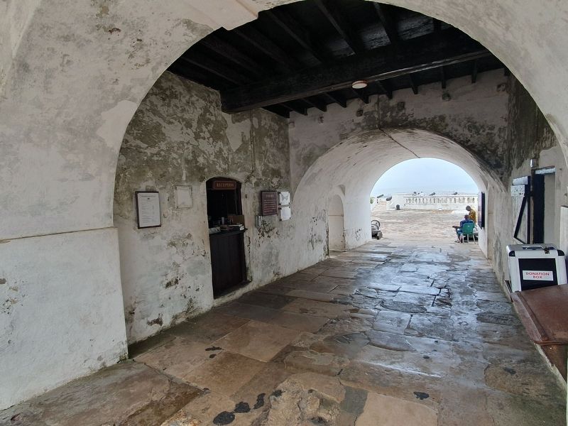
Near Victoria Road, on the right when traveling east.
Ghana Museums & Monuments Board
The arrival of Europeans along the Gold Coast in West Africa led to the establishment of fortifications at various locations to facilitate gold and slave trades. The fortifications were designed to . . . — — Map (db m231371) HM
Near Kings Street north of Victoria Road, on the right when traveling north.
Captains James Potter
The Wesley Methodist Church Ghana, salutes
Captain Potter for his unparalleled role in the
establishment of Methodism in Ghana. Captain Potter's story, culled from
"The Root of Ghana Methodism" by F. L. Bartels goes . . . — — Map (db m237509) HM
Near Victoria Road, on the right when traveling east.
In memory of John Swanzy, Governor of Accra, & Member of Council, 5th son of Henry & Anne Swanzy, of Avelreagh Co Monaghan, Ireland, who died at Cape Coast Castle 22nd Octbr 1807 His last act was to save from slavery some of the Fantees, seized . . . — — Map (db m227853) HM
Near Victoria Road, on the left when traveling west.
This plaque was unveiled by President Barack Obama and the First Lady Michelle Obama of the United States of America on the occasion of their visit to the Cape Coast Castle on the 11th day of July 2009 — — Map (db m227176) HM
Near Kings Street north of Victoria Road, on the right when traveling north.
Rev. Thomas Birch Freeman Rev. Thomas Birch Freeman is arguably,
the father of Ghana Methodist.
He arrived in 1838 and died here in 1890.
He expanded the work of the church
from Cape Coast to Ashanti.
He also established schools . . . — — Map (db m237508) HM
On Victoria Road west of Commercial Street, on the right when traveling west.
In memory of the officers, warrant
officers, non commissioned officers and men of the Gold Coast Forces, Royal West African Frontier Force who gave their lives for their king, country and people in the World Wars
1914-1918, 1939-1945 "Their . . . — — Map (db m226702) WM
Near Royal Lane east of Queens Drive, on the left when traveling east.
Sir James Marshall M.A B.L RCSG. CMG
Born: 29th December, 1829 at Edinburgh, Scotland Resident at British Headquarters
Cape Coast as Chief Magistrate and Judicial
Assessor to the Gold Coast (Ghana) 1873-1875
as Puisne Judge, Lagos, . . . — — Map (db m237504) HM
On King Street north of Victoria Road, on the right when traveling north.
Methodist Church Ghana Wesley Society – Cape Coast Pacesetter of Methodism in Ghana
Cape Coast Wesley Society, with its spectacular Victorian edifice in which the remains of the first 5 pacesetter missionaries Rev. Joseph R. Dunwell, Rev. & . . . — — Map (db m227173) HM
Near Kings Street north of Victoria Road, on the right when traveling north.
William Degraft
W.D. was the leader of the group in the Castle
called "The Bible Band", who were
desirous to read the Bible with the aid of
commentaries against the then Governor
Charles Maclean's directive. They were
imprisoned and . . . — — Map (db m237510) HM
On Dutch Cemetery Road at Dziewu Street, on the left when traveling east on Dutch Cemetery Road.
This Old Dutch Cemetery was initially constructed
in 1806 by Governor J. P. Hoogenboom.
Renovation works to the Old Dutch
Cemetery were undertaken in 2006 as part
of the implementation of the Elmina 2015
Strategy with financing from
the . . . — — Map (db m237534) HM
Near Liver Pool Road south of Benya Street, on the left when traveling south.
Ghana Museums & Monuments Board
The arrival of Europeans along the Gold Coast in West
Africa led to the establishment of fortifications at various
locations to facilitate gold and slave trades.
The fortifications were designed to . . . — — Map (db m237532) HM
Cedrela odorata (Cedar)
A cedar tree planted by the team of a research expedition from
Mendel University in Brno, Czech Republic, to Ghana to
commemorate the 200th anniversary of Johan Gregor Mendel,
the father of genetics. Medase, . . . — — Map (db m216986) HM
On Unnamed park road west of Route N4, on the right when traveling south.
Cocoa
The seed of this South American tree (Theobroma Cacao) have been used for food since
ancient times, the Aztecs of Central America called it food of the gods, believing it was
devine origion. This is also reflected in its scientific . . . — — Map (db m260652) HM
On unnamed street just west of Route N4, on the left when traveling south.
Scientific Name: Cola nitida.
Local Name: Bese (Twi).
Family: Sterculiaceae.
Medicinal Use, In Ghana a paste prepared from the nut is topically applied to lesions, it stimulates the Central Nervous System and is appetite depressant. In . . . — — Map (db m260653) HM
This monument was unveiled
on the occasion of the 110th anniversary of Aburi Botanic Gardens
by H.E. Flt. Lt. J. J. Rawlings President of the Republic of Ghana
on 27th May, 2000 — — Map (db m216988) HM
Lady Knutsford (silk cotton tree)
This tree (remains left) was the sole survivor of the
original forest and was named after the wife of Lord
Knutsford G.C.M.G then secretary of state for colonist
(1887-1892) to commemorate her . . . — — Map (db m216932) HM
Nutmeg
Nutmeg (Myristica fragrans) is native of the Molucca (Indonesia) and introduced to Ceylon (Sri Lanka) about 1804. The nutmeg of
shops is the hard, brown, ovoid kernel, which is
enclosed in a this brittle shell, . . . — — Map (db m216933) HM
On Unnamed park road north of Route N4, on the left when traveling north.
A large tree up to 120ft (36m) with high narrow
buttresses, leaves in whorls of 4-7 at each node and
flowers small and white. The wood is white with
slight yellowish tinge, soft and of uniform
texture. It is suitable for light carpentry. It . . . — — Map (db m261712) HM
On Unnamed park road north of Route N4, on the left when traveling north.
Scientific Name: Ficus elasticoides
Common Name: Rubber Shade Tree
Twi Amane Gyedua
This famous woody parasite was first
discovered in the fork of the tree "Afzelia africana" in 1906. It kept on developing
gradually and in 1936 it . . . — — Map (db m261714) HM
Vitellaria paradoxa
Common Name: Shea Nut Tree (Twi-nkudua)
Origin:
Guinea Savannah of Africa (Trop. Africa)
Family: Sapotaceae
It is called after Mungo Park, who first showed that the
Sudanese Toulon (Bambouk) ie. Shea butter, . . . — — Map (db m216931) HM
On Kwame Nkrumah Avenue at Asuogyaman-Atimpoku Road, in the median on Kwame Nkrumah Avenue.
This plaque was unveiled on the 23rd January 1962 by Osagyefo Dr. Kwame Nkrumah President of the Republic of Ghana Chairman of the Volta River Authority to mark the official commencement of construction of the Volta River Development — — Map (db m238350) HM
On Tema-Jasikan Road (National Route N2), in the median.
Asameni The Governor of the Christianborg Castle 1693-1694
Visit Nyanawase - (Akwamufie) to learn more about him and his military exploits.
Commissioned by Hon. Yaw Barimah (MP) & Eastern Regional Minister
and Hon. E.W. Ntow-Bediako . . . — — Map (db m238348) HM
Near Akosombo - Tema Road, on the right when traveling north.
Tree Columns Design at the Royal Senchi Hotel
These Tree Columns used in our Main and Conference Room entrances as
well as the Nsu Bar were harvested from the Volta Lake and had been
underwater for 45 years. At the time of flooding, the . . . — — Map (db m218887) HM
Near Harley Street, on the right when traveling west.
Born in Fukushima Prefecture in Japan. After the studies in Kitazato's Institute (Japan) and Pensylvania University (U.S.A.), he worked at Rockfeller Institute for Medical Research (U.S.A.) to investigate trachoma, . . . — — Map (db m308028) HM
On Harley Street west of Glover Addo Road, on the right when traveling west.
Born in Preston, Ontario, Canada, 20 July, 1869. Passed out of the Royal Military Academy, Woolwich, in 1889 as Second Lieutenant, Royal Engineers. Served from 1902 to 1908 as assistant director and later as director of the Mines Survey . . . — — Map (db m245215) HM
On Prof. Atta Mills High Street at Onamroko Korle Road, on the right when traveling east on Prof. Atta Mills High Street.
Welcome to Ussher Fort, Usshertown
Ussher Fort was originally built by the Dutch
in 1649 as Fort Crèvecoeur. It was part one of the Dutch forts along the
Gold Coast. Shattered by an earthquake, the Dutch Fort Crèvecoeur was . . . — — Map (db m225627) HM
On Kojo Thompson Road north of Market Road, in the median.
This monument in commemoration of
the centenary celebration of the death of
King Tackie Tawiah I
who reigned as the 20th king of the Ga State
from September 1862 to July, 1902
Was commissioned by Mr. John Agyekum Kufuor · . . . — — Map (db m221002) HM
On Prof. Atta Mills High Street just west of Independence Link, on the right when traveling west.
Martyrs of the Rule of Law On 30th June 1982, during the curfew hours,
three eminent High Court Judges and a retired Army Officer, namely:
Mr. Justice Frederick Poku Sarkodee, Mrs. Justice Cecilia Afran Koranteng-Addow,
Mr. Justice Kwadwo . . . — — Map (db m220215) HM
Near Prof. Atta Mills High Street east of Thorpe Road, on the right when traveling east.
Osagyefo Dr. Kwame Nkrumah
(1909-1972)
The original statue of
Dr. Kwame Nkrumah which stood in front of
Parliament House,
opposite Old Polo Grounds, Accra
Attacked by a mob,
vandalised as it stands
now in the wake of
a military . . . — — Map (db m231924) HM
On 28th February Road at Castle Drive, on the left when traveling east on 28th February Road.
Dedicated to the memory of Sgt Adjeitey ∙ Cpl Atipoe ∙ Pte Odartey Lamptey who died at Christianborg Crossroads on 28th February, 1948. Dedicated to the memory of Sgt Abdulai Allasan ∙ Cpl Lassey Sewoatsi ∙ Pte Francis . . . — — Map (db m216679) WM
On Castle Road at Angola Avenue, on the right when traveling west on Castle Road.
Ghana in the two World Wars Well before the First World War Gambia, Ghana, Nigeria and Sierra Leone had raised local infantry units. Ghana and Nigeria also had artillery batteries. Whilst their individual identities and recruitment areas were . . . — — Map (db m217015) HM WM
On Starlets 91 Road at Malam Awudu Road, on the right on Starlets 91 Road.
Gbomo nyemii dzi gbomo
(I am my brother’s keeper)
In memoriam In remembrance of the 127 persons who lost their lives at the Accra Sports Stadium on May 9 2001 May their souls rest in peace This memorial was unveiled on May 9 2003 by His . . . — — Map (db m217014) HM
Near Barnes Road at Tsiranana, on the left when traveling south.
Dr. Kwame Nkrumah (1909-1972)
The original statue of Dr. Kwame Nkrumah which stood in front of Parliament House, Accra attacked by a mob in the wake of a military and police coup d’etat on 24th February 1966 Recovered for the National . . . — — Map (db m215838) HM
On Airport Bypass Road just north of Giffard Road, on the left when traveling north.
Agusta 109A Helicopter
Registration number G670
Manufacturer Gruppo Agusta Company Italy
Engines two (2) Allison 250-(20B)
Endurance 2 hrs 30 mins
Max troop capacity 8 (2 pilots + 6 pax)
Year of entry into svc 1996
Hours flown . . . — — Map (db m222455) HM WM
Near Nehru Road at Liberation Road, on the right when traveling east.
In commemoration of our Golden Jubilee (1956-2006) Christ the King Intl. School with gratitude honour Rev. Fr. Leslie Hatfield, our founding father Unveiled on 23rd September 2006 by Most Rev. Charles Palmer-Buckle Rev. Fr. Leslie J. Hatfield . . . — — Map (db m219975) HM
On Fifth Link Road north of Second Circular Road, on the right when traveling north.
In honor and celebration of
Dr. Shirley Graham DuBois, Oberlin College and
Conservatory alumna, class of 1934 (A.B.) and 1935 (A.M.),
in recognition of her outstanding contributions
to humanity as social and political activist; . . . — — Map (db m219548) HM
On Fourth Circular Road at Cantonments Road, in the median on Fourth Circular Road.
Edward Akufo-Addo, COV 26:6:1906 – 17:7:1979 Founding member of United Gold Coast Convention (UGCC) Member of the “Big Six” Chief Justice of the Republic (1966-1970) President of the Republic (1970-1972) Your struggle for the total political . . . — — Map (db m224356) HM
On Liberation Road, on the right when traveling north.
This square is dedicated to the memory of our beloved compatriots who heroically and selflessly gave their lives in the noble cause of justice and peace. Unveiled by Flt. Lt. Jerry John Rawlings Chairman of the Provisional National Defence . . . — — Map (db m219883) WM
Near Fifth Link Road north of Second Circular Road, on the right when traveling north.
In recognition of our centennial anniversary and in celebration of the fiftieth anniversary of the independence of Ghana, we honor the legacy of W.E.B. DuBois, Ph.D., founder of Pan-Africanism and distinguished member of Alpha Phi Alpha . . . — — Map (db m219427) HM
On Mahama Road north of Empire Avenue, in the median.
Major Maxwell Adam Mahama (GH/3454) was born on 1st November
1985 in Bole. After his Senior Secondary Education, he enlisted into the
Ghana Military Academy on 6th October 2005 as part of Regular Career
Course 47. Maxwell was commissioned into . . . — — Map (db m240421) HM
Near Shai Hills Southern Access Road just east of Tema-Akosombo Road, on the right when traveling east.
Shai Hills Resource Reserve (one of the smallest Protected area in Ghana) located in the Dangme West District of the Greater Accra Region, was declared a Forest Reserve in 1962 with an area of 46.7 km² (4,700 ha; 18 sq. mi.) and was made a Resource . . . — — Map (db m274403) HM
This plaque was unveiled by Most Rev. Gregory E. Kpeibaya Archbishop of Tamale
on the occasion of OLA Cathedral Parish Golden Jubilee Tamale in commemoration of
the pioneers of the parish.
M. Afr. (W.F.) ∙ Frs. R. McCoy, T. Tryers, P. . . . — — Map (db m243571) HM