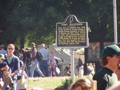
First post in Indiana area built nearby in 1717 by French Canada to counter British expansion in valleys of Wabash and Ohio rivers. Served as trade and communication post. French surrendered fort to British in 1761 during the French and Indian War. . . . — — Map (db m36207) HM
Used by Indian tribes and often traveled by Chief Tecumseh prior to defeat of his warriors by Gen. William Henry Harrison at the Battle of Tippecanoe on November 7, 1811. — — Map (db m34920) HM
(Side One)
was called "Wah-bah-shik-ki" by the Miami. The French called it the "Oua-ba-che." It was the principal route connecting Quebec and New Orleans. The Miami, Potawatomi, Mascouten, Wea, Kickapoo, and Piankashaw Indians lived in . . . — — Map (db m217625) HM
Granville cemetery was once part of the great Wea Plains and still contains many species of the original prairie vegetation. This is one of the last remnants of the Indiana prairies that covered much of Tippecanoe County. It is preserved and managed . . . — — Map (db m34903) HM
Surveyors’ maps of 1824 and 1846 of Tipton County marked the Indian Portage Trails through Tipton, the junction between the Indiana water ways.
[[ Maps on Left Side of Plaque ]]
To Wabash River Waters
Kokomo Trail - - . . . — — Map (db m37886) HM
In October 1818, Purchasing Commissioners Lewis Cass, Benjamin Parke and Governor Jonathan Jennings acquired Indian claims on the land shown on this marker. About one-third of modern Indiana was involved in this transaction. — — Map (db m213257) HM
Site of a palisaded Middle Mississippi Indian village occupied circa 1500 A. D. This 450-acre site includes eleven man-made mounds, town plaza and village area for a population of about 1,000. Excavated by the Indiana Historical Society, 1939-1965. — — Map (db m227024) HM
Angel Site was a large prehistoric town that flourished between 1000-1450 C.E.
With towering earthworks, a broad plaza and well-built homes, Angel was an important regional center for people living along the Lower Ohio.
At its peak, around . . . — — Map (db m227028) HM
Archaeologist Glenn Black was born in
Indianapolis and spent much of his
career at Angel Mounds, a Native
American village and ceremonial
center (c. 1050-1400). Known for studies
there and at other sites, his work
redefined archaeological . . . — — Map (db m227008) HM
Isaac Knight was a prominent early settler
and Indian fighter in Vanderburgh County.
He was born in Washington Co. Pa. shortly
after his parents left New Jersey enroute to
Henderson, Kentucky. In 1793 he was captured
by the Indians in the . . . — — Map (db m227007) HM
Indiana University students trained with Glenn Black.
From 1945-1964. Glenn Black trained students from Indiana University. Men and women enrolled in summer field schools to learn how to excavate, document and care for artifacts. If they . . . — — Map (db m227034) HM
WPA workers were the first to help with excavations.
In April, 1939, 20 WPA (Works Progress Administration) workers reported to the Angel Site. They were part of a Depression-era job corps funded by the government.
For the next three . . . — — Map (db m227030) HM
100 yards south, Harrison's Army crossed the Big Vermillion at sunrise, having just built Boyd's Blockhouse, enroute to the Prophet's Town at the mouth of the Tippecanoe to disperse the Indians there assembled. — — Map (db m3700) HM
Brouillette Creek (pronounced “Brew-yet”) that
flows through southern Vermillion County and
joins the Wabash River in northern Vigo County
is named for Michel Brouillette, French fur
trader from Vincennes. Michel Brouillette, the
father, came . . . — — Map (db m226126) HM
Side One
This bountiful area on the Wabash River was occupied early by American Indians. French and later Americans recognized this strategic area called terre haute (high land). At least one Wea village was present in area by late 1700s. Wea . . . — — Map (db m58387) HM
About 1747 the British encouraged the Miami at Kekionga to leave the French influence for their protection and cheaper trade goods at Pickawillany. The British post near Piqua, Ohio. Osandish, grandfather of Metocinyah, died shortly after he led his . . . — — Map (db m72540) HM
Chief Metocinyah, whose village was destroyed by Campbell's troops during the Mississinewa Expedition of 1812, has been credited with quieting the Miami after the invasion. This service to the Americans is believed to be the reason his band was . . . — — Map (db m215012) HM
This millstone is a remnant of the grist and saw mills built near here for Miami Indians by United States government as part of 1818 Treaty of St. Mary's. Treaty also established several Miami reservations in area. Possibly first industrial site in . . . — — Map (db m61118) HM
Captured as a child by the Delaware Indians in 1778 from her Pennsylvania home, she grew up with the Indians, married a Miami chief, and lived in Indiana till her death, 1847. — — Map (db m61140) HM
(North Face)
Frances Slocum
A child of English descent, was born in Warwick, Rhode Island, March, 1773, was carried into captivity from her father's house at Wilkes-Barre, Pennsylvania. November 2, 1778, by Delaware Indians soon . . . — — Map (db m85240) HM
The Problem
The Stockdale Mill has worked well for the production of flour and corn meal since construction in 1856 however;
the dam that provides waterpower to the mill turbine also hindered the ability of fish to migrate upstream. Nearly . . . — — Map (db m163122) HM
The Council House was used by the commissioners during negotiations and preparation of the Treaty of 1826. Following the completion of the treaty signing, it continued to play an important role in the development of the area.
In the spring of . . . — — Map (db m76574) HM
The treaty between the United States and the Miami Tribe of Indians was held near this spring October 23, 1826 U.S. Commissioners Louis Cass, James B. Ray and John Tipton.
Erected Indiana Centennial Year 1916 — — Map (db m76495) HM
Site chosen for 1826 Treaty of the Mississinewa due to the plentiful spring that once sprang forth from adjacent hill creating this wilderness valley Paradise.
In the early 1820's, the northern half of Indiana was predominantly occupied by . . . — — Map (db m215054) HM
Paradise Spring Historical Park is rich with history. In 1826, United States representatives met on this site with the chiefs of the Miami and the Potowatami tribes. A treaty was signed allowing for white settlement of land in northern Indiana and . . . — — Map (db m76548) HM
At treaty ground (two blocks east) in October, 1826, Potawatomi and Miami tribes signed treaties with the United States ceding lands north of the Wabash River. The treaties included provisions for land for a canal and the Michigan Road. — — Map (db m1458) HM
A veteran of the Battle of Tippecanoe, General Tipton was apointed to the Indian Agency located in Ft. Wayne Indiana, by President Monroe.
John Quincy Adams appointed Major General Tipton Indian Commissionder to oversee treaties with the Indians . . . — — Map (db m76577) HM
The Wabash River begins as a small stream near Fort Recovery, Ohio and passes through 16 Indiana counties on its 500 mile journey to its confluence with the Ohio River.
The river was named Wah-Bah-Shi -Ka, meaning “water over the white . . . — — Map (db m76549) HM
In the early 1820's, the northern half of Indiana had very little white settlement.
The Miami and Potawatomie Indians had suffered serious defeats at the hands of General Anthony Wayne along the Maumee River (1794) and William Henry Harrison at . . . — — Map (db m215014) HM
In the yard of this home is visible the trail followed by the heavy wagons of the Army under Gen. Harrison passing here on the way to Tippecanoe, November 3, 1811 — — Map (db m41400) HM
On September 15, 1838, about 860 Potawatomi Indians camped near here on the forced removal from Indiana to Kansas. They had to camp by a dirty stream. Two small children who died on the trek from Williamsport were buried at this camp. — — Map (db m32495) HM
Nov. 3, 1811
Harrison’s Army
Camped on the West side of this grove near a spring, on his way to Tippecanoe. On his return trip he again camped here and buried two soldiers who had been wounded at The Battle of Tippecanoe. — — Map (db m41401) HM
In 1838 a band of over 800 Potawatomi Indians were forcibly removed from their homeland in Northern Indiana and marched to Eastern Kansas. Many died along the trail during the two month trek. This mournful caravan traveled this road on September 14, . . . — — Map (db m9307) HM
About 850 Potawatomi Indians camped here near Williamsport September 14, 1838. Two deaths occurred in the evening. Three chiefs were transported in a jail wagon because they refused to leave their beloved homeland in Indiana. — — Map (db m32620) HM
Indian Boundary Line
marking the
Twelve Mile Purchase
from the Indians by the
Fort Wayne Treaty
in 1809 by
Gov. William Henry Harrison
Placed by the
National Old Trails Chapter
Daughters of the American Revolution . . . — — Map (db m120639) HM
This Tablet Marks
the Boundary Line Between
Government and Indian Lands
fixed by
Gen. Anthony Wayne and
Twelve Tribes of Indians
in the Greenville Treaty 1795
also
The Site of Salisbury
1/3 mile south east ---- the first . . . — — Map (db m120635) HM
Peacemaker
"First Great Hoosier"
In 1795, Chief Little Turtle realized his confederacy of Indian warriors could not defeat General Anthony Wayne's U.S. Army and the large influx of settlers moving into Indiana and the Midwest. After he . . . — — Map (db m232397) HM WM
[Front Side of Marker];
With recommendation from Benjamin Franklin, Augustin de La Balme, former French Cavalry officer, came to America to assist in the American Revolution.
In November 1780, allegedly under secret orders from . . . — — Map (db m52817) HM
After General William Henry Harrison relieved Fort Wayne, he ordered Colonel James Simrall in September 1812 to prevent further Miami Indian attacks in the area. The Miamis fled as troops destroyed villages, crops, and supplies along Eel River; . . . — — Map (db m1335) HM
Ten Rods North. Site of a Miami trading post 1762. Fortified by Chief Little Turtle 1779. House built for him after Greenville Treaty. Spared when Fort Razed by Colonel Simrall. Sept 1812.
Funded by Col. Augustin de le Balme Chapter, Daughters . . . — — Map (db m222041) HM
In Memory of
Col. Augustin de La Balme and his
Soldiers who were killed in
Battle with the Miami Indians,
Under Little Turtle, at this place,
November 5th, 1780 — — Map (db m52758) HM
1752.......................1812
Site of British Fort
and
Last Home of
Chief Little Turtle
(Me-she-me-noc-quah)
1795.......................1812 — — Map (db m52803) HM
This area is within the territorial limits of Seek's Village Miami Indian Reservation. The tribe, ordered by the U.S. government to a reservation near Leavenworth, KS, left in 1837. — — Map (db m232343) HM
Little Turtle (Mishikinoqkwa), c. 1747–1812, was born and raised here on the Eel (Kenapocomoco) River. The Miami village was destroyed by American troops in 1812 and most of the tribe was removed from Indiana by 1843. — — Map (db m1336) HM
This area of high ground, over 300 acres south of the Eel River, is called "The Island". It was once a principal stronghold of the Miami Indians under Chief Little Turtle. It was a boundary line for lands between the Pottawattomis and Miamis, an . . . — — Map (db m29996) HM
Miami captive at 14; adopted by Little Turtle; appointed chief scout by Wayne in 1793; granted farm near Ft. Wayne by Congress for "valiant and conspicuous service." Died in Ft. Dearborn Massacre. — — Map (db m58108) HM
247 entries matched your criteria. Entries 201 through 247 are listed above. ⊲ Previous 100