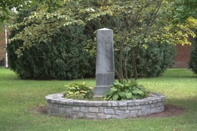
In memory of Frank Padget, a coloured slave who during a freshet in James River in January 1854, ventured and lost his life by drowning in the noble effort to save some of his fellow creatures, who were in the midst of the flood, from . . . — — Map (db m49863) HM
Remember your Rockbridge County Veterans
"For to live in hearts we leave behind is not to die"
They gave youth, mind, and body
Honoring all veterans of Korea
Honoring all veterans of Rockbridge County
For those who . . . — — Map (db m172890) WM
Relocated from its original site approximately fifty miles to the south on Little Patterson’s Creek in Botetourt County, Virginia, the Barger home, immediately in front of you, is an operational pre-Civil War farmstead from the Valley of Virginia. . . . — — Map (db m16653) HM
At the close of the eighteenth century, Virginia stretched from the Atlantic Ocean to the Ohio River. The coastal plain, Piedmont, Blue Ridge Mountains, and Alleghany Mountains lay between, with the James River running east to west. From the . . . — — Map (db m170607) HM
Rockbridge County. Area 616 Square Miles. Formed in 1778 from Augusta and Botetourt, and named for the Natural Bridge. Samuel Houston and Cyrus H. McCormick were born in this county. Robert E. Lee and Stonewall Jackson are . . . — — Map (db m55788) HM
The Confederates had four cannons at the Battle of Hoke's, although only one ,vas used in the fighting.
These guns belonged to the 1st Rockbridge Artillery; which had been organized in Lexington, Virginia (in Rockbridge County) in April . . . — — Map (db m303395) HM
In 1804, a group of Scotch-Irish Covenanters from Rockbridge County, Virginia, erected a log church on this location. In 1805, they organized the Cherry Fork Associate Reformed Presbyterian Church. Two brick churches were also built on this . . . — — Map (db m133853) HM
Native of RockBridge County Virginia He liberated agriculture befriended education and advanced the cause of religion Trustee and benefactor of Washington and Lee University — — Map (db m58713) HM
McCormick County: Gem of the Freshwater Coast
McCormick County was named or Cyrus McCormick, a 19th century agricultural equipment inventor, who purchased Dorn's Gold Mine (Town of McCormick) after the Civil War. While it is one of the last . . . — — Map (db m11398) HM
Sabine Hill, the large Federal-style structure on the knoll to the south, is one of the oldest surviving homes in Carter County. General Nathaniel Taylor (1771-1816), a veteran, of the War of 1812, began the construction of Sabine Hill shortly after . . . — — Map (db m174643) HM
"Happy Valley" and Sabine Hill (1778-1853) In 1778, during the Revolutionary War, Andrew Taylor traveled from Virginia to what would later become eastern Tennessee. Taylor settled near this location on the Powder Branch of Buffalo . . . — — Map (db m174640) HM
Born in County Armagh, Ireland, in 1754 and orphaned as a child, John Robinson was indentured as a weaver's apprentice before emigrating to the United States when he was a teenager. He settled in Rockbridge County, Virginia, where he worked as an . . . — — Map (db m231473) HM
To persons familiar with the history of McCormick, the Dorn Mill stands as a symbol of the influence of the Dorn family in the region. It rests on land previously owned by Gold Mine "Billy" Dorn and Cyrus McCormick, inventor of the reaper.
. . . — — Map (db m11391) HM
Dorn's Mill. Built ca. 1899, this steam-powered mill employed a milling process pioneered earlier by inventor Oliver Evans, which virtually eliminated manual labor. First known as the McCormick Enterprise Ginnery, the mill became the . . . — — Map (db m243241) HM
Amherst County. Area 470 Square Miles. Formed in 1781 from Albemarle, and named for Jeffrey, Lord Amherst, British commander in the French and Indian War. Balcony Falls are in this county.
Rockbridge County. Area . . . — — Map (db m49888) HM
Amherst County. Area 470 Square Miles. Formed in 1781 from Albemarle, and named for Jeffrey, Lord Amherst, British commander in the French and Indian War. Balcony Falls are in this county.
Rockbridge County. Area . . . — — Map (db m307447) HM
Bath County. Area 545 Square Miles. Formed in 1790 from Augusta, Greenbrier, and Botetourt, and probably named for the town of Bath in England. The warm springs and hot springs are in this county.
Rockbridge County. . . . — — Map (db m34304) HM
Alleghany County. Area 458 Square Miles. Formed in 1822 from Bath, Botetourt, and Monroe, and named for the Alleghany Mountains. At Fort Mann in this county a battle took place between settlers and Indians led by Cornstalk, . . . — — Map (db m46391) HM
Rockbridge County. Area 616 Square Miles. Formed in 1778 from Augusta and Botetourt, and named for the Natural Bridge. Samuel Houston and Cyrus H. McCormick were born in this county. Robert E. Lee and Stonewall Jackson are buried . . . — — Map (db m34306) HM
Rockbridge County. Area 616 Square Miles. Formed in 1778 from Augusta and Botetourt, and named for the Natural Bridge. Samuel Houston and Cyrus H. McCormick were born in this county. Robert E. Lee and Stonewall Jackson are . . . — — Map (db m23760) HM
Dr. Robert Sumter Griffith's life involved railroads. Even the fact that he practiced medicine in Waynesboro is because of the railroad. The popular physician, never seen without his round wire spectacles and his trademark western bowtie, was born . . . — — Map (db m237790) HM
"…in the fervent hope that our labours may be blessed and the religion of Christ advanced."
-- Robert E. Lee, Senior Warden. Report to Grace Church, September 16, 1868
Grace Church was established in . . . — — Map (db m172854) HM
Washington and Lee University's involvement with slavery is a regrettable chapter of its history that must nonetheless be confronted and examined. The most well-documented episode in that chapter is the 1826 bequest of 84 enslaved African Americans . . . — — Map (db m233084) HM
"The dance hall was the most popular activity." Community member Bertie Pannell
Visitors from Across the State
The significance of Montgomery Hall Park in the Jim Crow era stretched across Virginia. The segregated park was . . . — — Map (db m283120) HM
(Lower Plaque)
Built by Col. Valentine Ripley, early
businessman, this is one of the first
brick structures in Hendersonville.
Early uses were a general store,
post office and Confederate
commissary under Major Noe.
M.M. Shepherd . . . — — Map (db m34553) HM
Eli Seale 1793-1857
Elias (Eli) Seale was born in North Carolina in 1793. He served as a fifer in the War of 1812 in Mississippi, and in 1835 moved with his three brothers and his family from Alabama to Texas. He received his Mexican . . . — — Map (db m170484) HM
The oldest congregation in the Fincastle Presbytery, the Falling Spring Presbyterian Church, was organized before 1748. The Hanover Presbytery met here in October, 1780. The present Gothic Revival church was constructed of slave-made brick during . . . — — Map (db m165888) HM
Peace Circle, comprised of eleven monumental statues created by artist Linda Lewis at the Grapevine Foundry and completed in 2021, commemorates a moment in time that occurred on the Grape Vine Prairie in August 1843. That day, General Sam Houston, . . . — — Map (db m235682) HM
Thin black lines indicate changes in relevance. Between each pair of lines entries are ordered geographically but all have the same relevance.
* Inflectional forms of words are their plurals, singulars, and possessives as well as gramatical tenses and similar variations.