On State Street east of South Wall Street, on the left when traveling east.
”Lest we forget – lest we forget”
To the boys who wore the grey.
Erected by the Natchez Chapter No. 304
Daughters of the Confederacy
January 19, 1950
Commemorating those who left from
Natchez and Adams County
Mustered . . . — — Map (db m127098) WM
On Homochitto Street, on the right when traveling south.
In 1911, Booker T. Washington, President of Tuskegee Institute in Alabama, asked Julius Rosenwald, a Jewish Philanthropist, to serve on the board of directors at Tuskegee. Their unique partnership led to the creation of the Rosenwald Fund (1917) to . . . — — Map (db m288892) HM
On U.S. 61 1 mile south of Stampley Road, on the left when traveling south.
Curtis migrated to Cole's Creek in Natchez District from South Carolina in 1780 and encountered Indian attacks, disease and inclement weather. Despite constant obstacles and harassment from the Spanish authorities, in 1791, he helped establish the . . . — — Map (db m105823) HM
On North Main Street (State Highway 71) at Greenville Street (State Highway 20) on North Main Street.
Burt-Stark House When Jefferson Davis, President of the Confederacy, left Richmond after its fall in April 1865, he traveled south, trying to reach and rally the remnants of his army. On May 2, he spent the night at the home of Col. Armistead . . . — — Map (db m10564) HM
On Main Street at Greenville Street, in the median on Main Street.
This tablet was placed here to commemorate the last meeting of the Confederate States Cabinet which was held in the Burt House near by directly in front of this stone.
The following cabinet members were present:
Jefferson Davis, President . . . — — Map (db m73949) HM
On SC Highway 56, on the right when traveling south. Reported missing.
Jefferson Davis, President of the Confederacy on his flight from Richmond, Va. with his Cabinet and other high ranking officers spent the night of April 30, 1865 at the house 1½ miles west, then the home of Lafayette Young. Arriving there . . . — — Map (db m55837) HM
On Indian Mounds Park 0.1 miles west of South 5th Street, on the left when traveling east.
In 1804, the Sac and Fox cede their land between the Illinois and Mississippi Rivers to the United States. Nine years later, General Howard and 1,400 mounted rangers burn a Sac village near the future site of Quincy. Legend has it that the . . . — — Map (db m150073) HM
On St. Catherine Street 0.1 miles west of McCabe Street, on the left when traveling west.
The National Guard patrolled St. Catherine Street on September 3, 1965, not long after the August 27 bombing that nearly killed George Metcalfe, president of the local chapter of the Natchez Association for the Advancement of Colored People . . . — — Map (db m115639) HM
Near U.S. 61 1 mile south of Stampley Road, on the left when traveling south.
Until 1798, The Mississippi Territory was under Spanish rule. Threatened with banishment to the silver mines of Mexico because of preaching, Richard Curtis, Jr. returned to South Carolina until there was a change in the government. President . . . — — Map (db m105490) HM
On Jefferson Street at North Canal Street, on the right when traveling west on Jefferson Street.
The National Guard patrolled St. Catherine Street on September 3, not long after the August 27 bombing that nearly killed NAACP President George Metcalfe. The crowd stands in front of the Dr. John Banks House (above), then headquarters of the . . . — — Map (db m286373) HM
On Jefferson Street at North Canal Street, on the right when traveling west on Jefferson Street.
Civil Rights Act The March on Washington for Jobs and Freedom was the catalyst for the 1964 Civil Rights Act and the 1965 Voting Rights Act. The march, coupled with Dr. Martin Luther King Jr.'s “I Have a Dream” speech, were pivotal . . . — — Map (db m286372) HM
Near Cemetery Road 0.3 miles north of Maple Street, on the right when traveling north.
Civil War Natchez In 1860, Natchez was one of the wealthiest cities in the United States. Within the surrounding Adams County, population 19,000, nearly 70 percent were enslaved. A few individuals held the vast majority of those slaves. . . . — — Map (db m143536) HM
On North Doctor Martin Luther King Junior Street north of St. Catherine Street, on the right when traveling north.
The Natchez Deacons for Defense and Justice played a critical role in the civil rights movement in Mississippi. On September 10, 1965, they held their first meeting in this building, home to Leon Donnan's Barbershop, under the leadership of . . . — — Map (db m290905) HM
On State Street near South Wall Street, on the left when traveling west.
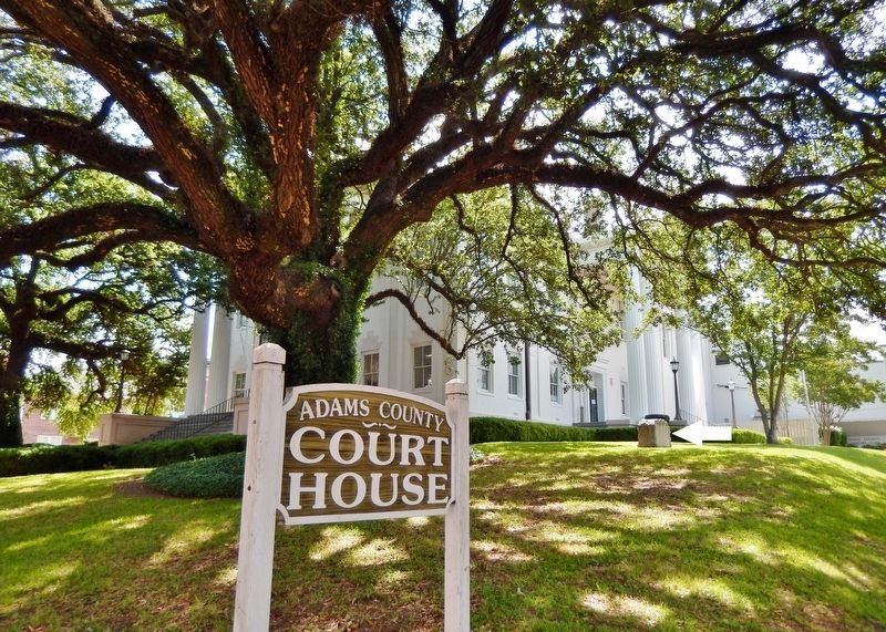
The domed Federal-style Adams County Courthouse appears in Audubon's 1822-1823 painted landscape of Natchez. Built in 1817, this courthouse is the oldest in Mississippi. It was remodeled in 1925. Actions at the courthouse impacted all of . . . — — Map (db m114502) HM
Natchez was an economic and cultural center for the Lower Mississippi River Valley in the years before the U.S. Civil War. Twentieth Century development has centered around industry, but much of the city's antebellum flavor has been preserved. . . . — — Map (db m115161) HM
On St. Catherine Street at 6th Street, on the left when traveling west on St. Catherine Street.
The photograph of the 1946 Brumfield High School Choral. Club, taken in the front yard of Brumfield, provides the best image of the Louis Winston House on the left. The house unfortunately burned in the 1990s. The house on the right, which still . . . — — Map (db m114661) HM
On South Pearl Street north of Main Street, on the right when traveling north.
This building, completed in July of 1853 and known as Institute Hall, was re-christened Memorial Hall in 1921 in honor of veterans of World War I. Re-dedicated in 2007, the structure was extensively renovated and now houses the United States . . . — — Map (db m106223) HM
A.Palmetto Bend
Mile 326.0 AHP
This bend and the plantation that lay on its bank were named for the Palmetto, a type of palm tree that was utilized by early settlers and found in abundance in this area. The trunks made durable wharf . . . — — Map (db m115158) HM
"Who shall say, I am the superior, and you are the inferior?" asked Lincoln in July 1858. The Lincoln-Douglas Debates focused on slavery. During the October 13th Quincy debate Lincoln affirmed: "...in the right to eat the bread . . . — — Map (db m58798) HM
On St. Catherine Street at 6th Street, on the left when traveling west on St. Catherine Street.
John R. Lynch turned to writing in his later years and wrote the Facts of Reconstruction in 1913. He completed his autobiography Reminiscences of an Active Life when he was 90, two years before his death in 1939.Lynch invested . . . — — Map (db m115927) HM
Near N. Broadway Street north of Main Street, on the right when traveling south.
Bontura, built in 1851, was the home of Robert Smith, a free African American who ran the city’s most successful carriage business in the 1850s. The house stands at the head of Silver Street, which leads to Natchez Under-the-Hill. Smith . . . — — Map (db m87179) HM
Near Havana Street (Wildlife Drive) 0.6 miles north of East 64th Avenue (Wildlife Drive), on the right when traveling north.
In 1942, women and men of the U.S. Army built this Arsenal that helped achieve victory in WWII and the Cold War. With thanks to our partners, the U.S. Army, Shell Oil Company and their contractors, we dedicate this flagpole to the employees of . . . — — Map (db m119380) HM
On Liberty Road south of St. Catherine St. (U.S. 61), on the right when traveling north.
[Panel 1:]
Natchez in the Center of Slavery
Slavery is central to American history. The labor of enslaved African Americans built much of the nation’s wealth and enabled it to gain its economic independence. The enslavement of people . . . — — Map (db m41533) HM
On North Dr. Martin Luther King Street at St. Catherine Street, on the right on North Dr. Martin Luther King Street.
The original appearance of Mt. Sinai Baptist Church is visible in a ca. 1930 historic photograph. The church featured corner towers crowned with domes.Mt. Sinai organized in 1913 and built the church soon afterwards. Like most historic African . . . — — Map (db m108636) HM
Near North Broadway Street near Learneds Mills Road.
Venomous Snakes of Adams County Venomous Snakes of Adams County Watch where you walk! Adams County is home to five species of venomous snakes: the Copperhead, Eastern Cottonmouth, Eastern Coral Snake, and the Canebrake and Pygmy Rattlesnakes. . . . — — Map (db m114651)
Woodland Cemetery—The necropolis that in life (Cornelius Volk) did so much to beaut(ify) and make attractive" (Quincy Daily-Herald, 1898). Among significant historical Woodland memorials are the gravestones of Orville and Eliza . . . — — Map (db m150258) HM
On 24th Street (Illinois Route 96) at Jersey Street, on the left when traveling south on 24th Street.
On an August night in 1842, Dr. Richard Eells, an active Quincy Abolitionist in the 1830-40's, was transporting a runaway slave named Charley to a safer location when his carriage was stopped near this spot by a posse searching for Charley. . . . — — Map (db m156857) HM
"Here, too, the father of the town, with other men of large renown, are gathered by that reaper stern, who cuts down each and all in turn" (Henry Asbury, Reminiscences of Quincy, Illinois". Referring to the leaders from an earlier . . . — — Map (db m150257) HM
On Baltimore Street south of Breckinridge Street when traveling south. Reported missing.
The American Civil War (1861-65) began several months after George and Hettie Shriver and their two daughters, Sadie and Mollie, settled into their new home (left). Shortly thereafter George mustered into Co. C Cole’s Cavalry of the Union Army in . . . — — Map (db m225454) HM
On North Union Street at Grant Street on North Union Street.
In memory of the Afro-American Experience in Natchez
Adams County Mississippi of segregated schools for
black children. Our treatment was second class at best,
but our principals and teachers were first class in their
guidance and values. Full . . . — — Map (db m224619) HM
On West 18th Street at Baynard Boulevard on West 18th Street.
African American Medal of Honor Recipients Memorial
The Medal of Honor takes its place in our country as the highest award for military valor. The honor, awarded by the President in the name of Congress, may only be accorded an . . . — — Map (db m173924) HM WM
Thin black lines indicate changes in relevance. Between each pair of lines entries are ordered geographically but all have the same relevance.
* Inflectional forms of words are their plurals, singulars, and possessives as well as gramatical tenses and similar variations.