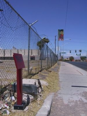
On North Las Vegas Boulevard at Cashman Center, on the right when traveling south on North Las Vegas Boulevard. Reported missing.
This WWII neighborhood was named for the Nevada Biltmore Hotel which opened nearby in 1942. A WWII housing shortage called for the construction of several hundred homes for military personnel and their families. The federal government approved the . . . — — Map (db m51057) HM
On West Van Buren Avenue at North E Street, on the right when traveling east on West Van Buren Avenue.
This fairy-tale residence reflects the unique family that built it, whose roots stretch back to a pioneering Utah Mormon blacksmith, ranchers in Idaho and Nevada, and railroad workers in Las Vegas.
The life of Las Vegas pioneer Lucretia Tanner . . . — — Map (db m51052) HM
On F Street at West Adams Avenue, on the right when traveling south on F Street.
Black entertainers were not allowed to stay at the Strip hotels where they performed in the 1940s and 1950s. Mrs. Harrison's boarding house offered fine accommodations for many of the era's most famous stars.
During one memorable week in . . . — — Map (db m51050) HM
On Jackson Avenue at F Street, on the right when traveling east on Jackson Avenue.
Commerce on the Westside was short lived, collapsing in 1905 when rival Las Vegas Townsite opened on the east side of the railroad tracks. In 1942, the Westside defined a new commercial district to serve the ethnic population of the area.
The . . . — — Map (db m51051) HM
On North Main Street at Paiute Drive, on the right when traveling south on North Main Street.
The Bureau of Indian Affairs (BIA) bought this ten-acre site in 1911 from Helen J. Stewart, former owner of the Las Vegas Ranch, to provide a home for the Southern Paiute Indians living in and near Las Vegas. With this purchase, the government . . . — — Map (db m51055) HM
On H Street at West McWilliams Avenue, on the right when traveling north on H Street.
Created by J.T. McWilliams in 1905, the Original Las Vegas Townsite was Las Vegas' first business and residential development.
J.T. McWilliams (photo top right) was hired to do survey work in and around the Las Vegas Valley for the San Pedro, . . . — — Map (db m51048) HM
Herman Moody, Las Vegas' first black career police officer, was raised in this house at 321 Van Buren Avenue, built by his parents (father Henry Moody pictured lower left) who came here in 1939.
As first African-American in Las Vegas to make a . . . — — Map (db m51053) HM
On West Bonanza Road (Nevada Route 579), on the right when traveling west.
The first integrated hotel and casino in Las Vegas, the Moulin Rouge opened in May 1955. It is celebrated as a landmark of racial integration in Las Vegas and the United States.
Entertainers from the Las Vegas Strip and Hollywood flocked to . . . — — Map (db m51047) HM
The first school in West Las Vegas opened with two rooms and two teachers for four grades.
From 1904 until 1923, children from McWilliams' Townsite crossed the railroad tracks to get to school in Clark's Townsite. This dangerous situation . . . — — Map (db m51054) HM
On North Las Vegas Boulevard at Foremaster Lane on North Las Vegas Boulevard.
Until 1914, when the railroad donated land for a city cemetery, people buried the dead in small family plots or on public land just north of the railroad-owened Las Vegas Ranch, east of Las Vegas Boulevard.
In pre-railroad times, the Paiute . . . — — Map (db m51056) HM
On H Street at Morgan Avenue, on the left when traveling south on H Street.
St James has been a vital force in meeting the needs of this underserved, segregated but expanding community.
The second Catholic Church in Las Vegas, St. James opened in 1940 in a small concrete building at H and Morgan streets (pictured . . . — — Map (db m51049) HM
On Twin Lakes Drive 0.1 miles south of West Washington Avenue, on the left when traveling south.
Lorenzi Lake, the dream of pioneer David G. Lorenzi, opened as a private resort in 1926, became the Twin Lakes Lodge in the 1940s, and a public park in 1966.
Arriving in southern Nevada in 1911, Lorenzi began building his park on 80 acres . . . — — Map (db m51044) HM
On West Bonanza Road at North Tonopah Drive, on the right when traveling west on West Bonanza Road.
Colorful Horseshoe Club owner Benny Binion and his family lived here from 1947 to 1989.
Originally built in 1942 by service station owner C.A. Morehouse, the home was one of the largest in Las Vegas with three bedrooms, several baths, a . . . — — Map (db m51045) HM
On West Bonanza Road (State Highway 579) at Clarkway Drive, on the right when traveling west on West Bonanza Road.
Here in the 1930s and 1940s, Korean immigrant Frank Kim raised melons, tomatoes, and onions. His devoted son, Frank Kim, Jr. became a pillar of the community.
From the early days of Las Vegas, Asian [...] considerable skill to make poor desert . . . — — Map (db m51046) HM
On Isabella Walker Pass Road (State Highway 178 at milepost 88), on the right when traveling west. Reported missing.
In 1834 explorer Joseph R. Walker passed this junction of Indian trails after discovering nearby Walker Pass. Death Valley 49er parties here diverged west and south after their escape from Death Valley enroute to the California gold fields. . . . — — Map (db m207791) HM
Near South Valley View Boulevard north of Alta Boulevard.
Seemingly Built Overnight
There wasn't much in the way of services for the hardy souls who chose to settle here in 1905, but Las Vegas changed rapidly in these early years.
Residents quickly went to work, establishing new . . . — — Map (db m286216) HM
On South Valley View Boulevard at Meadows Lane, on the right when traveling north on South Valley View Boulevard.
Bubbling artesian springs flowed here until they were exhausted in the middle of the 20th century, over-pumped to serve the city's growing population.
These springs and the creek they created gave life to the center of the valley. They . . . — — Map (db m51043) HM
On Village Boulevard at Diamond Street, on the left when traveling east on Village Boulevard.
Stretching for 130 miles across Clark County, this historic horse trail became Nevada's first route of commerce in 1829 when trade was initiated between Santa Fe and Los Angles. The trail was later used by the wagons of the "49ers" and Mormon . . . — — Map (db m29218) HM
Stretching for 130 miles across Clark County, this historic horse trail became Nevada’s first route of commerce in 1829 when trade was initiated between Santa Fe and Los Angeles. The trail was later used by the wagons of the “49ers” and . . . — — Map (db m1414) HM
On Highway 160 west of Benedict Drive, on the right when traveling west.
Stretching for 130 miles across Clark County, this historic horse trail became Nevada's first route of commerce in 1829 when trade was initiated between Santa Fe and Los Angeles. The trail was later used by the wagons of the "49'ers" and Mormon . . . — — Map (db m89437) HM
Near South Carson Street (U.S. 395/50) near East Musser Street.
Nevada's State Capital, one of the state’s oldest communities, was established in 1851 as Eagle Station, a trading post and ranch on the Carson Branch of the California Immigrant Trail, by Frank and Warren L. Hall, George Follansbee, Joe and . . . — — Map (db m20911) HM
Near South Carson Street (U.S. 395/50) near East Musser Street.
Completed in 1871, Nevada’s splendid Victorian Capitol was built of sandstone from the quarry of the town’s founder, Abe Curry. The octagon annex was added in 1907, the north and south wings in 1915. Notable features are its Alaskan marble walls, . . . — — Map (db m20812) HM
"It will only be for two years," Archibald promised his wife Helen in 1882, coaxing her away from civilized Pioche, Nevada to a ranch in middle of the desert. Two years later, Helen buried Archibald after he lost his life in a gun fight at the . . . — — Map (db m241368) HM
On Hwy 93 at 317 (Route 317), on the left on Hwy 93.
Residents of desert areas know that flooding is always a possibility. In 1910, one of the worst rainstorms in southern Nevada history hit Lincoln and Clark Counties, causing damage from Meadow Valley Wash to the Vegas valley. In 1905, the San Pedro, . . . — — Map (db m207371) HM
Journeys & Heroes
The Life & Legacy of Mike O'Callaghan (1929-2004)
Life
Mike O'Callaghan, born on 10 September 1929 in La Crosse, Wisconsin, had hardworking rural beginnings that he never forgot. His parents named him Donal Neil . . . — — Map (db m269088) HM
On South 7th Street south of East Bridger Avenue, on the right when traveling north.
The tradition of “Senior Squares” was created one night in 1941 when two students pulled a prank and painted one of the cement slabs in front of the main steps of the original Las Vegas High School. Expressing innocence the next morning when called . . . — — Map (db m203381) HM
In 1864 Brigham Young called for settlers to colonize the Muddy (now Moapa) Valley. On January 8, 1865, eleven men and three women arrived and began the first settlement at St. Thomas, now covered by the waters of Lake Mead. Later other settlements . . . — — Map (db m145959) HM
On South 3rd Street, on the right when traveling south. Reported missing.
On May 15, 1905 Senator William Clark's railroad auctioned off lots to found the new town of Las Vegas. Block 20, between Second and Third and Carson and Bridger, was reserved for public purposes. In 1909 when the state legislature created Clark . . . — — Map (db m47822) HM
Our world changed forever on September 11, 2001.
The people of our nation demonstrated strength and resilience as well as love
and compassion for our fellow man.
In the following days and years, New York New York's Lady Liberty was . . . — — Map (db m255923) HM
On South Las Vegas Boulevard at Tropicana Avenue, on the right when traveling south on South Las Vegas Boulevard.
Our world changed forever on September 11, 2001.
The people of our nation demonstrated strength and resilience as well as love
and compassion for our fellow man.
In the following days and years, New York New York's Lady Liberty was . . . — — Map (db m255925) HM WM
On West Mesquite Boulevard, on the right when traveling west.
Library
Circa 1941
The museum building started as a library and was one of only two National Youth Administration (NYA) projects in Nevada. Volunteers finished the building when NYA funds were diverted to the war effort. Clark . . . — — Map (db m46744) HM
Life in the Las Vegas Valley in the 19th Century revolved around three ranches owned by O.D. Gass/Archibald Stewart, Conrad Kiel and Jim Wilson.
The Gass/Stewart Ranch (1865-1905) was built on land developed earlier by the Mormons. The . . . — — Map (db m241716) HM
Thin black lines indicate changes in relevance. Between each pair of lines entries are ordered geographically but all have the same relevance.
* Inflectional forms of words are their plurals, singulars, and possessives as well as gramatical tenses and similar variations.