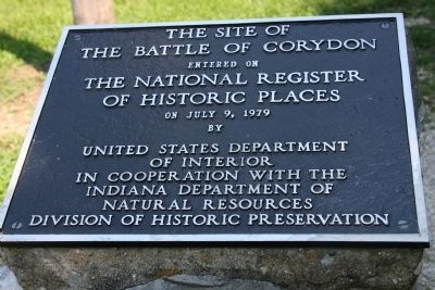
Near Old State Road 135 south of West Heidelberg Road NW, on the right when traveling south.
On July 9, 1863, along this wooded ridge - - - from the “Laconta” Road extending across the “Mauckport” Pike to the old “New Amsterdam” Road - - - occurred the only Civil War battle in Indiana. It was between Gen. John Hunt Morgan’s Confederate . . . — — Map (db m9721) HM
Near East Main Street (Indiana Route 111) at State Street, on the right when traveling east.
As early as 1808, the area we know as New Albany was considered a good location for a settlement near the Ohio River and The Falls of The Ohio. The original 826 ½ acre tract of land — part of Clark’s grant — was between the Grant line and the foot . . . — — Map (db m194347) HM
On Reed Road at Plum Run Road, on the right when traveling north on Reed Road.
John Q. Law Farm, Reed Farm, Huss Farm
The Henry and Elizabeth Law Farm—officially designated as both an Ohio Historic Homestead and Ohio Sesquicentennial Farm—passed through an unbroken chain of the Law-Reed-Huss family. John Quincy Law . . . — — Map (db m313817) HM
On Main Street 0.1 miles east of Rock Street, on the right when traveling east.
Side A
Deersville was platted by John Cramblett on Nov. 25, 1815. The community reached its peak in the years before the Civil War when it was a stop on the stagecoach route between Wheeling and Wooster. Alexander Auld, a songwriter, lived . . . — — Map (db m79827) HM
On Dry Fork Road (County Route 8) at Ohio Route 150, on the left when traveling south on Dry Fork Road.
By July 25, 1863, Brigadier General John Hunt Morgan and his Confederate raiders knew that their pursuers were closing in. Major General Ambrose Burnside, directing the Union
pursuit from his Cincinnati headquarters, decided to change his . . . — — Map (db m173473) HM
On Everest Drive just north of Merchant Street (West Virginia Route 73), on the left when traveling east.
On April 20, 1863, Confederate Gens. William E. “Grumble” Jones and John D. Imboden began a raid from Virginia through present-day West Virginia against the Baltimore and Ohio Railroad. Taking separate routes, they later reported . . . — — Map (db m21136) HM
On Old Indiana 135, on the right when traveling south.
Civil War cannon has been dedicated to the memory of Arville L. Funk: historian, author, lawyer, teacher, civic and church leader
This six-pound field gun is similar to those used by General John Hunt Morgan’s Raiders and the Harrison County . . . — — Map (db m9687) HM
On South Main Street (U.S. 27), on the right when traveling south. Reported damaged.
Rebel Raider John Hunt Morgan's two famous Kentucky raids in 1862 and 1864 included significant engagements with Union forces at Cynthiana. Morgan's mission was to destroy railroad facilities, disrupt communications, acquire supplies, recruit, . . . — — Map (db m218101) HM
Near Squire Boone Road Southwest near Pleasant Grove Road Southwest.
Into this cave opening Squire Boone escaped pursuing Indians about 1790. Thereafter he considered the cabe holy ground. At his request, he was buried in this cave in a walnut coffin hewn from native timber by his own hands. At the time of his . . . — — Map (db m205362) HM
Near Lincoln Highway (U.S. 30) just west of Monroe Avenue, on the right when traveling west.
In 1912, there were approximately one million motor vehicles registered in the United States but few good roads. Most of the roads outside of urban areas were dirt that turned to mud when wet. Long-distance travel by car was still very much a . . . — — Map (db m162418) HM
Near Lincoln Highway (U.S. 30) just west of Monroe Avenue, on the right when traveling west.
Ninety percent of Iowa's land area is in agriculture, the highest of any state in the United States. As you travel the roads in Iowa, you will notice most of the crops are one of two types: corn or soybeans. Corn Native to central Mexico, where . . . — — Map (db m162420) HM
On South Main Street (U.S. 250) at Ohio Route 9, on the left on South Main Street.
United States of America
Congressional Medal of Honor Recipients
State of Ohio Harrison County
Civil War
*Custer, Thomas Ward Lt. Col. Namozine Church, Virginia 1865 •
*Custer, Thomas Ward Lt. Col. Sailor's Creek, Virginia 1865 • . . . — — Map (db m208742) HM
On Main Street 0.1 miles west of Wood Street, on the right when traveling east.
Side A
Mary L. Jobe Akeley
Mary Leonore Jobe was born on January 29, 1878, near Tappan, Harrison County, Ohio. She earned a bachelor's degree from Scio College and master's degree from Columbia University. While studying, she began a . . . — — Map (db m79822) HM
On North High Street 0.1 miles north of Apple Street, on the right when traveling north.
Early settler, tavern keeper, Indian fighter, and founder of Millerstown all describe the life of David Miller. By 1763, Miller had settled in Rye Township, Perry County, on a tract at the present-day location of Donnally Mills, where he . . . — — Map (db m241811) HM
Near South Linden Avenue east of Cherry Street, on the left when traveling east.
(Panel 1):
John George Jackson (1777-1825) - also known as John G. Jackson - of Clarksburg, Harrison County, Va. (now W.Va.). Born in Hardy County, Va. (now W.Va.), September 22, 1777. Son of George and Elizabeth Brake Jackson; . . . — — Map (db m256467) HM
On West High Street, on the right when traveling west.
Corydon’s Constitution Elm stood a few
blocks to the north of Indiana’s first capitol.
The huge elm tree, about 50 feet high and
spread over 130 feet, offered cooling shade
from the summer sun. When the framers
of the Indiana Constitution met . . . — — Map (db m137628) HM
Thin black lines indicate changes in relevance. Between each pair of lines entries are ordered geographically but all have the same relevance.
* Inflectional forms of words are their plurals, singulars, and possessives as well as gramatical tenses and similar variations.