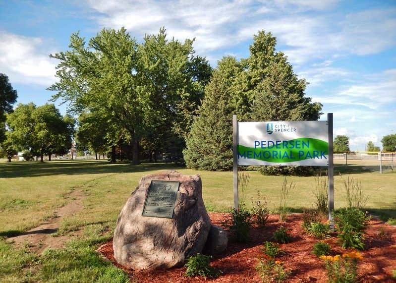
On Grand Avenue (U.S. 18/71) just south of East 8th Street, on the right when traveling north.
Who for thirty-five years played Santa Claus to the needy children of this community. May his untiring efforts, his sacrifices and generosity ever be an inspiration to all to share their blessings with those less fortunate. — — Map (db m238883) HM
Fourteen thousand years ago the spot on which you are standing was covered under a mile-high ice sheet. The fourth Wisconsin glacier carved the cluster of lakes into Northwest Iowa. While this north-south cut is typical of glacial lakes, West . . . — — Map (db m142094) HM
Near Circle Drive north of Miriam Lane, on the right when traveling north.
This is the site of the famous
"Spirit Lake Massacre,"
a violent conflict in March 1857 that led to the deaths of 36 settlers. Survivor Abbie Gardner (thirteen years old at the time of the massacre) returned to Arnolds Park and purchased the . . . — — Map (db m233751) HM
On Lake Street 0.2 miles north of Okoboji Grove Road.
American Indians called the Lakes Region home for thousands of years. They were enticed to the lakes for many reasons: the tallgrass prairie provided ample grazing for an abundance of buffalo and elk; the lakes were a flyway for flocks of . . . — — Map (db m142095) HM
On Monument Drive at Miriam Lane, on the right when traveling south on Monument Drive.
The pioneer settlers named below were massacred by Sioux Indians March 8 to 13 1857. This barbarous work was commenced near this spot and continued to Springfield now Jackson Minn.
Robert Clark ·
Rowland Gardner ·
Frances . . . — — Map (db m245504) HM
On Lake Street 0.2 miles north of Okoboji Grove Road.
The Lakes Region was settled in the 1850's. By 1884, small towns had developed and two railroads: The Burlington, Cedar Rapids & Northern; and the Chicago, Milwaukee & St. Pal laid tracks into the area. As hotels were built around the lakes, . . . — — Map (db m142093) HM
On Lake Street 0.2 miles north of Okoboji Grove Road.
In 1889, a water toboggan slide near this pier was the beginning of the Arnolds Park Amusement Park. Toboggans and wool swim suits could be rented by the day.
Over the next century, the area, named after pioneer developer Wesley Arnold, . . . — — Map (db m142092) HM
On Hill Avenue just south of 18th Street (U.S. 71), on the right when traveling south.
In Memoriam Honoring our Veterans of Dickinson County, both Men and Women. “America will never be destroyed from the outside, if we falter and lose our freedoms, it will be because we destroyed ourselves.” Abraham . . . — — Map (db m238889) WM
On Hill Avenue at 18th Street (U.S. 71), on the right when traveling north on Hill Avenue.
This property is listed in The National Register of Historic Places Iowa State Historical Department Division of Historic Preservation — — Map (db m238671) HM
On 18th Street (U.S. 71) at Hill Avenue, on the left when traveling west on 18th Street.
This tablet marks the spot where the people of this community were sheltered during the Indian Uprising of 1861 and 1862
Dedicated to the pioneer men and women of Dickinson County — — Map (db m233805) HM
Near 340th Avenue (County Highway N22) 0.3 miles north of 110th Street, on the left when traveling north.
State Line Congregation, Augustana Synod was organized April 11, 1871. A number of families had been active in the State Line Trustee District of the Estherville Lutheran Church. In 1887 these two groups organized the Union State Line Lutheran . . . — — Map (db m232785) HM
Near Tuttle Lake Road 0.2 miles north of 110th Street (County Highway A13), on the left when traveling north.
Discovered by Jean Nicollet 1838
Camp site of General Fremont
and later of Major T. W. Sherman
on Government Road surveyed in 1860
Okamanpadu Park
Donated by E.L. and J.C. Williams
Tablet placed by Okomanpado Chapter . . . — — Map (db m232789) HM
On Central Avenue (Iowa Route 9) just west of North 7th Street, on the right when traveling west.
Memorial honoring Emmet County Veterans Erected by Estherville Chapter Service Star Legion originally War Mothers of America 1918 1938 Paul Atbey • Glen A. Alt • Stanley Alt • Steven Andrea • Dewey Allgood • Harvey L. Arnett • Norman Andrews . . . — — Map (db m238196) WM
Near West North 1st Street south of West 2nd Avenue North, on the right when traveling north.
This suspension cable swinging bridge was built at the site of the "Old Mill Dam" in 1937. Labor for the construction was furnished by the Works Progress Administration (WPA), part of Franklin D. Roosevelt's "New Deal" Program. The bridge was . . . — — Map (db m233860) HM
Near West North 1st Street south of West 2nd Avenue North, on the right when traveling north.
This suspension cable swinging bridge was built at the site of the "Old Mill Dam" in 1937. Labor for the construction was furnished by the Works Progress Administration (WPA), part of Franklin D. Roosevelt's "New Deal" Program. The bridge was . . . — — Map (db m233861) HM
On North 6th Street just north of Central Avenue (State Route 9), on the right when traveling north.
Donated to Estherville by the Elmer Weir family, Sept. 1, 1985 in memory of Stanley Larsen who exemplified good health & vigor and refused to grow old. — — Map (db m238190) HM
On North 6th Street north of 1st Avenue North, on the right when traveling north.
Erected on block 59, original plat of Estherville, Iowa, by Company A, Northern Border Brigade, for the protection of settlers against marauding Indians.
To the memory of the pioneers of Emmet County, Iowa and in honor of the patriotic . . . — — Map (db m232788) HM
On State Highway 4 at 390th Avenue, on the right when traveling north on State Highway 4.
Fell 482 feet due west of this spot on May 10, 1879. • • • It was one of the three greatest “falls” on record. • • • Parts of the meteorite are found in important museums of the world. — — Map (db m176315) HM
On Broadway Street (State Highway 4) 0.1 miles south of 12th Street, on the left when traveling south.
These railroad tracks were laid by the Milwaukee Company in August 1878. The company also built the depot that stood just north of here, on the other side of the tracks. In doing so, the Milwaukee Company, which owned the town site, laid the . . . — — Map (db m238304) HM
On Broadway Street north of 11th Street, on the right when traveling north.
In Memory of Paddy Horan Solberg 1942-2014 Beloved Wife, Mother, Grandmother, Best Friend Paddy was an Irish citizen living in Palo Alto County from 1968 to 2014. Paddy’s spirit lives on here with this Blarney Stone, which she transported from . . . — — Map (db m161901) HM
On Broadway Street (State Highway 4) 0.1 miles south of 12th Street, on the left when traveling south.
Duty Honor Country Our Service Men and Women have experienced hardships few will ever endure, confronted challenges and prevailed when the odds were stacked against them. May this memorial be a constant reminder of the personal . . . — — Map (db m238313) WM
On Broadway Street north of 11th Street, on the right when traveling north.
Robert Emmet — Irish Patriot and martyr to the Irish cause for freedom. Namesake of Emmetsburg, Iowa. Born 1778 - Died 1803. Considered by many to be the most romantic patriot in Irish history. Loved by all as "The Darlin' Of Erin" as he . . . — — Map (db m161899) HM