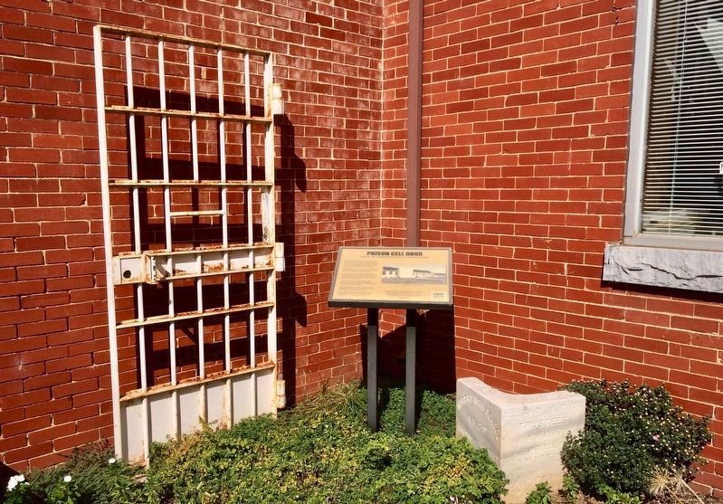
On Peachtree Street at Alpine Street, on the right when traveling north on Peachtree Street.
The austere prison in Peachtree housed up to 100 prisoners tasked with building and maintaining local roads. In 1931, the state combined the Highway Commission and the State Prison Department. "Road camps" were built throughout the state to provide . . . — — Map (db m123081) HM
On East Main Street (County Route 1106) at Court Street, on the right when traveling west on East Main Street.
During the Civil War, Graham Country (then part of Cherokee County) offered scant support to the secessionist cause, although both ardent Confederates and staunch Unionists lived here. The region was not financially dependent on slavery. Most . . . — — Map (db m75453) HM
Near Pinnacle Road, on the right when traveling east. Reported permanently removed.
A natural thoroughfare through the Appalachian Mountain barrier, Cumberland Gap assumed great strategic importance in the Civil War. Both sides sought to control the Gap. It changed hands three times, but no battles were fought. Troops garrisoned . . . — — Map (db m207711) HM
The path now known as the Unicoi Turnpike Trail has existed for over 1,000 years. The earliest European maps of the area note the trail as a connector between Cherokee Territories and the coastal ports of Charleston and Savannah. In 1756 British . . . — — Map (db m82302) HM WM
On Kickapoo Street (County Highway 3305) at County Highway 3331 on Kickapoo Street.
Cherokee County pioneer David Greene Templeton arrived in the county shortly after the legislature organized it in 1846. Settling in the Gum Creek community (later Old Jacksonville), the North Carolina native became a prominent landowner and civic . . . — — Map (db m232776) HM
The path now known as the Unicoi Turnpike Trail has existed for over 1,000 year. The earliest European maps of the area note the trail as a connector between Cherokee Territories and the coastal ports of Charleston and Savannah. In 1756 British . . . — — Map (db m82299) HM WM
The path now known as the Unicoi Turnpike Trail has existed for over 1,000 years. The earliest European maps of the area note the trail as a connector between Cherokee Territories and the coastal ports of Charleston and Savannah. In 1756 British . . . — — Map (db m82303) HM
Near Locust Street at County Highway 1419, on the left when traveling north.
(preface)
In 1838, the United States government deported more than 16,000 Cherokee Indian people from their homelands in Tennessee, Alabama, North Carolina, and Georgia, and sent them to Indian Territory (now Oklahoma). Thousands of . . . — — Map (db m156081) HM
In Memory of
William Anderson
Who was born in
County Antrim, Ireland
Oct. 1, 1821
Emigrated to America, 1841
Died far from home, among
kind-hearted strangers
May 1, 1847 . . . — — Map (db m44272) HM
The Seven Branches Of Learning
Quadrivium
The higher division of the seven liberal arts in the Middle Ages, composed of geometry, astronomy, arithmetic, and music
Trivium
The lower division of the seven liberal arts . . . — — Map (db m7253) HM
On North Carolina Avenue just north of West Cherokee Street (State Route 11), on the left when traveling north.
Early Days The Chesnee area has a long history, despite the fact that the town itself is one of the youngest in the Spartanburg County. Like all of the upstate, the Chesnee area was once inhabited by the Cherokee Indians. The abundant old . . . — — Map (db m196934) HM
Near Locust Street at County Highway 1419, on the left when traveling north.
(preface)
In 1838, the United States government deported more than 16,000 Cherokee Indian people from their homelands in Tennessee, Alabama, North Carolina, and Georgia, and sent them to Indian Territory (now Oklahoma). Thousands of . . . — — Map (db m156080) HM
Near Elm Road 0.3 miles east of Belton Drive, on the right when traveling east.
Established about 1785, Cleveland County's oldest and most historic church cemetery contains remains of the earliest settlers from nearby communities and their descendants. Among those buried here are heroes of the Revolutionary War, the Indian . . . — — Map (db m285815) HM
Near Peachtree Street at Alpine Street, on the right when traveling north.
Cherokee Heritage Trails (Tsalagi Usdi Nvnohi) wind through the mountains of North Carolina, Tennessee, and Georgia, in the heart of Cherokee homelands that once encompassed more than 140,000 square miles. Here, where Cherokee people have lived . . . — — Map (db m134947) HM
On Unicoi Turnpike north of Alpine Street, on the right when traveling north.
The path now known as the Unicoi Turnpike Trail has existed for over 1,000 years. The earliest European maps of the area note the trail as a connector between Cherokee Territories and the coastal ports at Charleston and Savannah. In 1756, British . . . — — Map (db m120338) HM
On South Main Street (State Highway 124) at East Broad Street, on the left on South Main Street. Reported permanently removed.
As a tribute to his skills exploiting enemy weaknesses, Pickens became known as the "Wizard Owl" or "Skyagunsta" - a bird known for seeing clearly, acting wisely and striking quickly.
Pickens was a tall, religious Presbyterian from . . . — — Map (db m259654) HM
On Cherohala Skyway (Bypass Route 165) at Herford Street, on the left when traveling west on Cherohala Skyway.
Cherokee Heritage Trails (Tsalagi Usdi Nvnohi) wind through the mountains of North Carolina, Tennessee, and Georgia, in the heart of Cherokee homelands that once encompassed more than 140,000 square miles. Here, where Cherokee people have lived . . . — — Map (db m75410) HM
On Cherohala Skyway at Herford Street, on the left when traveling south on Cherohala Skyway.
The path now known as the Unicoi Turnpike Trail has existed for over 1,000 years. The earliest European maps of the area note the trail as a connector between Cherokee Territories and the coastal ports at Charleston and Savannah. In 1756, British . . . — — Map (db m261780) HM
Cherokee Heritage Trails (Tsalagi Usdi Nvnohi) wind through the mountains of North Carolina, Tennessee, and Georgia, in the heart of Cherokee homelands that once encompassed more than 140,000 square miles. Here, where Cherokee people have lived for . . . — — Map (db m75440) HM
Cherokee Heritage Trails (Tsalagi Usdi Nvnohi) wind through the mountains of North Carolina, Tennessee, and Georgia, in the heart of Cherokee homelands that once encompassed more than 140,000 square miles. Here, where Cherokee people have lived for . . . — — Map (db m281288) HM
Pacolet River Heritage Preserve, owned and managed by the S.C. Department of Natural Resources, covers 278 acres in Spartanburg County, SC. Come to bird-watch, take photographs, fish or simply enjoy the woods and Pacolet River. Leave with a sense . . . — — Map (db m55086) HM