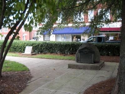
On North Main Street near W Center Street, on the right when traveling south.
In 1750, Daniel Boone, age 16, came with his father from Pennsylvania and settled near Boone’s Ford on Yadkin River, then in Rowan, now Davidson County. Near this spot, in 1781, the American Army under Gen. Nathanael Greene passed on its way from . . . — — Map (db m222580) HM
On Trading Ford Way (State Highway 1147) north of Sowers Road (State Highway 1139), on the right when traveling north.
General Nathanael Greene in his masterly retreat from the British army under Lord Cornwallis, crossed the Yadkin at Trading Ford, one-half mile southeast of this spot, February 2-3, 1781. A sudden rise in the river prevented the passage of . . . — — Map (db m222575) HM
The North Carolina legislature created Davidson County, named for Valley Forge veteran Brigadier General William Lee Davidson was a small fraction of its original size, the county first embraced most of Middle Tennessee. Cumberland River curves . . . — — Map (db m200235) HM
Near Jackson Street south of Seventh Street, on the right when traveling south.
Born in North Carolina in 1793, John Nelson was a veteran of the War of 1812 who moved to Tennessee and married Nancy Edwards of Davidson County in 1824. After her death, he migrated to Mississippi and married Maria Ann Robinson of Tennessee. He . . . — — Map (db m114169) HM
Near Yokley Road 0.6 miles east of Ridge Road, on the left when traveling east. Reported missing.
For an hour on the evening of Easter Sunday, April 16, 1865, a pine grove outside Lexington became the de facto seat of government for the Confederate States of America and the state of North Carolina. President Jefferson Davis and his cabinet, . . . — — Map (db m222585) HM
Near East Lee Street east of John Sevier Road, on the right when traveling east.
Itinerant pastor to pioneer Lutherans in the Virginia counties of Frederick, Shenandoah, Rockingham, Augusta, Botetourt, Montgomery, Wythe, and Washington; Organizer of numerous congregations in the Shenandoah Valley, in southwest Virginia, in the . . . — — Map (db m173535) HM
Near North Carolina Route 73 at McGuire Nuclear Stat Roadd, on the right when traveling east.
Brigadier General William Lee Davidson, the leading partisan officer of the North Carolina piedmont in the Revolutionary War, was killed on the Mecklenburg bank of the Catawba River at Cowan's Ford on February 1, 1781. The exact spot is now under . . . — — Map (db m248196) HM WM
Davidson County. Established 1783; named in honor of Brig. Gen. William Lee Davidson of North Carolina. Distinguished officer in the Revolutionary War. Served with the Army at Valley Forge. Killed in action at Cowan’s Ford, N.C., 1781.
. . . — — Map (db m2374) HM
The smokehouse originally stood on the Wharton Place three miles Southeast of Lebanon on Sparta Pike. Jesse Wharton of Davidson County bought the 912 acre farmland in 1811 from John Gray Blount of North Carolina. Jesse deeded the farm to his son, . . . — — Map (db m109660)
Near South 2nd Street (Tennessee Route 76) south of Franklin Street, on the left when traveling south.
Clarksville, located along the banks of the Cumberland River, was established by John Montgomery and Martin Armstrong in 1784, before Tennessee became a state. It was governed by the Clarksville Compact of 1784 and named for General George Rogers . . . — — Map (db m169076) HM
On East Innes Street just east of South Main Street (U.S. 29/70), on the right when traveling east.
John Willis Ellis was born November 20, 1820, in the area of Rowan County which later became a part of the new county of Davidson. In 1842 he opened his law office at No. 2 Cowan's Row, located in this block. Early in his career he won a seat in . . . — — Map (db m175778) HM
On Gallatin Pike South 0.2 miles north of Briley Parkway ( Route 155), on the right when traveling north.
Fort Nashboro settlers began building outposts throughout Davidson County. An area known as Springhill, located on a hill with a freshwater spring, became one of the most important in the development of present day Madison. Spring Hill Cemetery, the . . . — — Map (db m224783) HM
On Franklin Road (U.S. 31) 0.2 miles south of Old Hickory Boulevard (State Highway 254), on the right when traveling south.
Davidson County
Established 1783; named in honor of
Brig. Gen. William Lee Davidson
of North Carolina. Distinguished officer in the Revolutionary War. Served with the Army at Valley Forge. Fought at the Battle of King's Mountain. Killed in . . . — — Map (db m149818) HM
On Valley Pike (U.S. 11) south of Shady Lane, on the right.
Near here was born John Sevier, pioneer and soldier, September 23, 1745. He was a leader in the Indian Wars and the Battle of King’s Mountain, 1780. He was the only governor of the short-lived state of Franklin and the first governor of Tennessee. . . . — — Map (db m654) HM
On River Highway (North Carolina Route 150) at Mariner Pointe Lane, on the right when traveling west on River Highway.
Among the original pioneers from Pennsylvania, New Jersey, and Maryland who settled on the east side of the Catawba River were George Davidson (1-home destroyed), Reverend John Thomson, Moses White, Hugh Lawson, John Oliphant, John Brevard, . . . — — Map (db m283194) HM
Andrew Jackson built a cotton gin and press at The Hermitage in 1807, both of which stood in the field in front of you. It was a shrewd decision on Jackson's part, not only making his plantation more self-sufficient, but also generating additional . . . — — Map (db m85479) HM
In Memory of Francis Nash
1742 - 1777
Revolutionary War Hero
Brigadier General
in the Continental line of North Carolina, who was mortally wounded at the Battle of Germantown,Pennsylvania in 1777. In his honor, the Cumberland settlers, in . . . — — Map (db m163821) HM
On Browntown Lane at Abbotts Creek Church Road, on the left when traveling south on Browntown Lane.
This 1756 church contains unique and artistic
North Carolina soft soapstone & pierced
tombstones, carved. by Anglo-German cabinet
and furniture makers, many attributed to the
Swicegood School, using the same tools as
used in furniture. They . . . — — Map (db m239122) HM
Near Saint Stephens Church Road 0.3 miles south of Baptist Church Road, on the right when traveling south.
The Randolph shaft (located about 50 ft. from this sign), was more than 300 feet deep when it opened in 1855, after more than a year of preparatory digging, which yielded (according to the company president) not "one cent return to the company . . . — — Map (db m298996) HM
On Tom Austin Highway (U.S. 431) south of Abednego Road, on the right when traveling south.
★ Davidson County ★
Established 1783; named in honor of
Brig. Gen. William Lee Davidson
of North Carolina. Distinguished
officer in the Revolutionary War.
Served with the Army at Valley
Forge. Killed in action at . . . — — Map (db m151813) HM
Indigenous populations lived in the Cumberland Valley of
Middle Tennessee in large villages such as Mound Bottom in
present-day Cheatham County. They were the first farmers of
Tennessee and grew corn, beans, and squash for their own
sustenance . . . — — Map (db m205342) HM
1783 North Carolina Legislature creates Davidson County, which includes parts
of present-day Rutherford County.
1786 North Carolina Legislature makes initial land grants in Stones River area.
1788 Last elk in county is killed . . . — — Map (db m207990) HM