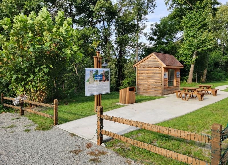
On National Pike (U.S. 40) 2.1 miles west of Jumonville Road (County Route 2021), on the right when traveling east.
The Turner Inn was built in 1925 by Bill Turner and owned by Dr. Leroy C. Waggoner and leased to "Corky" Ruse. In 1937, Mr. Turner commissioned Frank Durigon to build the chimney's. Friends and family knew him as "Poppa Durigon" and would say he . . . — — Map (db m206169) HM
Formed September 26, 1783 from Westmoreland County. Named for the Marquis de Lafayette. Among the French and Indian War sites here is Fort Necessity. The county seat, Uniontown, was incorporated 1796. On the National Road, eventually US Route 40. — — Map (db m181951) HM
On 10 Mile Street at County Park Road, on the right when traveling east on 10 Mile Street.
Abraham (1718-1781) and Mary Parker Tegarden from Frederick County, Virginia 1753, made an 'improvement' opposite mouth of Tenmile Creek, Fayette County; Abraham, sutler for Colonel Bouquet 1759, fought in French and Indian War, Captain Virginia . . . — — Map (db m56944) HM
On National Pike (U.S. 40) west of the entrance to Fort Necessity Nat. Battlefield, on the right when traveling east.
Fort Necessity was located about 400 yards to the south in the Great Meadows. Built and commanded, 1754 by Lieutenant Colonel George Washington, aged 22. Here, after 9 hours engagement with M. Coulon de Villiers in command of 900 French regulars . . . — — Map (db m341) HM
On Morgantown Road 0.1 miles north of Georges Fairchance Road (Pennsylvania Route 857), on the right when traveling north.
Built on the Catawba Trail as a refuge from the Indians, by Thomas Gaddis about 1764. Gaddis was later a colonel in the Pennsylvania Continental Line during the Revolution. — — Map (db m188105) HM
On Kentucky Route 1 at Laurel Road, on the left when traveling north on Kentucky Route 1.
The first white child born of American parents west of the Allegheny Mountains—Mrs. Lucy Virgin Downs—was a resident of Oldtown, Greenup County, from 1807 until her death in 1847. She was the daughter of Jeremiah and Lucy Virgin, born . . . — — Map (db m126330) HM
On Pittsburgh Road (Pennsylvania Route 51) at Laurel Hill Road, on the right when traveling north on Pittsburgh Road.
In 1817 ironmaster Isaac Meason and Welshman, Thomas Lewis built a puddling furnace and bar rolling mill here using a process from Wales that revolutionized the iron industry. It removed carbon from brittle pig iron creating malleable wrought iron . . . — — Map (db m108156) HM
On U.S. 27 at Hutchison Station Road (Kentucky Route 1939), on the right when traveling north on U.S. 27.
Hopewell, one of the oldest Presbyterian churches in Bourbon County, has held worship services since 1785. The first congregation included Dutch settlers. It was recognized by the Transylvania Presbytery in 1787. Original church was located near . . . — — Map (db m218204) HM
Near Headlands Road north of McGulpin Point Road, on the right when traveling north.
Worlds collide in Mackinac’s “Middle Ground” Charles Michel de Langlade was an Odawa war chief, diplomat, fur trader and a French officer. He was one of the most influential people in the Great Lakes during the 1700s, due to his reputation as . . . — — Map (db m154700) HM
On South Main Street 0.1 miles north of 5th Avenue, on the right when traveling north.
Sheepskin Trail
History & Detail
The original rail line that defines much of the Sheepskin Trail was built in the 1890's as the Fairmont, Morgantown, and Pittsburgh branch of the B&O Railroad. It was to meet the needs of a booming coal . . . — — Map (db m203191) HM
On Old College Road 0.5 miles south of State Highway 159, on the left when traveling south.
First institution of higher education in Texas. Recommended in 1837 by Martin Ruter, D.D. Chartered as a Methodist School in 1840. Granted four leagues of land by the Republic of Texas. After educating more than 8oo students it merged in 1856 . . . — — Map (db m239483) HM
On Main Street (County Route 120) at Simmons Avenue, on the left when traveling east on Main Street.
While the description of Bramwell as a town of millionaires can be
viewed as an exaggeration, it did have a significant number of wealthy
families. Their wealth was built largely upon the rapid growth of the
Pocahontas coalfield and Bramwell’s . . . — — Map (db m179168) HM
Near East North Loop Road 0.2 miles west of Wurzbach Parkway.
Jefferson (Jeff) Davis Smith, son of Henry M. and Fanny (Short) Smith, was born in Kendall County, Texas. Jeff, age 9, and his brother Clint, age 11, were kidnapped by Lipan and Comanche Indians while herding sheep near their home in 1871. Jeff . . . — — Map (db m177107) HM
On U.S. 77 at Rabb's Prairie Road, on the right when traveling south on U.S. 77.
This portion of Fayette County is named for William Rabb (1770-1831), a prosperous miller from Pennsylvania who came to Texas in 1821 with members of his family. Rabb claimed a site on the east side of the Colorado River he had selected during an . . . — — Map (db m61297) HM
On East Main Street (Business U.S. 40) at Beeson Avenue, on the left when traveling west on East Main Street.
Historic Uniontown
Scheduled to open in July, 2004, the Uniontown Central Railroad Co (UCRR) offers regularly scheduled trips from its base at Grindle's Station for tourists and individuals to experience the nostalgia of railroad travel. . . . — — Map (db m306037) HM
On East Main Street (Business U.S. 40) at Moran Alley, on the right when traveling west on East Main Street.
Historic Uniontown
Scheduled to open in July, 2004, the Uniontown Central Railroad Co (UCRR) offers regularly scheduled trips from its base at Grindle's Station for tourists and individuals to experience the nostalgia of railroad travel. . . . — — Map (db m306047) HM
On North Main Street south of First Street, on the left when traveling south.
Colonel William R. Morrison
One of Waterloo's most renowned and distinguished citizens was Colonel William R. Morrison, to whom the city owes its library.
The library building at the corner of Library and Park Streets was Colonel . . . — — Map (db m219967) HM
Perry Fitzgerald, pioneer, farmer, and rancher was born December 22, 1815 in Redstone, Fayette County, Pennsylvania. Perry moved to Vermillion, Illinois wen he was about 20 years old and began farming. While there, he married and began his family. . . . — — Map (db m224750) HM
On Main Street (West Virginia Route 211) 0.1 miles east of North Michigan Avenue, on the right when traveling east.
As Mt. Hope emerged, there occurred one of the most important events in the state's history: the Chesapeake & Ohio Railroad, routed through the New River Gorge, was completed in 1873. The C&O was the first railroad to enter southern West Virginia . . . — — Map (db m242622) HM
Morrisons Cove Memorial Park Entrance History
In the early 1900s, this inviting picnic area of White Oak trees was known as Snyder's Grove. Today, as Morrisons Cove Memorial Park, it is owned by the residents of Morrisons Cove and operated . . . — — Map (db m307906) HM
Near East George Street north of Old Ferry Road (County Route 1017), on the left when traveling north.
Coal Land Speculation
Interest in large scale mining in Greene County began in 1891 with the purchase of coal lands in the townships along the Monongahela River. Coal land speculation was at its height from the 1890s to the early 1900s. . . . — — Map (db m264107) HM
Near Main Street north of Rices Landing Road (County Road 1010), on the left when traveling north.
Coke
Coke is a gray, hard and porous fuel with a high carbon content and few impurities. It is used as a fuel and as a reducing agent in smelting iron ore in a blast furnace. The carbon monoxide produced by its combustion reduces iron . . . — — Map (db m182162) HM
Near Main Street north of Rices Landing Road (County Route 1010), on the left when traveling north.
Edward Mine to Emerald Mine
When the mine first opened in 1921, it was known as the Edward Mine and was located near Clarksville and operated by the Chartiers Southern Coal Company. In 1923, the company constructed the initial 70 houses . . . — — Map (db m181680) HM
On Main Street (County Route 120) at Simmons Avenue (County Route 120), on the left when traveling west on Main Street.
Bramwell was not just the home to the owners and operators of the mines. The productive Pocahontas coalfield needed labor. Native Appalachians, immigrants of southern and eastern Europe and African-Americans from the agricultural south filled the . . . — — Map (db m179100) HM
On W. State Street, on the right when traveling west.
Around 1804, Septimus Cedwalader
and his family settled at Quaker Falls.
They were Quakers, as the town's
name will suggest, who came from
Brownsville, Fayette County in the
twenty years after Cadwalader laid
the stones of his home and grist . . . — — Map (db m202321) HM
Thin black lines indicate changes in relevance. Between each pair of lines entries are ordered geographically but all have the same relevance.
* Inflectional forms of words are their plurals, singulars, and possessives as well as gramatical tenses and similar variations.