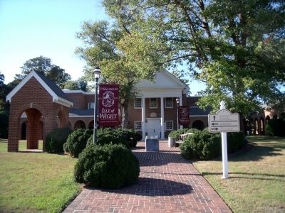
Entries Containing All of the Phrases «isle of wight county» AND «virginia»
This list will also include matches for inflectional* forms of the words. The following noise* word you entered was ignored: of. If this word is required for a successful search, go to the Advanced Searches page and use the Google Search from there.
Near Monument Circle at Courthouse Highway (U.S. 258).
Isle of Wight County
formerly called
Warrosquoyacke
after Indians of this area
visited by
Captain John Smith
1608
settled by
Captain Christopher Lawne
and other adventurers
1619
one of eight
original shires
1634-1637 . . . — — Map (db m36057) HM
On Pruden Boulevard (U.S. 460) 0.1 miles east of Ennis Mill Road (County Route 690), on the right when traveling east.
Isle of Wight County. Area 314 Square Miles. One of the original Shires formed in 1634. Its name was at first Warrascoyack, changed in 1637 to Isle of Wight. Of the oldest churches in the United States is in this county. . . . — — Map (db m76777) HM
Near Fort Boykin Trail (Virginia Route 705) at Morgarts Beach Road ( Route 673), on the left when traveling north.
Virginia Indians
In the late 16th and early 17th centuries, a paramount chief, known by the English as Chief Powhatan, created a powerful organization by affiliating 30 tributary peoples whose territory was much of eastern Virginia. At the . . . — — Map (db m244347) HM
On Norsworthy Drive (Virginia Route 670) at Old Georgian Lane, on the left when traveling south on Norsworthy Drive.
Col. Josiah Parker (1751-1810) served in the Revolutionary War in the 5th Virginia Regiment from Aug. 1776 until July 1778 when he resigned his commission. Parker distinguished himself at the Battle of Trenton (25-26 Dec. 1776), the Battle of . . . — — Map (db m35974) HM
Near Monument Circle at Courthouse Highway (U.S. 258).
Boykin's Tavern is a rare surviving example of the hostelries once common in Virginia courthouse complexes, where they offered food and accommodations for people attending court. The original structure was built in the late 18th century for Maj. . . . — — Map (db m35977) HM
Near Fort Boykin Trail (Virginia Route 705) near Morgarts Beach Road ( Route 673), on the left when traveling north.
From 1861 to 1862, soldiers serving inside the fort were from Company E, Isle of Wight County Blues, 9th Virginia Infantry, as well as Company I, James River Heavy Artillery, 3rd Virginia Artillery. Soldiers from the Surry Light Artillery also . . . — — Map (db m244352) HM
Near Fort Lane south of Enterprise Way, on the right when traveling north.
Lt. Cocke was borne at Shoal Bay, Isle of Wight County, Virginia in 1792. He was a career naval officer, being commissioned a midshipman in 1809 by President Thomas Jefferson and promoted to the rank of lieutenant by President James Monroe. He . . . — — Map (db m297346) HM
On Dan Smith Drive just west of Jericho Road, on the left when traveling west.
In the early 1600s, Captain John Smith and the Jamestown colonists noted long-needled pines along the south bank of the James River and recognized their potential as a valuable resource. Soon after, the first "tryalls of pitch and tar" (naval . . . — — Map (db m166419) HM
On Plank Road (Virginia Route 35) 0.5 miles north of Big Woods Road, on the right when traveling south. Reported missing.
Southampton County. Southampton County was formed in 1749 from Isle of Wight County, a part of Nansemond County was added later. The county was either named for the English borough of Southampton or for Henry Wriothesley, third earl of . . . — — Map (db m316091) HM
On Colonial Trail E (Route 10), on the right when traveling north.
Surry County. Surry County, named for the county of Surrey in England, was formed from James City County about 1652. The Quiyoughcohannocks, whose villages were primarily situated in present-day Surry County, were among the first Virginia . . . — — Map (db m2680) HM
Near Talcott Terrace at Lawnes Neck Drive, on the right when traveling east.
Fort Huger (pronounced Hu-gee) sits on the James River on a site formerly known by names - Hardy's Bluff, Harden's
Bluff and Mother Tynes' Bluff. The overlook and deep navigable channel just offshore made this location a strategic military . . . — — Map (db m244356) HM
Newport News was a small community located in Warwick County until late in the 19th century. Established as a town in 1880, it was incorporated as a city in 1896. Warwick County, one of the eight original Virginia shires formed by 1634, became . . . — — Map (db m92325) HM
Near Fort Lane at Holladay Street, on the right when traveling north.
Judge Crocker was adjutant of the Ninth Virginia Infantry and was wounded and captured July 3, 1863, during Pickett's Charge at Gettysburg, Pa. A native of Isle of Wight County, he served as its representative to the House of Delegates and after . . . — — Map (db m297368) HM
Near Nike Park Road (Virginia Route 669) 0.1 miles south of Carrollton Court.
The Cold War and Nike-Ajax Base N-75
The “Cold” War (1949-1990) is so named because no actual armed conflict took place between the two alliances: The Warsaw Pact and the North Atlantic Treaty Organization (NATO). It began when Joseph . . . — — Map (db m36019) HM
On Talcott Terrace at Lawnes Neck Drive, on the right when traveling east on Talcott Terrace.
Shells have been found in amazing quantities along this area of the river. The Indians who lived beside the saltwater stretches of river did not have tuckahoe and other freshwater plants to sustain them in poor crop years, when shellfish likely . . . — — Map (db m18641) HM
On West Water Street at Monroe Street, on the right when traveling west on West Water Street.
In its edition of August 27, 1851, the Plymouth Villager made a backhanded confirmation of the presence of abolitionists in Washington County, North Carolina. "A coat of tar and feathers is in waiting for the gentleman who will come about . . . — — Map (db m276306) HM
Near Talcott Terrace at Lawnes Neck Drive, on the right when traveling east.
The Confederate Army rented slave labor and hired free black laborers to construct the fort. Records of their payment show that these men worked for 50 cents a day.
In December 1861, Isle of Wight County Commissioner of the Revenue B.J. Gray . . . — — Map (db m244365) HM
On Walters Highway (U.S. 258) 0.2 miles south of Burdette Road ( Route 619), on the right when traveling south.
In 1900 the Isle of Wight Monument and Memorial Association was formed by R. Lee Seward, J.R. Jordan, N.F. Young, R.E. Boykin, and C.J. Bradshaw for the purpose of erecting a monument to the county's soldiers who left for war and never returned. . . . — — Map (db m296781) HM
More than 100,000 rivers, streams, and creeks flow through the Chesapeake region. This massive web of waterways includes some 11,000 miles of shoreline---more than that of the entire U.S. West Coast.
For centuries, these watercourses comprised . . . — — Map (db m98262) HM
Near Fort Boykin Trail (Virginia Route 705) at Morgarts Beach Raod ( Route 673), on the left when traveling north.
The fort was purchased in 1950 by the Jordan sisters - Ella, Elizabeth and Susan.
This property belonged to their grandparents, Colonel Josiah William Jordan and Francis Moseley Dawley Jordan, from 1841 to 1849. The sisters, upon their . . . — — Map (db m244351) HM
Near Fort Boykin Trail (Virginia Route 705) at Morgarts Beach Road ( Route 673), on the left when traveling north.
A well was necessary at this site as the brackish James River did not provide suitable drinking water. The well, elliptical in shape with different brick-laying styles throughout, was built from the bottom up. Over the years, erosion of the . . . — — Map (db m244350) HM
Near Mahan Street east of North Main Street ( Route 32).
1861 ~ 1865
More than 1,500 men and boys from Suffolk and Nansemond County left their homes and families in defense of constitutional liberty and states rights to face overwhelming odds. Many paid the ultimate price; all endured hardships and . . . — — Map (db m104106) HM WM
On South 6th Street at Addison Street, on the left when traveling south on South 6th Street.
Mother Bethel is the first African Methodist Episcopal (A.M.E.) Church in America, founded in 1791. Richard Allen (1760-1831), a former slave, was the founder, and later became the first bishop (1816) of the first African-American denomination in . . . — — Map (db m6840) HM
Near Boundary Road 0.4 miles west of Smiths Neck Road.
The Cold War and Nike-Ajax Base N-75
Here was located site N-75C (C for control) and the counterpart site N-75L (L for launch) was located at Carrollton Nike Park.
The “Cold” War (1949-1990) is so named because no actual armed conflict . . . — — Map (db m36038) HM
On East Windsor Boulevard (U.S. 460) 0.1 miles west of Hidden Acres Circle, on the right when traveling west.
On 22 Apr. 1861, at the beginning of the Civil War, six sons of Benjamin Mills Roberts and Mary Ann Wright Roberts enlisted in Co. D (Isle of Wight Rifle Grays), 16th Va. Inf. Regt. They were Mills W., John W., Sylvester J., Benjamin C., Francis C., . . . — — Map (db m182335) HM
Thin black lines indicate changes in relevance. Between each pair of lines entries are ordered geographically but all have the same relevance.
* Inflectional forms of words are their plurals, singulars, and possessives as well as gramatical tenses and similar variations.
* A noise word is a word that has been deemed too common to index. “The,” “to,” and “then” are examples of noise words. You will find a full list on the Advanced Searches page, in the Rules and Options link of the Keyword Search.