Pendleton County. Formed in 1788 from Hardy, Augusta, Rockingham. Named for Edmund Pendleton, Virginia statesman-jurist. This county has a range of altitude of over 3500 feet. Here are Seneca Rocks, Smoke Hole, and Spruce Knob.
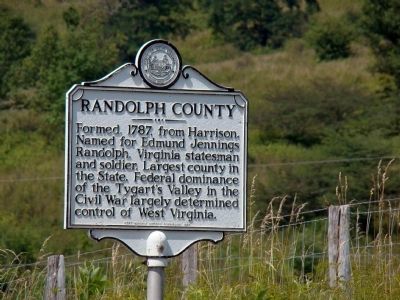
Randolph . . . — — Map (db m9290) HM
On Main Street (U.S. 219), on the right when traveling south.
The Blackman-Bosworth Store building was built 1827-28 by David Blackman on lot #14. It originally stood next to the James Westfall log house that had been used as an early courthouse. Slaves built the store building, supervised by bricklayer J.W. . . . — — Map (db m159011) HM
On Walnut Street Extended at Court Street on Walnut Street Extended. Reported permanently removed.
On April 20, 1863, Confederate Gens. William E. “Grumble” Jones and John D. Imboden began a raid from Virginia through present-day West Virginia against the Baltimore and Ohio Railroad. Taking separate routes, they later reported that they . . . — — Map (db m159285) HM
On Buckhannon Pike (old U.S. 33) (West Virginia Route 151) at Lantz Road (County Route 13), on the left when traveling south on Buckhannon Pike (old U.S. 33).
Upshur County. Formed in 1851 from Lewis, Barbour, and Randolph. Named for Abel Parker Upshur, the great Virginia statesman. Samuel and John Pringle were the first settlers in 1764, and later they guided other pioneers here.
Randolph . . . — — Map (db m179503) HM
On Main Street (U.S. 219) at Court Street, on the right when traveling north on Main Street.
This lot, originally part of the James Westfall plantation, was used as a public playground prior to the chartering of Beverly in 1790. In 1813, county plans were to use this lot as the site for the new jail. Adam Myers, owner of the Valley House . . . — — Map (db m158757) HM
On Main Street (U.S. 219), on the right when traveling south.
In the 1830s Isaac Baker, Sr. bought a two-story log house on this site from the heirs of Daniel Capito. The Bakers lived here and operated a hotel called the Rising Sun. In 1843, Baker lost the property because of debts, and the house and lot were . . . — — Map (db m159010) HM
On West Virginia Route 15 6 miles west of Monterville, on the right when traveling west.
Webster County. Formed, 1860, from Braxton, Nicholas, Randolph. Named for Daniel Webster. Webster County is noted for its fine mountain scenery. Its forest produced the tree that was the largest hardwood at the Chicago World’s Fair, 1893.
. . . — — Map (db m82652) HM
On Seneca Trail (U.S. 219) 0.5 miles north of Dry Branch Road, on the right when traveling north.
Pocahontas County. Formed from Bath, Pendleton and Randolph in 1821. Named for Pocahontas, Indian princess, friend of the Jamestown settlers. Site of Droop Mountain battle, November 6, 1863. The famous Cranberry Glades are in this county.
. . . — — Map (db m165104) HM
On West Virginia Route 28 just east of the Pocahontas County line, on the right when traveling west. Reported damaged.
Here mountain waters divide into many rivers. Greenbrier, Gauley and Elk start south and west to the Kanawha; the Jackson east to the James; north goes the South Branch to the Potomac, and the Cheat and Tygard to the Monongahela. — — Map (db m124091) HM
On Railroad Street (U.S. 219) at U.S. 250 on Railroad Street.
(Preface): On April 20, 1863, Confederate Gens. William E. “Grumble” Jones and John D. Imboden began a raid from Virginia through present-day West Virginia against the Baltimore and Ohio Railroad. Taking separate routes, they . . . — — Map (db m155086) HM
On Kennedy Drive 0.2 miles west of Seneca Trail (U.S. 250), on the right when traveling west.
Hall of Fame Athlete • Educator
United States Marine • Counselor
Coach • Humanitarian
Born Elkins, West Virginia, September 27, 1925. Died August 15, 2001, 2nd Team All State in football (guard) - 1941; 1st Team All State in football . . . — — Map (db m266149) HM
On Railroad Avenue just south of 3rd Street, on the right when traveling south.
Built as the center of booming railroad expansion, the new city was declared to be "decidedly the most accessible point in the State."
The sleepy village that became Elkins was selected by Senators Henry Gassaway Davis and Stephen B. . . . — — Map (db m178460) HM
The People of Thomas
The history books of Thomas are full of fascinating stories of the people who built these buildings and lived their lives here. Hundreds of people from around the world came to Thomas to seek their fortunes, . . . — — Map (db m153066) HM
Near Valley Falls Road (County Route 31/14) 2.8 miles east of East Grafton Road ( Route 310), on the left when traveling west.
Long ago, when the Great Spirit created Valley Falls, he made a masterpiece, which no writer's pen nor artist's brush has been able to do justice. Here was the ideal site for the ancient campfire of the children of nature to supply their needs, . . . — — Map (db m206430) HM
Eight panels mounted to the inside of the town gazebo depict some historical and notable features of the town.
Panel 1 - Town of Ansted
The town of Ansted, West Virginia chartered in 1891, was created because of coal. The town's . . . — — Map (db m173340) HM
On Pike Street / Monumental Road (County Route 21) at Buffalo Road (Local Route 250/32), on the right when traveling north on Pike Street / Monumental Road.
This covered bridge, built in 1853 by Eli and Lemuel Chenoweth, West Virginia’s pioneer bridge builders, is an excellent example of a modified Burr Truss and is in substantially original condition. The bridge was saved from destruction during Jones’ . . . — — Map (db m75051) HM
Thin black lines indicate changes in relevance. Between each pair of lines entries are ordered geographically but all have the same relevance.
* Inflectional forms of words are their plurals, singulars, and possessives as well as gramatical tenses and similar variations.