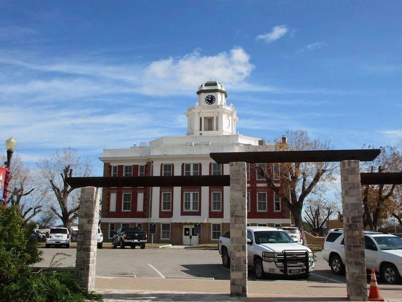
On South Cherokee Street north of East Commerce Street, on the right when traveling north.
The United Confederate Veterans (UCV) began in 1889 and grew in popularity following the death and burial of former Confederate president Jefferson Davis a few months later. Camps formed across the South, and annual reunions allowed Confederate . . . — — Map (db m215181) HM
Near State Highway 16 0.1 miles East Lewis Street.
James “Jim” Louis Baker (1829-1903) and Eleanor “Ellen” Prather Austin Baker (1839-1909) married in Travis County on June 15, 1859. Jim’s family moved to Texas from Tennessee during the time of the Republic, and Ellen’s . . . — — Map (db m155533) HM
On Rose Way Circle, on the right when traveling north.
Before migrating to Texas, A. J. Rose made a fortune in the 1849 California Gold Rush. In 1857 he and his wife Sallie (Austin) brought their family from Missouri to Travis County, Texas. Later they settled in San Saba County, where Rose ran a mill . . . — — Map (db m29345) HM
John Wesley Hardin was one of the most notorious outlaws of the old west and Charlie Webb was a Brown County sheriff's deputy who was shot and killed by Hardin. Charlie Webb was a Texas Ranger and served Brown and San Saba Counties. In 1874 Webb had . . . — — Map (db m248265) HM
On U.S. 190 at County Highway 100, on the right when traveling west on U.S. 190.
The history of San Saba is closely tied with the story of Freemasonry in the area, as many of those who helped organize San Saba County were Masons. Local Freemasons were already gathering as a group when the first county courthouse was erected in . . . — — Map (db m175300) HM
On East Commerce Street at South Mill Street, on the left when traveling east on East Commerce Street.
Born in Pearl (Coryell Co.), Alma Ward graduated in Goldthwaite and attended college in Denton, earnings teaching certificate c. 1916. She married James L. Hamrick in 1919; the couple had two daughters. Alma taught in Eastland, McCulloch and San . . . — — Map (db m158102) HM
On South Cherokee Street 0.1 miles south of West Wallace Road (U.S. 190), on the right when traveling south.
Elijah Estep (1828-1901), San Saba County's second tax assessor-collector, was born in Sangamon County, Illinois. He married Abigail Montgomery (1826-1868) and the couple was living in the community of Cherokee when San Saba County was founded. . . . — — Map (db m158119) HM
On West Wallace Street (U.S. 190) at South Live Oak Street, on the left when traveling east on West Wallace Street.
In 1856, the Texas Legislature created and organized San Saba County. A two-story frame courthouse (1857-1878) and later a stone courthouse (1878-1910) on this site served the county and provided space for public gatherings. In 1910, the City of . . . — — Map (db m158121) HM
On Fisher Street (U.S. 183) at 1st Street, on the left when traveling north on Fisher Street.
This area's first Colorado River bridge was at Regency, on Mills-San Saba County line. Built 1903, it served ranchers and farmers for going to market, but fell in 1924, killing a boy, a horse, and some cattle. Its successor was demolished by a 1936 . . . — — Map (db m217375) HM
On East Wallace Street (U.S. 190) 0.1 miles east of Mill Street.
Details:
Records left by Spanish explorers, missionaries and traders indicate that the Apache were moving into Texas, including the San Saba County area, from areas further northward in the late 1600s and early 1700s to hunt buffalo and escape . . . — — Map (db m247778) HM
On County Road 122 at County Road 114 on County Road 122.
The Terry Cemetery exists as a reminder of the first pioneers to arrive in this area. In 1859, Stephen Woodson Terry (1828-1913) and wife Volumnia Jane (Adams) (1830-1901), granddaughter of Revolutionary War soldier Brittain Adams, moved their . . . — — Map (db m263546) HM
A pioneer of this region. Born in Madison County, Ky. With bride, Sarah Coffey, came to Texas in wagon train led by his father, Isaac, and including brothers David, John R., Kelse, and other kin. Moved to Berry’s Creek area on Dec. 24, 1848. . . . — — Map (db m201886) HM
On U.S. 183 0.1 miles north of U.S. 190, on the left when traveling north.
A 25-mile narrow-gauge railroad that operated about 1912-1920 from Lometa to San Saba County. Constructed by Edward and Alfred Scholten (From Holland). Line hauled cedar posts and piling to Santa Fe line at Lometa to be distributed to fast-growing . . . — — Map (db m175320) HM
On Ranch to Market Road 501 at County Road 424, on the left when traveling north on Road 501.
Chappel, established in the 1850s, is one of San Saba County's earliest settlements. The land for this cemetery is part of 16 1/2 acres donated by Joab B. Harrell (1814-1893) that he formally deeded in 1886 to the Methodist Episcopal Church, South. . . . — — Map (db m247772) HM
On Farm to Market Road 2732 10 miles south of U.S. 190, on the left when traveling south.
Archibald Johnson (A.J.) Rose was born in 1830 in Caswell County, North Carolina. Shortly after his birth, the family left North Carolina in a covered wagon for Missouri. At the age of 18, Rose traveled to California during the Gold Rush and found . . . — — Map (db m263536) HM
On South Live Oak Street at East Wallace Street, on the left when traveling north on South Live Oak Street.
Born to Hamilton and Mary (Pedigo) Neal in the Fairview community in Wilson County, Edgar T. Neal (1869-1946) was a famed San Saba lawman. Early in his adult life, he followed his father and cultivated a close connection with the Masonic fraternity. . . . — — Map (db m263544) HM
On East Wallace Street (U.S. 190) 0.1 miles east of Thomas Stewart Drive, on the right when traveling west.
On northeastern border of the Edwards Plateau, created from Bexar County, Feb. 1, and organized May 3, of 1856. Named for San Saba river. County seat of same name.
Area first explored in 1732 by Juan Antonio Bustillo y Zevallos. . . . — — Map (db m240817) HM
On West Dry Street at 6th Street, on the left when traveling west on West Dry Street.
Episcopal church services in San Saba date from the early years of settlement. Before the Texas Legislature created and organized San Saba County in 1856, Rev. John Fletcher Fish, a U.S. Army Chaplain from San Antonio, held Episcopal services in the . . . — — Map (db m238848) HM
South Carolina native Dillard Cooper came to Texas in Jan. 1836 with Capt. John Shackelford's Red Rovers, landing at Copano Bay and joining Col. James Fannin's command. Following the Texians' defeat at the Battle of Coleto Creek on March 20, the . . . — — Map (db m238502) HM
On Farm to Market Road 574 at County Road 433, on the right when traveling east on Road 574.
This area's first Colorado River bridge was built in 1903 between Mills and San Saba counties to serve area ranchers and farmers. The bridge fell into the river on May 9, 1924, killing Raymond Burns Jernigan (b. June 28, 1914), his horse, and . . . — — Map (db m238862) HM
On East Wallace Street (U.S. 190) 0.1 miles east of Mill Street.
Life and Work:
Risien was an English immigrant who arrived in San Saba in 1874. From 1880 to 1890, he and his family lived in a house that formerly stood in this immediate vicinity. He helped develop the San Saba community's first . . . — — Map (db m239001) HM
On U.S. 190 1.4 miles east of County Road 120, on the left when traveling east.
Heights used from pre-settlement days to 1870s by Comanches and others to send messages over long distances. Smoke once rose from here (Five Mill Hill); Chapel Hill, 2 mi. south; and old community of Sloan in west San Saba County. Tribes wintered . . . — — Map (db m212083) HM
Near County Highway 132 0.4 miles north of U.S. 190.
This burial ground was apparently already in use in 1874 when A.J. and Ellen Crawford deeded it to trustees D.A. Harris, A.J. Wells, James Wayland, F. Brookerson and W.L. Adams as part of a five-acre site to be used for a school and place of . . . — — Map (db m175310) HM
Near East Wallace Street (U.S. 190) 0.1 miles east of Mill Street.
Details:
Native Americans occupied Texas for at least 13,000 years before the first settlers of Old World heritage arrived. The nonperishable remains left behind at the campsites and other activity areas of these Native Americans in San . . . — — Map (db m247777) HM
On West Wallace Street (U.S. 190) at South 2nd Street, on the left when traveling west on West Wallace Street.
San Saba County was organized in 1856, and in 1860 the commissioners court issued a block of land to each religious body; the Christian Church was one of these. The congregation traded their land for another block upon which they built a small . . . — — Map (db m175292) HM
On South Cherokee Street at West Wallace Road (U.S. 190), on the left when traveling south on South Cherokee Street.
Removed from major roads and railways, early San Saba County residents had limited access to law enforcement and government. Beginning in the mid-1850s, citizens in and around the county formed vigilante mobs to dispatch justice. Although . . . — — Map (db m158122) HM
Thin black lines indicate changes in relevance. Between each pair of lines entries are ordered geographically but all have the same relevance.
* Inflectional forms of words are their plurals, singulars, and possessives as well as gramatical tenses and similar variations.