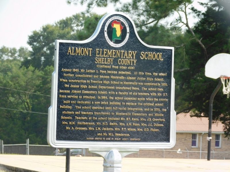
On Gilmore Nick Circle at Vassar Circle, on the left when traveling north on Gilmore Nick Circle.
In the 1930s, the Shelby County educational system consolidated many of its
one-, two-, and three-teacher schools. During the 1938-39 school year,
the citizens of Almont donated a five-acre plot to establish a school for
African American . . . — — Map (db m307411) HM
On Gilmore Nick Circle at Davis Hawkins Street, on the left when traveling north on Gilmore Nick Circle.
Pilgrim Rest Missionary
Baptist Church,
established in 1910, has
been designated as a
significant African American
historic site by the Alabama
Historical Commission — — Map (db m307410) HM
On County Route 42 1 mile south of Alabama Highway 25, on the left when traveling south.
The Confederate Army established a soldier's home and hospital here (1863-1865) as a part of the CSA Camp Winn Training Site. Father Leray and the Sisters of Mercy staffed the hospital after fleeing Civil War destruction in Vicksburg, MS. They . . . — — Map (db m24212) HM
On Ashville Road Northeast at Morgan Street Northeast, on the right when traveling west on Ashville Road Northeast.
Shiloh Cemetery is the first recorded Cumberland Presbyterian Cemetery in middle Alabama. Burial at Shiloh began in 1820, a year before the Shiloh Cumberland Presbyterian Church organized in 1821 at Oakridge, now Leeds. The cemetery stood back from . . . — — Map (db m49350) HM
On County Road 16 at Bacon Cove Road (County Road 75), on the right when traveling south on County Road 16.
Pottery-Making Families of Randolph County
During the 1830s, pottery-making families moved directly from the Carolinas and Georgia. Most came from the Edgefield District of western South Carolina, which boasted an important pottery-making . . . — — Map (db m118124) HM
On Main Street (State Highway 119) at Middle Street, on the right on Main Street.
Home of the University of Montevallo, American Village and the Alabama Veterans Cemetery, Montevallo is located in the geographical center of Alabama at 33° 6’ 18” N 86° 51’ 46” W. In 1814, Jesse Wilson laid claim to “Wilson’s . . . — — Map (db m37178) HM
On North Main Street (County Road 47) at Mildred Street, on the right when traveling north on North Main Street.
Side 1
Columbiana, originally called Columbia, was selected as the county seat of Shelby County in 1826 over rivals Calera and Montevallo. After the selection as the county seat, Columbiana celebrated by drilling holes in a large pine . . . — — Map (db m76251) HM
On Ballantrae Club Drive 0.1 miles east of Weatherly Club Drive, on the right when traveling east.
Side 1
Pelham, Alabama
Pelham, located in Shelby County, Alabama, acquired its name in approximately 1867. It was named for “Gallant Pelham” who fought in the Confederate Army and was killed in action at Kelly’s Ford, . . . — — Map (db m76260) HM
On Parkway Drive (U.S. 78) at 6th Steet Southeast, on the right when traveling east on Parkway Drive.
The War of 1812, geography, geology, and three cultures shaped the history of Leeds. Lying at the crossroads of ancient Indian paths in the center of Alabama, Leeds drew Europeans, Cherokee, and African-American settlers to a land of fertile . . . — — Map (db m49351) HM
On Chelsea Road (County Road 47) at County Road 333, on the right when traveling north on Chelsea Road.
Around 1818, itinerant Methodist circuit riders traveled through the Mississippi Territory and organized church services. In 1837, Alfred Musgrove Lester and his wife, Mary Ann Poindexter Lester, left South Carolina and settled in Shelby County . . . — — Map (db m295086) HM
Known as the Alabama College Laboratory School, Montevallo High School was housed in Reynolds’ Hall on the University of Montevallo campus from 1922 until January 1930 when the central portion of this building was completed. The original structure . . . — — Map (db m37428) HM
On County Road 17 north of Longmeadow Road, on the right when traveling north.
In Honor of Revolutionary War Soldier and
Shelby County Pioneer
Pvt. David Lindsay served with the Pennsylvania
Militia during the Revolutionary War and moved
to Alabama with wife Mary Casey Lindsay before
1820. The David Lindsay Historical . . . — — Map (db m144907) HM
On Alabama Route 25, on the left when traveling south.
The oldest known grave is that of Oprah Moore (1772-1823), consort to Rev. (Doctor) Lemuel Moore. This is the final resting place of American Revolutionary War Patriot William Jennings (1761-1840) and the professed burial site of the Last Creek . . . — — Map (db m59652) HM
On Pelham Parkway (U.S. 31) at Church Street, on the right when traveling south on Pelham Parkway. Reported missing.
Near this site stood Shelbyville, A. T., first county seat of Shelby County; named for Isaac Shelby, governor of Tennessee. Shelby County was established February 7, 1818 by an act of the Alabama Territorial legislature. The first orphans’ court . . . — — Map (db m294988) HM
On 2nd Avenue North west of 5th Street South, on the right when traveling west.
Established by the Alabama Legislature on December 30, 1868,
from land obtained from Autauga, Bibb, Perry, and Shelby counties.
Originally designated Baker County for Alfred Baker, postmaster,
justice of the peace, state legislator, and . . . — — Map (db m155116) HM
On Oak Tree Lane 0.1 miles west of U.S. 31, on the left when traveling west.
In 1872 four lime works existed in the state of
Alabama. Three of these were in Shelby County:
Calera Lime Works, Siluria Lime Works, and
Whiting Lime Works. The O'Neal Lime Works
was established in 1880 by C.L. O'Neal. At that
time the . . . — — Map (db m295089) HM
On U.S. 84 at Farm to Market Road 2787, on the right when traveling east on U.S. 84.
Georgia natives Henry L. and William Rubin Brook, brothers who married sisters Mary Jane and Caroline E. Henry, respectively, migrated from Alabama to Shelby County by 1850. Henry Brook settled 320 acres through an 1845 Republic of Texas Act . . . — — Map (db m160610) HM
Gen. James H. Wilson, USA, having crossed the Tennessee River with a large force of well equipped cavalry, grouped them here at Elyton.
Their mission: to destroy Alabama's economic facilities for supporting the War.
From these headquarters he . . . — — Map (db m24358) HM
Harpersville is one of Shelby County’s oldest communities. Its existence precedes that of Shelby County and the State of Alabama. Big Springs, as Harpersville was originally called, was settled around 1815 by the Harper and Kidd families. Prime . . . — — Map (db m61886) HM
On Island Street west of Bloch Street, on the right when traveling west.
Operating from as early as 1924 to 1939, the first public school for Black children in Montevallo stood on this corner. Known affectionately as the "Little School," the two-room school was built with funds raised by the African American community . . . — — Map (db m295102) HM
On Ensign Drive north of Pike Drive, on the right when traveling north.
James Taylor Gaines (1776-1856) was an early Texas entrepreneur, adventurer, Republic of Texas congressman, and signee of the Texas Declaration of Independence. He was born in Culpeper County, Virginia, to Thomas and Susanah Strother Gaines. In . . . — — Map (db m290386) HM
On South Main Street at Mildred Street, on the right when traveling north on South Main Street.
Major source of pig iron for the Confederacy. Furnished iron to Selma arsenal for heavy cannon, naval armor plate.
Furnaces destroyed in 1865 by Wilson’s Cavalry raiders U.S.A.
Rebuilt 1873, closed 1923. — — Map (db m28523) HM
On Main Street (Alabama Route 119) at Shelby Street, on the right when traveling north on Main Street.
Lynching in America. Thousands of African Americans were lynched in the United States between the Civil War and World War II. Lynching, a form of racial terrorism used to intimidate black people and to enforce white supremacy, was most . . . — — Map (db m258637) HM
On Summerfield Highway (Alternate State Highway 2) at Corney Lake Road, on the right when traveling west on Summerfield Highway.
Alabama Methodist Church has been placed on the National Register of Historic Places in 1995 by the United States Department of the Interior — — Map (db m209818) HM
On Washington Avenue at North B.B. King Boulevard (Tennessee Route 3/14), on the right when traveling east on Washington Avenue.
A native of Somerville, Alabama, Patterson
moved to Memphis with his parents in 1872.
Educated at Christian Brothers College and
Vanderbilt University, he was admitted to
the bar in 1883. From 1894 to 1900 he served
as attorney-general for . . . — — Map (db m221415) HM
On Samford Street near Selma Road, on the right when traveling west.
On this site stood Prentice High School, established in 1950 to meet the need for an African American high school in Montevallo. Before the school was built, Black students had to travel eighteen miles to Columbiana for secondary
education. The . . . — — Map (db m307405) HM
Near Old Route 66 North south of West Kirkham Street.
In the late 1800's in Shelby County, Illinois, William W. McDaniel and his son John H. started the McDaniel & Son blacksmith and livery store. John began developing an idea to harness the abundant Illinois wind to improve farm production and rural . . . — — Map (db m159650) HM