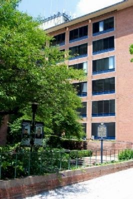
One of Pennsylvania's three original counties. Formed 1682 by William Penn and site of his home, Pennsbury Manor. Name is derived from abbreviation for Buckinghamshire in England. Doylestown, chosen as county seat in 1812, was incorporated 1838. — — Map (db m21461) HM
On New Falls Road at Main Street, on the left when traveling north on New Falls Road.
The first Falls Meeting House
built here in 1690
on 6 acres given by
Samuel Burges
The second House, 1728
The third, present, house, to left, 1789
The fourth, present, house, to right, 1841
Here
William Penn
attended and . . . — — Map (db m30601) HM
On Audubon Avenue at 192nd Street, on the right when traveling north on Audubon Avenue.
In grateful remembrance of the patriot volunteers of the Pennsylvania Flying Camp led by Colonel William Baxter of Bucks County, Pennsylvania who with many of his men fell while defending this height 16 November 1776 and was buried near this . . . — — Map (db m41581) HM
Near Swamp Road 0.7 miles east of Worthington Mill Road.
“We crossed this river by a wooden bridge, roofed and covered in on all sides, and nearly a mile in length. It was profoundly dark; perplexed, with great beams, crossing and recrossing it at every possible angle; and through the broad . . . — — Map (db m310739) HM
The famous Indian Walk of a day and a half from Wrightstown, Bucks County, to near the present Mauch Chunk was performed for the Penn Proprietors of Pennsylvania September 19-20, 1737 by Edward Marshall and his associates who slept at the end of the . . . — — Map (db m188225) HM
David Leech was born in Bucks County, PA in 1791 and trained as a civil engineer at Allegheny College in Meadville, PA. Leech arrived here in 1827 with a contract to build a lock & dam for the Pennsylvania Canal. He laid out the town in 1829 then . . . — — Map (db m275957) HM
On Delaware Avenue at Williams Street, on the right on Delaware Avenue.
Landscape painter Edward Willis Redfield was born near Bridgeville, Delaware on December 19, 1869. After studying in Philadelphia and Paris he moved to Buck’s County, Pennsylvania, where he became leader of a colony of artists called the New Hope . . . — — Map (db m38654) HM
On Main Street, on the right when traveling north.
In 1790 Benjamin Parry, who owned mills on both the New Jersey and Pennsylvania sides of the Delaware River, lost his mills in Pennsylvania to fire. He rebuilt them and named them "New Hope Mills", commencing operation with new and fresh hope for . . . — — Map (db m20102) HM
On Ridge Road (Route 23) at Warwick Furnace Road, on the left when traveling west on Ridge Road.
Built 1737 by Anna Nutt and Co. Made first Franklin stoves, 1742. Supplied shot and cannon for American revolutionists. Furnace a mile and a half away on side road; iron mines a mile west on the highway. — — Map (db m158387) HM
On Frederick Road (Maryland Route 144) at Oella Avenue, on the right when traveling west on Frederick Road.
Established 1772 by the three Ellicott brothers from Bucks County, Pennsylvania. They opened the road from here to Baltimore. The B. and O. R. R. was completed to this point May 20, 1830. — — Map (db m175) HM
On Jerusalem Road 0.2 miles west of Jericho Road, on the left when traveling west.
Established 1772 by David Lee a Quaker from Bucks County, Pennsylvania. A gun manufactory back of the mill furnished guns for the Revolution in 1776. The original tract called Jerusalem patented 1687. — — Map (db m1253) HM
By the end of the 17th century William Trent, a native of Inverness Scotland, had established himself as a prominent Philadelphia merchant trading in flour, tobacco, rum and molasses, slaves and indentured servants. His shipping interests extended . . . — — Map (db m166141) HM
Near Aquetong Road, on the right when traveling east.
Headquarters of Brigadier-General Lord Stirling previous to the Battle of Trenton. Quartered with him were Captain William Washington, Lieutenant James Monroe (later President of the United States) and Captain James Moore of the New York Artillery, . . . — — Map (db m13770) HM
On Washington Avenue, on the right when traveling west.
The Newtown Reliance Company for the Detection and Apprehension of Horse Thieves and Other Villains was formed here in 1819 by area landowners and businessmen to recover stolen horses, mules and property and to prosecute the thieves. The Newtown . . . — — Map (db m263559) HM
Near Lehigh Avenue (U.S. 209) at Lehigh Gorge Trail.
“Our residents take pride and partner in their heritage — they understand the meaning of what we have and act to preserve it” Delaware & Lehigh National Heritage Corridor and State Heritage Park, Management Action Plan. . . . — — Map (db m153540) HM
Near Lehigh Avenue (U.S. 209) at Lehigh Gorge Trail.
"Since most of the land was donated to the railroads by the American public in the first place, we believe it should be returned to the public." David Burwell, President, Rails-to-Trails Conservancy, 1988 A Well-Worn Path The path you . . . — — Map (db m153536) HM
On Lehigh Gorge Trail 1.7 miles west of Main Street, on the right when traveling north.
“Our residents take pride and partner in their heritage — they understand the meaning of what we have and act to preserve it” Delaware & Lehigh National Heritage Corridor and State Heritage Park, Management Action Plan. . . . — — Map (db m153538) HM
Near Rockport Road 1 mile east of South Lehigh Gorge Drive.
"Since most of the land was donated to the railroads by the American public in the first place, we believe it should be returned to the public." David Burwell, President, Rails-to-Trails Conservancy, 1988 A Well-Worn Path The . . . — — Map (db m225717) HM
On Woodlawn Avenue 1.2 miles south of Church Street, on the left when traveling south.
"Since most of the land was donated to the railroads by the American public in the first place, we believe it should be returned to the public." David Burwell, President, Rails-to-Trails Conservancy, 1988 A Well-Worn Path The path you . . . — — Map (db m289330) HM
Near Main Street south of Berwick Street (Pennsylvania Route 940) when traveling south.
“Our residents take pride and partner in their heritage — they understand the meaning of what we have and act to preserve it” Delaware & Lehigh National Heritage Corridor and State Heritage Park, Management Action Plan. . . . — — Map (db m114641) HM
On Hugh Moore Park Road 0.1 miles south of Hill Road, on the left when traveling south.
Large iron ore and limestone deposits and dense forests that became charcoal, provided all the necessary elements to make Pennsylvania the leading iron producer in the American colonies. Durham Furnace, built in 1727 near the Delaware River in . . . — — Map (db m253021) HM
On South 2nd Street south of Chestnut Street, on the left when traveling south.
Born in 1671, she married William Penn, 1696. They lived at Pennsbury, and in the Slate Roof House here, 1699–1701. During his final illness, 1712–18, and until her death, 1726, she was Pennsylvania’s acting proprietor. She was the only . . . — — Map (db m32305) HM
On 10th Street west of Main Street (U.S. 40), on the left when traveling west.
In 1816, with a strong interest in internal improvements, the legislatures of Virginia and Ohio authorized the formation of the Wheeling and Belmont Bridge Company (Belmont because the bridge company was to connect from Wheeling, Virginia to . . . — — Map (db m230968) HM
On Main Street (U.S. 219), on the right when traveling south.
Pearl Sydenstricker Buck, author of 85 books, one of them "The Good Earth," for which she was awarded the Pulitzer Prize for Literature (1932), was born here at Stulting Place, June 26, 1892. In 1938, she achieved further distinction when she . . . — — Map (db m34143) HM
Near Hamilton Boulevard east of North Krocks Road, on the right when traveling west.
William Penn's 1681 charter from King Charles II of England authorized Penn to create counties and towns or townships in Pennsylvania. Philadelphia, Bucks, and Chester, all created in 1682, were the first three counties. If you were standing on . . . — — Map (db m252211) HM
In the 1670s and 1680s, most of the proprietors of the Province of West Jersey were Quakers. Quakers were attracted to the new colony by the promise of economic prosperity and religious freedom as well as the opportunity to raise families in a . . . — — Map (db m166122) HM
Near Swamp Road 0.7 miles east of Worthington Mill Road.
Citizens of Newtown and Northampton townships beseeched the County Commissioners in 1869 to build a bridge “on Neshaminy Creek at the place where the public highway to Holland crosses the said creek ...” their reasons were simple, “the ford there . . . — — Map (db m310751) HM
Welcome to the Delaware and Lehigh National and State Heritage Corridor, a collection of people, places and events that helped shape our great nation. Come journey through five Pennsylvania counties bursting with heritage and brimming with . . . — — Map (db m114644) HM
Born in Bucks County Pennsylvania, Neal a blacksmith by trade came to California with John Fremont’s second expedition in 1844. After working for John Sutter briefly at New Helvetia, obtained a land grant and established Rancho Esquon. After . . . — — Map (db m61826) HM
On Reservoir Drive 0.7 miles north of North Highland Avenue, on the right when traveling south.
(Front):
In memory of
Alexander Negley
Born in Germany 1734, of Swiss ancestry, came to Eastern Pennsylvania 1739, served in the War of the Revolution, settled on site of Highland Park 1778, died Nov. 3, 1809, and his wife . . . — — Map (db m273542) HM
Near East 8th Street 0.2 miles east of Cemetery Street, on the right when traveling east.
A local preacher organized a Methodist Society in 1797 at his home on the Scioto Brush Creek north of the village of Blue Creek in Adams County in the Northwest Territory. In August 1800 the Society built a log church on a site provided by Mr. . . . — — Map (db m185497) HM
On Sgt Stanley Hoffman Boulevard (U.S. 209) at North Main Lane, on the right when traveling north on Sgt Stanley Hoffman Boulevard.
"Since most of the land was donated to the railroads by the American public in the first place, we believe it should be returned to the public."
David Burwell, President,
Rails-to-Trails Conservancy, 1988
A Well-Worn . . . — — Map (db m116342) HM
Entrepreneur Asa Parker founded the Lehigh Valley Railroad (LVRR) in 1853 to more efficiently transport anthracite coal to market. A freight and passenger station was constructed on this site in 1862. The LVRR Slatedale Branch opened in 1870 for the . . . — — Map (db m85695) HM
Welcome to Delaware and Lehigh National and State Heritage Corridor, a collection of people, places and events that helped shape our great nation. Come journey through five Pennsylvania Counties bursting with heritage and brimming with outdoor . . . — — Map (db m114643) HM
Near Sullivan Trail (Pennsylvania Route 191) 0.1 miles south of Bangor Road ( Route 191), on the left when traveling south.
"Since most of the land was donated to the railroads by the American public
in the first place, we believe it should be returned to the public."
David Burwell, President,
Rails-to-Trails Conservancy, 1988
A Well-Worn Path The . . . — — Map (db m268094) HM
Near Old Columbia Pike 0.1 miles south of Main Street, on the left when traveling south.
Was born in Bucks Co., Pennsylvania, 1st month, 22nd, 1733; to which place his grandfather emigrated from near Falmouth, England about the year 1700, soon after his marriage to • Mary Fox •
Andrew moved from his mills in Bucks County, . . . — — Map (db m112433) HM
Near Old Columbia Pike 0.1 miles south of Main Street, on the left when traveling south.
Brother of Andrew, born in Bucks County, Pennsylvania, 12th month, 28th, 1739 and removed with his brother Andrew from their mills in Bucks Co., 5th month, 16th, 1771, • to Baltimore County, Maryland •
Here they built mills and settled this . . . — — Map (db m112434) HM
On 102 Shewell Ave. (one-way, NW direction) close to N. Main St., on the right.
Built in 1909, the Doylestown National Guard Armory stood on this site for more than 100 years, original home to the only military unit based in Bucks County: Company G, 6th Infantry Regiment, National Guard of Pennsylvania.
Having served as . . . — — Map (db m136895) HM
On August 10, 1777, George Washington chose the Moland House as his headquarters while awaiting military intelligence on British naval and troop movements. With him were 11,000 Continental and militia soldiers encamped on the farms surrounding the . . . — — Map (db m86375) WM
Near Swamp Road 0.7 miles east of Worthington Mill Road.
The Schofield Ford Covered Bridge
Tyler State Park
Newtown, Pennsylvania
Governor Tom Ridge · Lt. Governor Mark S. Schweiker ·
Secretary John C. Oliver
Pa. Department of Conservation and Natural Resources ·
DCNR Bureau of . . . — — Map (db m310709) HM
On Mill Street east of 4th Street, on the left when traveling east.
[Historical portion of informational marker]
Since 1999, Quakertown Alive!, Quakertown's nationally-accredited Main Street® program, has worked with the Borough of Quakertown, the Upper Bucks Chamber of Commerce, and Visit Bucks County to . . . — — Map (db m116074) HM
On River Drive (Pennsylvania Route 145) at River Street, on the right when traveling north on River Drive.
"Since most of the land was donated
to the railroads by the American public
in the first place, we believe it should
be returned to the public."
David Burwell, President,
Rails-to-Trails Conservancy, 1988
A . . . — — Map (db m124049) HM
On Sullivan Trail (Pennsylvania Route 191) 0.1 miles south of Bangor Road ( Route 191), on the left when traveling south.
“Our residents take pride and partner in their heritage—they understand the meaning of what we have and act to preserve it”
Delaware & Lehigh National Heritage Corridor and State Heritage Park, Management Action Plan.
Welcome to . . . — — Map (db m268093) HM
“Our residents take pride and partner in their heritage—they understand the meaning of what we have and act to preserve it”
Delaware & Lehigh National Heritage Corridor and State Heritage Park, Management Action . . . — — Map (db m114642) HM
On Main Street at Court Street, in the median on Main Street.
To the memory of
the Officers and Men
of the
One Hundred and Fourth
Pennsylvania Regiment
who fell in the late war
“Their good swords rust,
and their steeds are dust,
but their souls are with the saints we trust.” . . . — — Map (db m23480) HM
To the honor and the everlasting glory
of the citizens of Bucks County, Pennsylvania
who served in our armed forces during
1941 - World War II - 1945
Dedicated May 30, 1998 — — Map (db m23464) WM
On State Street at Mercer Street, on the left when traveling south on State Street.
The Bird in Hand (formerly the "Red Lion Inn" and "Old Frame House") has played a rich and diverse role in the history of Newtown. There is record of a tavern on this site dating back to 1686, and it is considered the oldest frame structure still . . . — — Map (db m32278) HM
On South Second Street 0 miles north of Walnut Street, on the right when traveling north.
By liberty of conscience we understand not only a mere liberty of the mind, but the exercise of a visible way of worship this day my country was confirmed to me by the name of Pennsylvania. My God will, I believe, bless and make it the seed of . . . — — Map (db m135453) HM
On Welland Road at Effingham Street, on the right when traveling east on Welland Road.
Pelham Monthly Meeting, the first Monthly Meeting in Canada, was established here in a log Meetinghouse on 10th month, 2nd day, 1799
The Quakers or Religious Society of Friends began arriving in Canada as early as 1786 These settlers were . . . — — Map (db m268047) HM
On Holiday Street at Baltimore Street on Holiday Street.
Rembrandt Peale, founder of the Gas and Light Company of Baltimore (now Baltimore Gas and Electric Company), was a famous portrait painter from Bucks County, Pennsylvania. He had a unique and groundbreaking connection to Baltimore.
In 1816, to . . . — — Map (db m101657) HM
When Philadelphia-born Dave Frederick moved to Lewes in 1975 to accept a Cape teaching and coaching position, he quickly found his second hometown. Frederick coached three seasons a year for the next 13 years. As head track coach 1976 - 86 and head . . . — — Map (db m300303) HM
On Guilford Street at East John Street (Road Hunting), on the left when traveling south on Guilford Street.
Huntington High School
This site served Huntington as both Huntington High School (1918 -1970) and Crestview Jr. High School (1970 - 1998) for a period of 82 years. Many distinguished citizens graduated from these schools and went on to . . . — — Map (db m211584) HM
On Basin Park 0.1 miles south of Mill Street, on the left when traveling south.
Points of Interest
118.8: Bristol Marsh Preserve contains an important freshwater tidal marsh, one of the few remaining along Pennsylvania's coastal region. Visitors may use the viewing platforms, a walking trail, and interpretive . . . — — Map (db m160092) HM
Near Duncan Road (Virginia Route 670), on the left when traveling south.
Charles H. Carr, a native of New York, purchased twenty acres from the Boisseaus of Tudor Hall in March 1859. He began construction of the house in front of you shortly afterwards. Carr died in July 1862 while enlisted in the Confederate army. In . . . — — Map (db m285347) HM
On South Sycamore Street, on the right when traveling north.
The McMasters House is located at 13 West Centre Avenue, on the corner of Sycamore Street and Centre Avenue. This building was built in about 1833 by John Bond and has been named after one of its early owners, Robert McMasters, a blacksmith who . . . — — Map (db m263581) HM
Near Swamp Road 0.7 miles east of Worthington Mill Road.
Until 1873, crossing from Newtown to Northampton Township meant fording Neshaminy Creek close to where you’re standing now, braving ice floes and changeable water levels. Local residents petitioned the Bucks County Commissioners to build a bridge . . . — — Map (db m310724) HM
On Sgt Stanley Hoffman Boulevard (U.S. 209) north of North Main Lane, on the right when traveling north.
“Our residents take pride and partner in their heritage—they understand the meaning of what we have and act to preserve it”
Delaware & Lehigh National Heritage Corridor and State Heritage Park, Management Action . . . — — Map (db m116343) HM
On River Drive (Pennsylvania Route 148) at River Drive, on the right when traveling north on River Drive.
“Our residents take pride and partner in their heritage—they understand the meaning of what we have and act to preserve it”
Delaware & Lehigh National Heritage Corridor and State Heritage Park, Management Action . . . — — Map (db m124051) HM
On Woodlawn Avenue (Pennsylvania Route 437) 1.2 miles south of Church Road, on the left when traveling south.
“Our residents take pride and partner in their heritage—they understand the meaning of what we have and act to preserve it”
Delaware & Lehigh National Heritage Corridor and State Heritage Park, Management Action Plan.
Welcome to . . . — — Map (db m289326) HM
Tyler Formal Gardens served as an "outdoor parlor"
for George F. and Stella Elkins Tyler, original owners
of the former baronial estate that comprised nearly
2,000 acres of prime Bucks County real estate.
Perched on a hilltop overlooking . . . — — Map (db m279978) HM
Thin black lines indicate changes in relevance. Between each pair of lines entries are ordered geographically but all have the same relevance.
* Inflectional forms of words are their plurals, singulars, and possessives as well as gramatical tenses and similar variations.