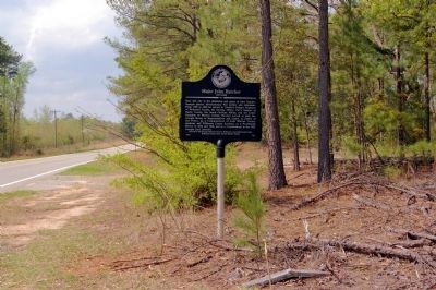
On Court Lord Highway (State Highway 112) 1 mile south of Liberty Church Road, on the right when traveling north.
Near this site is the plantation and grave site of John Hatcher, Georgia patriot, Revolutionary War soldier and statesman. From 1780 to 1800 he served in Candler’s Refugee Regiment of Richmond County, the Georgia Militia, Carr’s Rangers of Burke . . . — — Map (db m13080) HM
On South Liberty Street (U.S. 25) 0 miles south of West 6th Street (Georgia Route 80), on the right when traveling south.
The game is yet in our own hands; to play it well is all we have to do – nothing but harmony, honesty, industry and frugality are necessary to make us a great and happy people.
George Washington — — Map (db m59851) HM
On Ocean Highway (U.S. 17) at Martin Rd, on the left when traveling south on Ocean Highway.
Dr. Lyman Hall was a Georgia signer of The Declaration Of Independence. He represented Saint John's Parish in the Continental Congress, and was a delegate from Georgia to the Second Continental Congress meeting in Philadelphia.
He was a founder . . . — — Map (db m8785) HM
On West Quaker Road 1.9 miles west of Cohen Road, on the right when traveling west.
Ivanhoe Plantation was established in 1765 by a Crown Grant to Thomas Whitehead from King George III of England. The plantation is located 3 or 4 miles east of Waynesboro, Georgia and 15 miles along Brier Creek going down stream. The grant . . . — — Map (db m103303) HM
On Laney Walker Boulevard 0.1 miles west of C S Hamilton Way, on the right when traveling west.
Attorney Judson Whitlocke Lyons was the first Black lawyer in the
State of Georgia. He was born in Burke County, but lived most of his
life in Augusta. He was a graduate of Augusta Institute
(now Morehouse College) and Howard University Law . . . — — Map (db m227151) HM
On East Columbia Street at North Ayish Street, on the right when traveling west on East Columbia Street.
Born Feb. 3, 1808 in Burke County, Georgia. Came to Texas in 1835. Joined the Army of Texas after signing the Declaration of Independence. First county clerk of San Augustine County First district clerk of the First Judicial District Died, February . . . — — Map (db m221324) HM
On Laney Walker Boulevard at C S Hamilton Way, on the right when traveling west on Laney Walker Boulevard.
Born into poverty in Edgefield, South Carolina, fewer than ten years after
the Civil War, he became one of the wealthiest men in the Augusta area.
In South Carolina, he owned a 420-acre tract of land, farms in
Beech Island and Sumter, and . . . — — Map (db m227143) HM
On East Winthrope Avenue (State Highway 17) at Harvey Street, on the right when traveling west on East Winthrope Avenue.
This boulder is placed by
The Wayside Home Chapter
United Daughters of the Confederacy
of Jenkins County, Georgia and
The Margaret Jones Chapter
United Daughters of the Confederacy
of Burke County, Georgia
to perpetuate the name of . . . — — Map (db m221766) HM
On State Highway 28 at Old Charleston Road (Local Road 38), on the left when traveling south on State Highway 28.
About four miles southeast is the site of the American Revolutionary Battle of Long Cane. On December 12, 1780, Lieutenant Colonel Isaac Allen and a British force of 400-500 men defeated Colonel Elijah Clarke and 100 Americans, an advanced . . . — — Map (db m241074) HM
On State Highway 56 at Bark Camp Church Road, on the right when traveling south on State Highway 56.
Constituted in the early part of 1788, Bark Camp Baptist Church was a center for culture and hospitality in Bark Camp, one of the oldest settlements in Burke County and a community of wealthy and prominent plantation owners. Among the 29 charter . . . — — Map (db m44549) HM
Near Martin Luther King Boulevard ( West Broad Street when traveling south.
Reared in Burke County, Georgia.
Mills, like his Dublin-born father
John, fought for independence.
John served in Collier's Regt. of
N.C. Militia and Mills served in his
local militia company. After the
bitter hostilities of the . . . — — Map (db m64127) HM WM
On North Railroad Street at Georgia Route 53, on the right when traveling north on North Railroad Street.
John Tate, born in Ireland in 1758, came to America in 1763. He volunteered for the Pennsylvania Militia in December 1776 from Shippensburg, Cumberland County, PA. He served as a private with Captain Robert Culbertson and later, at the Battle of . . . — — Map (db m315011) HM
On Deep Cut Road at Ohoopee Church Road, on the left when traveling north on Deep Cut Road.
Jared Irwin, Statesman and twice Governor of Georgia, moved from Mecklenburg Country, N.C to Burke County, Ga. as a child. Commissioned a brigadier general during the Revolutionary War, he distinguished himself following the War as an Indian . . . — — Map (db m35502) HM
On Lone Oak Road (Georgia Route 54) 0.1 miles west of Forest Road, on the right when traveling west.
When a new building was completed in 1939, the name of this church, established in 1844 as Prospect Methodist Church, was changed to Allen-Lee Memorial Methodist Church to honor two of its illustrious members, Dr. Young J. Allen and Dr. J. W. Lee. . . . — — Map (db m21403) HM
Near Bark Camp Church Road, on the left when traveling west.
Constituted in 1788, Bark Camp Church was the center for worship, culture and hospitality in Bark Camp,
one of the oldest settlements in Burke County.
Many of the congregation honorably served during the War Between the States as soldiers . . . — — Map (db m97007) HM
On Augusta Avenue, on the left when traveling east.
At this spring
close by the entrenchments of
the British who held Savannah
Sargent
William Jasper
and Sargent
John Newton
in 1779, effected their heroic rescue of a
number of American Patriots who were
being taken to . . . — — Map (db m9274) HM
Near Capitol Avenue Southwest south of M.L.K. Junior Drive Southeast, on the left when traveling north.
Expelled Because of Color” is dedicated to the memory of the 33 Black state legislators who were elected, yet expelled from the Georgia House because of their color in 1868.
The cinder block forms at the base of the sculpture symbolize the . . . — — Map (db m130191) HM