Near John B Gordon Drive 0.1 miles east of Jefferson Davis Drive, on the right when traveling east.
The Powell Academy was built around 1875, when Ulysses S. Grant was president. It was one of about 100 small community schools located in DeKalb County and served students in the Klondike Community until they reached Grade 6. The money for these . . . — — Map (db m208677) HM
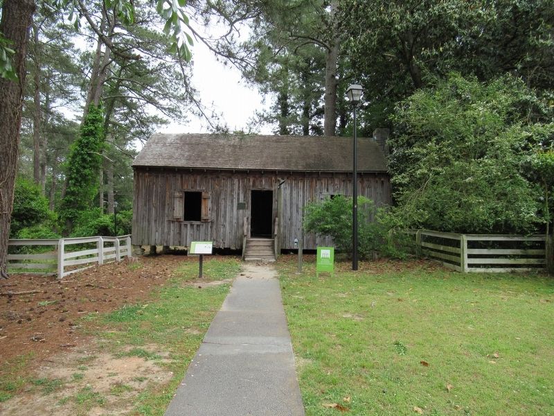
Near John B Gordon Drive 0.1 miles east of Jefferson Davis Drive, on the right when traveling east.
Around 1826, when John Quincy Adams was president, Dr. Chapmon Powell built this one room log cabin near today's intersection of Clairmont Avenue and North Decatur Road. A prominent physician, he was one of the earliest residents to settle in the . . . — — Map (db m208525) HM
On Oakdale Road NE at South Ponce De Leon Avenue, on the right when traveling south on Oakdale Road NE.
Lynching in America
Racial terror lynching claimed the lives of thousands of African
Americans between 1877 and 1950. Following the Civil War, white
Southerners sought to uphold an ideology of white supremacy and
used fatal violence . . . — — Map (db m185921) HM
On Cahaba Drive at Bayberry Drive, on the left when traveling north on Cahaba Drive.
Utoy Primitive Baptist Church, the oldest Baptist Church in present Fulton County, was constituted August 15, 1824, in a log house just west of here. The church was moved to its present location in the summer of 1828. In 1864 the church was used as . . . — — Map (db m8876) HM
On Ponce de Leon Ave at Clairemont Ave, on the left when traveling west on Ponce de Leon Ave.
This steatite boulder was found on the site of a prehistoric quarry along Soapstone Ridge 8 miles south of Decatur. It shows the methods of Indians in making stone bowls, with the first girdling of the stone to remove workable cores. It is . . . — — Map (db m8752) HM
On Bruce Street north of Walker Street, on the right when traveling south.
The remains of the Lithonia Negro School stand as a reminder of the power of community and education.
Beyond the Ruins
What you see before you are the remaining pieces of the historic Bruce Street School. It looks different from . . . — — Map (db m284091) HM
On North McDonough Street north of Trinity Place, on the right when traveling south.
Lynching in America
Following the Civil War, violent resistance to rights for African Americans, a need for heap labor, and an ideology of white supremacy led to fatal violence against Black women, men, and children. Thousands of Black . . . — — Map (db m245402) HM
Near South Clayton Street (Georgia Route 20) south of Luckie Street, on the right when traveling south.
[Left panel]
Early Gwinnett and adjacent counties were home to two important U.S. Army forts: Fort Daniel on Hog Mountain and Fort Gilmer along the Chattahoochee River, more commonly called "the fort at the standing peach tree.” During the . . . — — Map (db m197723) HM
On North McDonough Street at West Trinity Place, on the right when traveling south on North McDonough Street.
[First panel]
Illegally sentenced in a DeKalb County court to four months of hard labor on a false traffic charge, Dr. Martin Luther King Jr. put systemic injustice on trial in the court of public opinion.
[Second panel]
How Dr. . . . — — Map (db m197667) HM
Near Airport Road 0.3 miles east of Clairmont Road.
With the onset of World War II, Henry F. Doc Manget, Jr., interrupted his medical training at Emory University to enlist in the Navy. Assigned to the newly constructed Naval Reserve Aviation Base at this site, he began primary flight training on 12 . . . — — Map (db m303541) HM WM
On Max Cleland Boulevard south of Bond Street, on the right when traveling south.
Lynching in America. Following the Civil War, violent resistance to rights for African Americans, a need for cheap labor, and an ideology of white supremacy led to fatal violence against Black women, men, and children. Thousands of Black . . . — — Map (db m242055) HM
On Edgewood Avenue SE at Park Place NE, on the right when traveling west on Edgewood Avenue SE.
[Main marker]
SunTrust Bank played a key role in the New South's economic growth in the late nineteenth and twentieth centuries and became the largest bank headquartered in Georgia. In 1891 the Georgia General Assembly chartered the . . . — — Map (db m187137) HM
PDK —
DeKalb Peachtree Airport. Georgia’s first aviation park. Inspiring the next generation.
Doc Manget Memorial Aviation Park. Dedicated by Vernon Jones, CEO DeKalb County, June 3, 2006. — Board of Commissioners for DeKalb County: . . . — — Map (db m303553) HM
On Stone Mountain Freeway (U.S. 78) 0.2 miles west of West Park Place Boulevard, on the right when traveling west.
Hightower (Etowah) Trail, one of the best marked Indian Trails in Georgia, was a much used crossover between two of the noted Trading Paths radiating from Augusta. Recognized as a former boundary between Cherokee and Creek lands, a part of it . . . — — Map (db m33433) HM
On Hightower Trail 0.1 miles west of Huntcliff Trace, on the right when traveling west.
Hightower (Etowah) Trail, one of the best marked Indian trails in Georgia, and a main road along which many settlers built their homes until the 1840’s, crossed this highway near here on its way to a nearby ford on the Chattahoochee River. A . . . — — Map (db m33435) HM
Near John B Gordon Drive 0.1 miles east of Jefferson Davis Drive, on the right when traveling east.
From 1875 until 1915 children in the Klondike Community in southern DeKalb County attended Powell Academy on S. Goddard Rd. The one room school was capable of housing 25-30 students. It got its name from George Washington Powell, pioneer resident . . . — — Map (db m208680) HM
On Fulton Industrial Boulevard (Georgia Route 70) at Boat Rock Road SW, on the right when traveling south on Fulton Industrial Boulevard.
Sand Town (Oktahatalofa) and Buzzard Roost (Sulecauga) were two frontier Creek Indian communities here on the Chattahoochee River. The old Sand Town Trail extended westward to the Coosa River in Alabama and eastward into what is now DeKalb County. . . . — — Map (db m14157) HM
Near LaVista Road (Georgia Route 236) 0.3 miles east of Oak Grove Road, on the right when traveling west.
Transplanted from Curahee [sic] Mountain, Georgia March 3, 1988 to honor the memory of the officers
and men of the 501st Parachute Infantry Regiment
1942 — 1945
(panel)
This blackjack oak and granite monument were first placed by . . . — — Map (db m306998) HM WM
On Starvine Way 0.3 miles west of Clairmont Road (U.S. 23), on the right when traveling west.
The Hardman Family Cemetery is one of the oldest landmarks in DeKalb County and among the last vestiges of its early settlement. Both white settlers and enslaved African Americans were buried here. Nearby ran the Shallowford Indian Trail, a trade . . . — — Map (db m142533) HM
Near West Court Square south of West Ponce de Leon Avenue.
Five DeKalb County courthouses have been
erected here in the center of Decatur since 1823.
The third courthouse structure, between 1847
and 1898, was where DeKalb County's two
anti-secession delegates were selected to attend
Georgia's secession . . . — — Map (db m142543) HM
On East Dixie Avenue (Kentucky Route 61) at South Crestwood Street, on the left when traveling north on East Dixie Avenue.
"The Parrott gun was placed in the pike; it was opened as soon as the last message from Colonel Smith was received; and, as suddenly as if its flash had ignited them, Palmer's four guns roared out from the hill on the left of the road, about six . . . — — Map (db m170819) HM
Thin black lines indicate changes in relevance. Between each pair of lines entries are ordered geographically but all have the same relevance.
* Inflectional forms of words are their plurals, singulars, and possessives as well as gramatical tenses and similar variations.