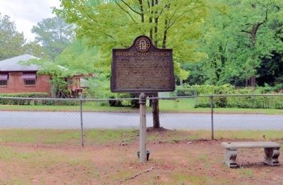
On Cahaba Drive at Bayberry Drive, on the left when traveling north on Cahaba Drive.
Utoy Primitive Baptist Church, the oldest Baptist Church in present Fulton County, was constituted August 15, 1824, in a log house just west of here. The church was moved to its present location in the summer of 1828. In 1864 the church was used as . . . — — Map (db m8876) HM
On Martin Luther King Junior Drive Southwest at Piedmont Avenue Southeast, on the right when traveling west on Martin Luther King Junior Drive Southwest.
Atlanta is a center for many levels of government - city county, state, and federal. Government buildings are linked by a corridor that extends along two parallel streets - Mitchell Street and Martin Luther King, Jr. Drive - from the State Capitol . . . — — Map (db m256439) HM
Near Mill Street 0.3 miles east of Atlanta Street, on the right when traveling south.
Vickery Creek (also known as Big Creek) is a 26.5 mile-long stream in Forsyth and Fulton Counties. It is named after Charlotte Vickery, a Cherokee, who owned extensive property near its headwaters in Forsyth County in the nineteenth century. The . . . — — Map (db m228113) HM
Near Mill Street 0.3 miles east of Atlanta Street when traveling south.
In 1832, the State of Georgia held a lottery to distribute land located north of the Chattahoochee River. This land was formerly part of the Cherokee Nation. The Cherokee Indians were removed to land west of the Mississippi over the route, which . . . — — Map (db m227728) HM
On South Main Street (Georgia Route 9) at Jones Avenue, on the right when traveling north on South Main Street.
This was the Courthouse of Milton County at the time it was merged with Fulton County Jan. 1, 1932. When the County was created by Act of the Legislature Dec. 18, 1857, it was named for Homer V. Milton, General in the War of 1812, though some claim . . . — — Map (db m21434) HM
On Roosevelt Highway (U.S. 29) at Smith Street, on the right when traveling south on Roosevelt Highway.
Old Town Charm
The downtown area of Fairburn is a Commercial Historic District that is listed on the National Register of Historic Places. The buildings located along West Broad Street between Smith and Dodd, and those adjacent to the . . . — — Map (db m284556) HM
Near South Clayton Street (Georgia Route 20) south of Luckie Street, on the right when traveling south.
[Left panel]
Early Gwinnett and adjacent counties were home to two important U.S. Army forts: Fort Daniel on Hog Mountain and Fort Gilmer along the Chattahoochee River, more commonly called "the fort at the standing peach tree.” During the . . . — — Map (db m197723) HM
On Thompson Avenue west of Main Street (U.S. 29), on the left when traveling west.
Lynching in America. Between 1865 and 1950, thousands of Black people were victims of lynching across the United States. Following the Civil War, many white Southerners fiercely resisted equal rights for African Americans and sought to uphold . . . — — Map (db m227407) HM
Near Northeast Broad Street at Pearl Street, on the right when traveling north.
Old Campbell County Courthouse
Has been placed on the
National Register
of Historic Places
by the United States
Department of the Interior
March 26, 1976 — — Map (db m285451) HM
On North McDonough Street at West Trinity Place, on the right when traveling south on North McDonough Street.
[First panel]
Illegally sentenced in a DeKalb County court to four months of hard labor on a false traffic charge, Dr. Martin Luther King Jr. put systemic injustice on trial in the court of public opinion.
[Second panel]
How Dr. . . . — — Map (db m197667) HM
On Marietta Boulevard NW 0.2 miles south of Bolton Road NW, on the right when traveling south.
On the rise above this marker is the family cemetery of Major J. M. C Montgomery (1770-1842) probably the first white man to settle permanently in what is now Fulton County. A soldier in the War of 1812, Montgomery served under Lt. George R. Gilmer . . . — — Map (db m21516) HM
Near Hardman Farm Road 1 mile north of Unicoi Turnpike ( Route 17).
James Hall Nichols
Born on 17 February 1835, James Hall Nichols built West End in the early 1870s. His father, Richard James Nichols, a Connecticut native, farmed a large plantation in the community of Midway, near Milledgeville, Georgia . . . — — Map (db m229222) HM
On Fulton Industrial Boulevard (Georgia Route 70) at Boat Rock Road SW, on the right when traveling south on Fulton Industrial Boulevard.
Sand Town (Oktahatalofa) and Buzzard Roost (Sulecauga) were two frontier Creek Indian communities here on the Chattahoochee River. The old Sand Town Trail extended westward to the Coosa River in Alabama and eastward into what is now DeKalb County. . . . — — Map (db m14157) HM
On Cleveland Avenue SW at Interstate 75, on the right when traveling west on Cleveland Avenue SW.
This monument marks the site of the Gilbert Cemetery, originally a one-acre plot set aside by Jerimiah S. Gilbert for burials. He acquired the land in 1861 from his father. Throughout the nineteenth and early twentieth centuries use of these grounds . . . — — Map (db m186569) HM
On Courtland Street Northeast at John Wesley Dobbs Avenue Northeast, on the left when traveling south on Courtland Street Northeast.
Lynching in America Racial terror lynching between 1865 and 1950 claimed the lives of thousands of African Americans and created a legacy of injustice that can still be felt today. During this era, lynching emerged as the most notorious form . . . — — Map (db m227435) HM
On Roy Street Southwest east of Windsor Street Southwest, on the left when traveling east.
Lynching in America
Between 1865 and 1950, thousands of Black people were victims of lynching across the United States. Following the Civil War, many white Southerners fiercely resisted equal rights for African Americans and sought to uphold an . . . — — Map (db m227409) HM
On Warren Way south of Headland Drive, on the right when traveling south.
Lynching in America. Between 1865 and 1950, thousands of Black people were victims of lynching across the United States. Following the Civil War, many white Southerners fiercely resisted equal rights for African Americans and sought to uphold . . . — — Map (db m227408) HM
On Henry M. Turner Street at Secession Avenue, on the left when traveling south on Henry M. Turner Street.
Historical Bicentennial marker
in memory of
Henry McNeal Turner
1834-1915
Birthplace: Newberry, South Carolina - Boyhood home: Abbeville, South Carolina
Missionary Pioneer to South Africa, Liberation Theologian, Social and Political . . . — — Map (db m20249) HM
On Atlanta Student Movement Boulevard at Chestnut Street NW, on the right when traveling west on Atlanta Student Movement Boulevard.
In early February 1960, Morehouse College students Lonnie King,
Julian Bond, Joseph Pierce and other students met here at the site
of the former Yates & Milton Drug Store-an informal gathering place
for students of the Atlanta University Center. . . . — — Map (db m185926) HM
Near Riverside Road 0.5 miles east of Roswell Road, on the right when traveling east.
Lynching in America
Racial terror lynching claimed the lives of thousands of African
Americans and created a legacy of injustice that can still be felt
today. After slavery ended, many white people remained committed
to racial hierarchy . . . — — Map (db m171842) HM
Near Streetman Road west of Ephesus Church Road, on the left when traveling west.
Family History
William Clinton (1754-1847) married Violet Perry (1760-1852) in South Carolina
Their known children are:
1. David - Born 1785. Moved to Campbell County (Douglas), then to Louisiana.
2. John P. - Born . . . — — Map (db m298430) HM
Thin black lines indicate changes in relevance. Between each pair of lines entries are ordered geographically but all have the same relevance.
* Inflectional forms of words are their plurals, singulars, and possessives as well as gramatical tenses and similar variations.