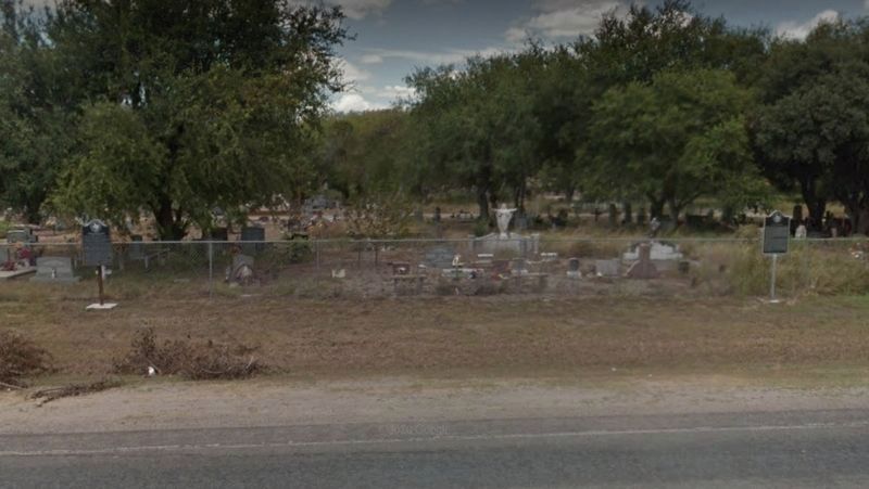
On South Flournoy Road (Farm to Market Road 1931) south of Sain Drive (County Road 342), on the right when traveling south.
Texas patriot famed as man who introduced the Lone Star Flag during the Texas Revolution.
Born in North Carolina, Dodson came to Texas with his parents in 1827. He served as a delegate to the 1832 Convention seeking governmental reforms. . . . — — Map (db m160345) HM
On McAlpine Street at South LaSalle Street, on the right when traveling north on McAlpine Street.
Frank Augustus Hamer became the Navasota City Marshal in 1908, after the Navasota City Council made a plea to the Governor of Texas for help. Grimes County had become a battleground for the decade prior to his arrival plagued with political and . . . — — Map (db m159681) HM
Near Navasota Street north of East 7th Street, on the right when traveling north.
A volunteer at Anahuac, 1832. Member of the Consultation, 1835. Commander of the schooner “Flash”, 1836. Most Worshipful Grand Master Grand (Masonic) Lodge of Texas, 1848-49. Born in Virginia, September 30, 1801. Died in Grimes County, . . . — — Map (db m44241) HM
On Avenue I at 9th Street, on the right when traveling north on Avenue I.
The present monument was erected by the State of Texas and unveiled on April 21, 1911, the 75th anniversary of the Battle of San Jacinto. Among several thousand spectators present were Houston family members, State officials, the two surviving . . . — — Map (db m82312) HM
On Farm to Market Road 1458 0.1 miles east of Buller Road, on the right when traveling west.
Virginia native Edwin Waller migrated to Texas from Missouri in 1831 as part of Stephen F. Austin's third colony. An active participant in the earliest stages of Texas' struggle for independence, Waller participated in the 1832 Battle of Velasco, . . . — — Map (db m145789) HM
On West 2nd Street (State Highway 22) near North 24th Street, on the right when traveling east.
Born in 1790 in North Carolina, James Clinton Neill came to Texas in 1831 with Stephen F. Austin's third colony. He settled in Milam County, and represented his neighbors at the Convention of 1833. On September 28, 1835, Neill entered the Texas Army . . . — — Map (db m63149) HM
On South Montgomery Street south of East Columbia Street (State Highway 547), on the left when traveling south.
San Augustine lawyer and public official who was the last Vice President of the Republic of Texas. Born in Hillsboro, N. C., Sept. 11, 1805. Moved in 1829 to Shelbyville, Tenn., and in 1837 to San Augustine. Here he was collector of customs by . . . — — Map (db m176318) HM
On State Highway 6 at County Route 112, on the right when traveling south on State Highway 6.
Tennessee native Albert G. Perry (1807-1874) began the study of law at age sixteen in his brother's Alabama law office. He became a successful attorney, but in 1831 left for Texas, settling in Washington, where he opened a law office. The following . . . — — Map (db m84676) HM
On State Highway 6 8.7 miles north of U.S. 290, on the right when traveling south.
A faithful Negro slave. Came to nearby Courtney, Grimes County in 1851 with his master, John W. S. West from North Carolina. West was a prominent and wealthy pioneer planter and landowner.
At the outbreak of the Civil War, West sent Kelly "to . . . — — Map (db m119574) HM
On County Road 666 2 miles north of County Road 668, on the right when traveling west.
What is known as Bassett Farms encompasses nearly 2,500 acres of land in Limestone and Falls counties. The 1875 Bassett House and surrounding Bassett Home Place tract represent the core of the property, retained in family hands for over one hundred . . . — — Map (db m293480) HM
On 12th Street at University Avenue, on the right when traveling west on 12th Street.
Following the American Civil War and emancipation of slaves in 1865, it was not until 1871 that African Americans in Texas were able to uniformly register to vote, following the ratification of the 15th amendment to the U.S. constitution.
While . . . — — Map (db m307955) HM
On State Highway 214 0.2 miles south of Farm to Market Road 37, on the right when traveling south.
La Pista de Vida Agua (Trail of Living Water) crossed the Llano Estacado, linking several lakes in the region. Three lakes in Bailey County lie along the trail: Coyote Lake, where the Mackenzie Expedition camped; Monument Lake; and White Lake . . . — — Map (db m151351) HM
On South Main Street (Loop State Highway 429) at West Buffington Avenue, on the left when traveling north on South Main Street.
Unique Victorian Texas public building. Third courthouse here. Site, in an 1824 land grant from Mexico, was donated 1850 by Henry Fanthorp, first permanent settler in county.
Built 1891 of hand-molded brick with native stone trim. Vault is . . . — — Map (db m284315) HM
On Farm to Market Road 1774 at County Road 313, on the right when traveling north on Road 1774.
Settlers mostly from the Lower South (Alabama, Louisiana, Mississippi, Georgia) settled this part of Grimes County near John's Creek. By the late 19th century, Blackberry became a largely African-American settlement. Most families raised livestock . . . — — Map (db m128635) HM
On State Highway 90 at County Highway 106, on the left when traveling south on State Highway 90.
Alabama native Calvin Cullen Bullard (1824-1882) brought his family to this area from Hunt County, Texas, in 1867 and settled on 160 acres of land between Bedias Creek and Caney Creek. In their new home, he and his second wife, Zillah (Woodbury), . . . — — Map (db m157880) HM
On Austin Street (Business U.S. 290), on the right when traveling west.
Created from Austin and Grimes counties, April 28, and organized Aug. 16, 1873. Named for Edwin Waller (1800-1861), a signer of the Texas Declaration of Independence, 1836; Postmaster General, Texas Republic; First mayor of Austin.
Site of rich . . . — — Map (db m125605) HM
On South Main Street (State Highway 429) at Buffington Lane, on the left when traveling north on South Main Street.
Mathew Caldwell was called Paul Revere of the Texas Revolution. Caldwell’s daughters Lucy Ann and Martha Elizabeth came to Grimes County from Gonzales. Martha E. Married Isham Dixon Davis and settled N. Grimes County at Mesa, near Iola, by 1846. . . . — — Map (db m111903) HM
On North Magnolia Avenue at NW 7th Street, on the left when traveling north on North Magnolia Avenue.
A well drilled near this site in 1894 produced hot mineral water at a depth of 3,100 feet. Hot mineral baths were popular then for treatment of various diseases, and Marlin and Mineral Wells were among Texas towns with successful bath houses. In . . . — — Map (db m208867) HM
On South Main Street (Loop State Highway 429) at Buffington Avenue, on the right when traveling south on South Main Street.
Civil War military concentration point for troops and ordnance. Rich farm land.
By 1861 densely populated. Favored secession by 907 to 9 vote. Sent 5 cavalry, 4 infantry companies to Confederate Army.
Arms and ordnance works at Anderson . . . — — Map (db m118976) HM
On Center Street at West Helga Street, on the right when traveling south on Center Street.
History of Centennial Marker
The Texas Legislature created a commission and funded the Texas Centennial Markers in 1935 to celebrate the 100th anniversary of Texas' independence from Mexico. The state placed about 1,100 buildings, memorial . . . — — Map (db m236105) HM
Near Boonville Road 0.1 miles east of Austins Colony Parkway.
Though it's called a cabin, the Turner-Peters Dogtrot was house and home during the 1800s to early settlers. For over 160 years, the homestead was situated atop a sandy hill overlooking a small branch of Peach Creek in Grimes County. Thanks to . . . — — Map (db m170387) HM
Born in Tennessee. In 1828 he and family joined Robertson's Colony, bound for Texas. Arrived in 1830, probably having stopped to "make a crop" along the way.
Lived in present Grimes County; was granted a third of a league of land in Robertson's . . . — — Map (db m118939) HM
On County Highway 108 at Sollock Lane, on the left when traveling west on County Highway 108.
Zion Cemetery is the final resting place of early pioneers of Grimes County and their descendants whose memory is preserved here. Methodist Episcopal Church, South, now known as Zion United Methodist Church, formed in 1852 when settlers purchased . . . — — Map (db m158885) HM
On Hunter Road (Farm to Market Road 2439) 0.3 miles north of Center Point Road, on the right when traveling north.
John Drayton Pitts was born at sea on August 26, 1798, during the voyage of his parents, John and Jane Pitts, from England to Charleston, South Carolina. They moved to Georgia during the War of 1812, and John D. married Eliza Permelia Daves in April . . . — — Map (db m150958) HM
Near Navasota Street north of East 8th Street, on the right when traveling north.
Hon. Jesse Grimes Born Feb. 6, 1788 Died Mar. 15, 1866 A signer of the Texas Declaration of Independence Member of the Congress of the Republic Died in Grimes County A county named in his honor Rosanna Ward Wife of Jesse Grimes Born Dec. 31, . . . — — Map (db m168018) HM
On Farm to Market Road 861 0.2 miles north of County Road 103, on the left when traveling north.
Organized in Illinois, July 26, 1833 by Daniel Parker
Members moved to Texas in a body
arriving November 12, 1833.
First recorded meeting in Texas
was held in Austin's Colony near the present town of Anderson, Grimes County January 20, . . . — — Map (db m258247) HM
On South Main Street (Loop State Highway 429) at West Buffington Avenue, on the left when traveling south on South Main Street.
On road used 1690 by Spanish explorer Alonso de Leon. In 1821 Andrew Millican began settlement. Henry Fanthorp opened his inn 1834, a post office 1835. Kenneth Anderson, last Vice-President, Republic of Texas, died at Fanthorp's, 1845. After his . . . — — Map (db m118977) HM
On State Highway 30 at Williams Road, on the left when traveling west on State Highway 30.
Legislated after the close of the Civil War, the Texas Constitution of 1866 provided for a public school system supported by funds derived from property taxes; monies collected from African Americans would go to schools for their children. Although . . . — — Map (db m195072) HM
On South Main Street (County Highway 245) south of West Apalonia Avenue, on the right when traveling south.
This historic bridge was originally located on CR 263 (known locally as CR 180) over Rocky Creek. Constructed around 1905, the Warren pony truss measured 50 feet in length and is a rare survivor of a once-common structure. The single-span, four . . . — — Map (db m111910) HM
On an unnamed cemetery road, on the right when traveling south.
Henry Schumacher (1832-1901), a native of Germany, opened one of the first cottonseed oil mills in this region in 1873, assembling the machinery with only the aid of an old encyclopedia. The oil works produced cottonseed oil, meal, and cake, and . . . — — Map (db m126532) HM
On Farm to Market Road 362 0.1 miles south of County Highway 305, on the right when traveling south.
As communities were developed by early settlers in Texas, small rural schools were established. Primarily serving farm families, the schools were often closed when children were needed to help harvest crops or perform other farm chores.
A . . . — — Map (db m169238) HM
On Farm to Market Road 1094 at Swearingen Road, on the right when traveling west on Highway 1094.
Austin County pioneer and Texas War for Independence veteran, Elemelech Swearingen, was born in Shepherdsville Kentucky (Bullitt Co.) in 1805. He married Angelina Weeks (1811-1883) in 1827 and in 1831, moved with his family to Texas. The Swearingens . . . — — Map (db m202526) HM
Near Center Street at West Helgera, on the left when traveling north.
Site of the home
in 1836 of
Dr. George
Moffit Patrick
1801-1889
Pioneer surveyor • Here the Texas
Army encamped after the Battle
of San Jacinto and cabinet meet-
ings were held — — Map (db m53323) HM
Thin black lines indicate changes in relevance. Between each pair of lines entries are ordered geographically but all have the same relevance.
* Inflectional forms of words are their plurals, singulars, and possessives as well as gramatical tenses and similar variations.