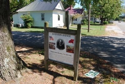
On Boynton Avenue at West 10th Street, on the right when traveling south on Boynton Avenue.
Boynton, born in Henry County, Georgia, enlisted as a private in the thirtieth Georgia Regiment and rose to the rank of Colonel of the Regiment. His regiment bore its full share of danger and toil and the regiment never went into action except . . . — — Map (db m88976) HM
On Jonesboro Road 0 miles west of Babbs Mill Road, on the right when traveling east.
After the failed McCook and Stoneman raids, Union Maj. Gen. W. T. Sherman mounted one last effort to cut Atlanta's railroads with his cavalry. Just before dark, August 18, 1864, Brig. Gen. Judson Kilpatrick led 4,500 troopers of the 2nd and 3rd . . . — — Map (db m9843) HM
On Decatur Road (Georgia Route 155) at Shingle Roof Drive, on the right when traveling south on Decatur Road.
Shortly after this section of land in Henry County was ceded to the State of Georgia by the Creek Indians in the Treaty of Indian Springs in 1823, camp
meetings were held here under brush arbors. In 1831, 100¼ acres of land was purchased by the . . . — — Map (db m14531) HM
Near East Poplar Street west of 2nd Street, on the right when traveling east.
James Stoddard Boynton was born in Henry County, Georgia to Elijah Snow Boynton & Elizabeth Moffett on May 7, 1833. He attended Hearn's School at Cave Springs, Georgia and later studied law.
Upon passing the Bar in October 1852, Boynton . . . — — Map (db m268839) HM
On School west of U.S. 23, on the left when traveling west. Reported damaged.
Leaving McDonough on Thursday, November 17, 1864, the Federal 15th and 17th Corps separated and marched generally southeast using multiple roads. They comprised the “Right Wing” of Major General William T. Sherman's army, led by Major General Oliver . . . — — Map (db m263750) HM
On Main Street (Jefferson Davis Memorial Highway) at Norwood Street on Main Street (Jefferson Davis Memorial Highway).
First National Flag (Stars and Bars)
The first official flag of the confederacy was the Stars and Bars, and was reported to the provisional congress of the C.S. by the flag committee on March 4, 1861. It appears to have not had a recorded . . . — — Map (db m90441) HM
On South Main Street at West Church Street (Alabama Route 52), on the right when traveling south on South Main Street.
Founded in 1820, Columbia was originally located about a mile south, near where the Omussee Creek flows into the Chattahoochee River. It served as the county seat of Henry County from 1826 to 1833. Bordering the State of Georgia and the . . . — — Map (db m73364) HM
On North McDonough Street at King Street, on the right when traveling north on North McDonough Street.
Clayton County was created by Act of Nov. 30, 1858 from Fayette and Henry Counties. It was named for Augustine Smith Clayton, born at Fredericksburg, Va., Nov. 27, 1783, who moved to Georgia before 1800. A graduate of the U. of Ga., he was a lawyer, . . . — — Map (db m18956) HM
Turner Hunt Clements, an early settler, built this log cabin in the 1820's. It originally stood on Georgia Highway 20, northeast of McDonough and is one of the oldest buildings in Henry County. The last to live in this cabin were George and Shirley . . . — — Map (db m103149) HM
On Georgia Route 81 at Griffin Street (U.S. 23), on the left when traveling east on Georgia Route 81.
By Wednesday evening, November 16, 1864, after marching that day from the vicinity of Stockbridge, two Federal infantry corps camped at locations around McDonough, the seat of Henry County. The 17th Corps, more than 11,000 strong and commanded by . . . — — Map (db m186572) HM
On North Main Street (Alabama Route 95) at River Street, on the right when traveling north on North Main Street.
This church was constituted in 1835 following the withdrawal of six people from Omussee Baptist Church in a dispute over the role of missions. The first pastor Edmund Talbot, who served the Church until 1853, donated that land and had the church . . . — — Map (db m73361) HM
On County Road 28 2.5 miles east of State Route 95, on the right when traveling east.
Side 1
Reuben Hicklin Hall Log Home
Reuben Hicklin Hall (1812-1890) and Mary Ann Strange (1814-1872) moved to Henry County by ox wagon from Washington County, Georgia, in 1845. They built a log home just south of here with slave . . . — — Map (db m71821) HM
On East Church Street (Alabama Route 52) at South Davis Street, on the right when traveling east on East Church Street.
Side 1
History suggests that, in the early 1820's, circuit riding preachers from the South Carolina Conference of the Methodist Episcopal Church arrived in the newly settled town of Columbia. Assigned to the Early County Mission in . . . — — Map (db m73363) HM
Side 1
William Lafayette Shelley (1868-1953), son of Mark Shelley and Mary Jane Ronie Shelley, was a progressive farmer and entrepreneur in the Tumbleton community of Henry County, Alabama. “Papa Billy”, as he was known by . . . — — Map (db m73377) HM
On Bluff Street south of Commerce Street, on the right when traveling south.
Side 1:
The second covered bridge across the Chattahoochee River, connecting Clay County, Georgia and Henry County. Alabama was constructed between 1867-69. Bonner and Walden, a New York construction company, were the original contractors . . . — — Map (db m254009) HM
Thin black lines indicate changes in relevance. Between each pair of lines entries are ordered geographically but all have the same relevance.
* Inflectional forms of words are their plurals, singulars, and possessives as well as gramatical tenses and similar variations.