THE HISTORICAL
MARKER DATABASE
“Bite-Size Bits of Local, National, and Global History”


13 entries match your criteria.  


Related Historical Markers

Battle of Trevilian Station Virtual Tour by Markers.
 
By Devry Becker Jones (CC0), April 3, 2021
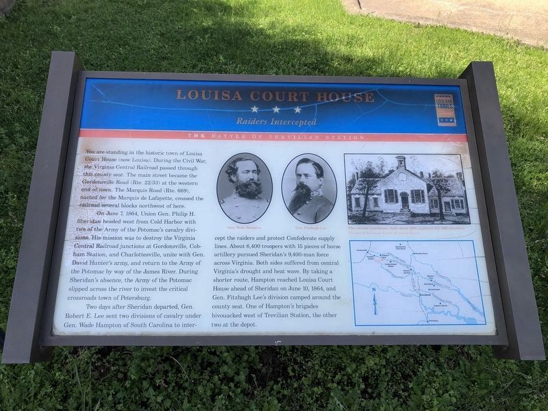
Louisa Court House Marker
SHOWN IN SOURCE-SPECIFIED ORDER
1 ► Virginia, Louisa County, Louisa — Louisa Court House — Raiders Intercepted — The Battle of Trevilian Station
On West Main Street (U.S. 33) at Elm Avenue, on the right when traveling east on West Main Street. Reported permanently removed.
2 ► Virginia, Louisa County, Louisa — First Contact — “a considerable fight” — The Battle of Trevilian Station
On Ellisville Drive (County Route 669), on the right when traveling south. Reported permanently removed.
3 ► Virginia, Louisa County, Louisa — Clayton's Store — Sheridan's Camp — The Battle of Trevlian Station
On Ellisville Drive (County Route 669) at Oakland Road (County Route 613), on the right when traveling north on Ellisville Drive. Reported permanently removed.
4 ► Virginia, Louisa County, Louisa, Oakland — Bibb's Crossroads — First Shots — The Battle of Trevilian Station —
On Oakland Road (County Route 613), on the right when traveling north.
5 ► Virginia, Louisa County, Louisa, Trevilians — Netherland Tavern — Hampton's Headquarters — The Battle of Trevilian Station —
On Oakland Road (County Route 613), on the right when traveling north.
6 ► Virginia, Louisa County, Louisa, Trevilians — Custer's First Last Stand — A "Living Triangle" — The Battle of Trevilian Station —
On Louisa Road (U.S. 33) at Danne Road (County Route 682), on the right when traveling west on Louisa Road.
7 ► Virginia, Louisa County, Louisa, Trevilians — Custer Rescued — An All-out Assault — The Battle of Trevilian Station —
On Louisa Road (U.S. 33) at Danne Road (County Route 682), on the right when traveling west on Louisa Road.
8 ► Virginia, Louisa County, Louisa, Trevilians — W-210 — Trevilian Station Battle
On Louisa Road (U.S. 33) at Danne Road (Route 682), on the right when traveling west on Louisa Road. Reported missing.
9 ► Virginia, Louisa County, Louisa, Trevilians — Battle of Trevillians —
On Louisa Road (U.S. 33) at Trevilians Square, on the right when traveling east on Louisa Road.
10 ► Virginia, Louisa County, Louisa, Trevilians — W-209 — Battle of Trevilians
On Louisa Road (U.S. 33) at Trevilians Square, on the right when traveling east on Louisa Road. Reported permanently removed.
11 ► Virginia, Louisa County, Louisa — W-208 — Green Springs —
On Spotswood Trail (U.S. 33) at Dunkum Store Road (County Route 636), on the right when traveling west on Spotswood Trail.
12 ► Virginia, Louisa County, Louisa — Oakland Cemetery — Confederates at Rest — The Battle of Trevilian Station —
On West Street (County Route 666) at Purcell Drive, on the left when traveling west on West Street.
13 ► Virginia, Louisa County, Louisa — Decisive Confederate Victory — The Largest All-Cavalry Battle of the Western Hemisphere — The Battle of Trevilian Station —
On West Street (County Route 666) at Purcell Drive, on the left when traveling west on West Street.
 
 
CeraNet Cloud Computing sponsors the Historical Marker Database.
This website earns income from purchases you make after using our links to Amazon.com. We appreciate your support.
Paid Advertisement
Nov. 11, 2026