By William Fischer, Jr., May 9, 2009
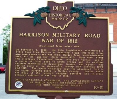
Harrison Military Road Marker (Side B)
RANKED BY RELEVANCE
| On Marion Street (Ohio Route 423) at Main Street, on the right when traveling north on Marion Street. |
| On Davids Street at Barks Road West, on the right when traveling south on Davids Street. |
| On Marion-Galion Road (Local Road 114), on the left when traveling east. |
| On High Street (Ohio Route 37), on the right when traveling south. |
| On East Center Street (Ohio Route 309) at Sharpless Ct, on the right when traveling west on East Center Street. |
| On Delaware Avenue (Ohio Route 423) at Main Street, on the right when traveling north on Delaware Avenue. |
| On Center Street (Ohio Route 95/309) at Main Street ( Route 4), on the right when traveling west on Center Street. |
| On Mount Vernon Avenue (Ohio Route 95) close to Richland Road ( Route 529), on the right when traveling east. |
| On East Center Street (Ohio Route 309) at True Avenue, on the right when traveling west on East Center Street. |
| Near North Prospect Street. |
| On Quarry Street, on the right when traveling west. |
| On Pole Lane Rd (County Route 174), on the right when traveling north. |
| On Harding Highway East (Ohio Route 309), on the right when traveling east. |
| On LaRue-Prospect Road (Ohio Route 203) at Marion- Green Camp Rd ( Route 739), on the right when traveling south on LaRue-Prospect Road. |
| On Harding Highway East (Ohio Route 309), on the right when traveling east. |
| On Baltimore Pike (State Highway 97), on the right when traveling north. |
| On Water Street (Ohio Route 47) 0.1 miles west of Main Street ( Route 203), on the right when traveling west. |
| On County Route 113 south of County Route 126, on the right when traveling south. Reported permanently removed. |
| On South Poplar Street (U.S. 51) at County Route 2400N, on the right when traveling north on South Poplar Street. |
| On North Main Street (Ohio Route 423) at Center Street ( Route 309), on the right when traveling north on North Main Street. |
| On Brookville Road (U.S. 52) east of Whispering Drive, on the left when traveling east. |
| On Brundage Road (County Road 125) 1.2 miles north of Norton Road (County Road 229), on the right when traveling north. |
| On Adams Street north of Monroe Street, on the left when traveling north. |
| On Old National Road (U.S. 40) at North Layman Ave., on the right when traveling west on Old National Road. |
| Near East Douglas Street at North Line Street, on the right when traveling east. |
| On Jefferson Street at Washington Street, on the right when traveling south on Jefferson Street. |
| On East Silver Springs Boulevard at SE First Avenue on East Silver Springs Boulevard. |
| On U.S. 23 at milepost 6 at Newmans-Cardington Rd (County Route 123), on the right when traveling north on U.S. 23. |
| On Main Street at Huber Street, on the right when traveling south on Main Street. |
| On East Main Street at Justice Center Drive, on the right when traveling east on East Main Street. |
| Near Valley Falls Road (County Route 31/14) 2.8 miles east of East Grafton Road (West Virginia Route 310), on the left when traveling west. |
Thin black lines indicate changes in relevance. Between each pair of lines entries are ordered geographically but all have the same relevance.* Inflectional forms of words are their plurals, singulars, and possessives as well as gramatical tenses and similar variations.
Nov. 13, 2026
