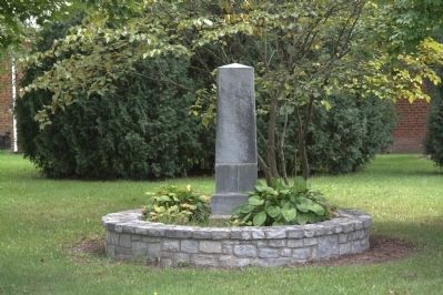
By J. J. Prats, September 18, 2011
Frank Padget Memorial Obelisk at Centennial Park
RANKED BY RELEVANCE
On Blue Ridge Road (County Route 684) at McCulloch Street, on the right when traveling north on Blue Ridge Road.
On South Main Street (Business U.S. 11) just south of East Washington Street, on the right when traveling north.
On Avenue of Trees, on the left when traveling south.
On Blue Ridge Tunnel Trail 0.1 miles west of Afton Depot Lane, on the right when traveling west.
On South Lee Highway (Virginia Route F055) 0.7 miles north of Chambers Road ( Route 610), on the left when traveling north.
On Saint Andrews Drive (County Highway 3/1) south of Hammonds Mill Road (State Route 901), on the left when traveling south.
On Ohio Route 138 south of 2nd Street (U.S. 137), on the right when traveling south.
On Letcher Avenue, on the left when traveling east.
Near West G Street (Tennessee Route 67) at U.S. 321, on the left when traveling west.
Near West G Street (Tennessee Route 67) 0.1 miles west of Sabine Street, on the left when traveling west.
Near Letcher Avenue north of North Jefferson Street (Business U.S. 11), on the left when traveling north.
On North Mine Street, on the left when traveling south.
On Lexington Turnpike / Midland Trail (U.S. 60) at Blue Ridge Parkway and Panther Falls Road, on the right when traveling east on Lexington Turnpike / Midland Trail.
Paid Advertisement
On Elon Road (U.S. 501) 3 miles east of Virginia Route 130, on the right when traveling east.
On Maury River Road (State Highway 39), on the right when traveling east.
On West Midland Trail (Virginia Route 850) 1.7 miles south of Brattons Run ( Route 780), on the right when traveling north.
On Virginia Avenue (State Highway 42), on the right when traveling south.
On Lee Jackson Highway (U.S. 11) near Raphine Road (County Route 606), on the right when traveling south.
Near Three Notched Mountain Highway (U.S. 250) 0.8 miles north of Interstate 64, on the left when traveling north.
On West Washington Street at Lee Avenue, on the right when traveling west on West Washington Street.
Near Letcher Avenue at Stemmons Plaza, on the left when traveling east.
Near Kenneth Jones Drive 0.2 miles west of Montgomery Avenue, on the left when traveling west.
On North Main Street, on the right when traveling north.
Near Boonville Road 0.1 miles east of Austins Colony Parkway.
On South Lee Highway (U.S. 11) at Falling Springs Road ( Route 680), on the right when traveling south on South Lee Highway.
On Timber Ridge Road (Virginia Route 716) at Sam Houston Way ( Route 785), on the right when traveling east on Timber Ridge Road.
On South Main Street at E Dallas Road, on the right when traveling north on South Main Street.
︽
Thin black lines indicate changes in relevance. Between each pair of lines entries are ordered geographically but all have the same relevance. * Inflectional forms of words are their plurals, singulars, and possessives as well as gramatical tenses and similar variations.
Nov. 13, 2026