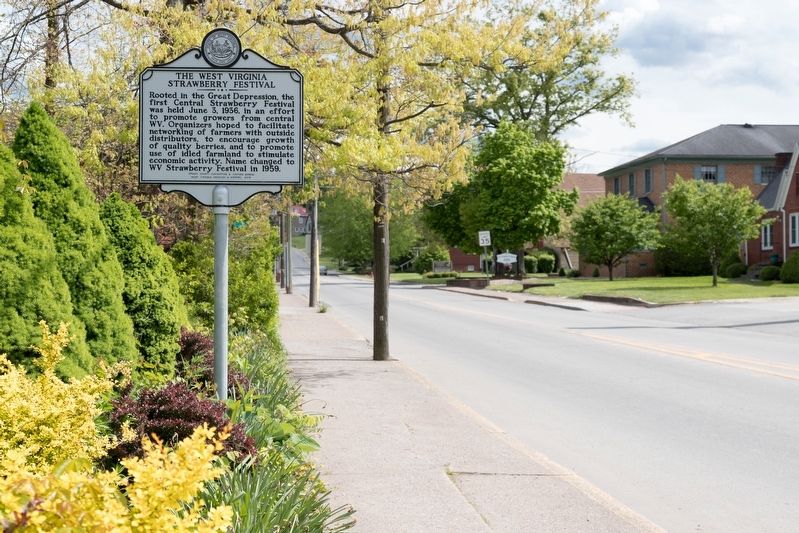
By J. J. Prats, May 16, 2021
The West Virginia Strawberry Festival Marker
RANKED BY RELEVANCE
On South Kanawha Street (West Virginia Route 20) at West Lincoln Way, on the right when traveling south on South Kanawha Street.
On South Spring Street north of Madison Street, on the right when traveling north.
On Baxter Street at Warfield Way, on the left when traveling east on Baxter Street.
On Rock Cave Road (West Virginia Route 4) at Route 20, on the right when traveling north on Rock Cave Road.
On North Locust Street (West Virginia Route 20) at West Main Street (County Route 151), on the right when traveling north on North Locust Street.
On Madison Street near South Florida Street, on the left.
On Buckhannon Pike (old U.S. 33) (West Virginia Route 151) at Lantz Road (County Route 13), on the left when traveling south on Buckhannon Pike (old U.S. 33).
On East Main Street (County Road 151) just east of North Kanawha Street, on the right when traveling west.
On Camden Avenue north of Walktrail Lane, on the left when traveling north.
On West Main Street (County Route 151) at Locust Street ( Highway 20), on the right when traveling east on West Main Street.
On East Main Street (County Route 151) just east of North Kanawha Street, on the right when traveling west.
On Camden Avenue north of Walktrail Lane, on the left when traveling north.
On Park Street at Gum Street, on the right when traveling south on Park Street. Reported damaged.
On Mud Lick Road (County Route 5/7) at Old Weston Road (County Road 12), on the right when traveling north on Mud Lick Road.
Near Camden Avenue north of Walktrail Lane, on the left when traveling north.
Paid Advertisement
On Madison Street east of South Florida Street, on the left when traveling east.
On Hall Road (County Route 13) south of Weatherford Boulevard, on the left when traveling south.
On East Main Street (County Road 151) at Traders Alley, on the right when traveling east on East Main Street.
Near Main Street north of Rices Landing Road (County Route 1010), on the left when traveling north.
Near State Park Road 1.1 miles north of U.S. 19, on the left when traveling north.
On Coal River Road (West Virginia Route 3) just north of Bridge Avenue, on the right when traveling north.
On Veterans Memorial Highway (West Virginia Route 7) at Alpine Lake Road (County Route 46), on the right when traveling west on Veterans Memorial Highway.
︽
Thin black lines indicate changes in relevance. Between each pair of lines entries are ordered geographically but all have the same relevance. * Inflectional forms of words are their plurals, singulars, and possessives as well as gramatical tenses and similar variations.
Nov. 13, 2026