17 entries match your criteria.
Valkenburg Bevrijding/Liberation Route Historical Markers
This series presents the 20+ markers erected in 2019 in the town of Valkenburg and the surrounding area that commemorate the 75th anniversary of liberation from the German occupation.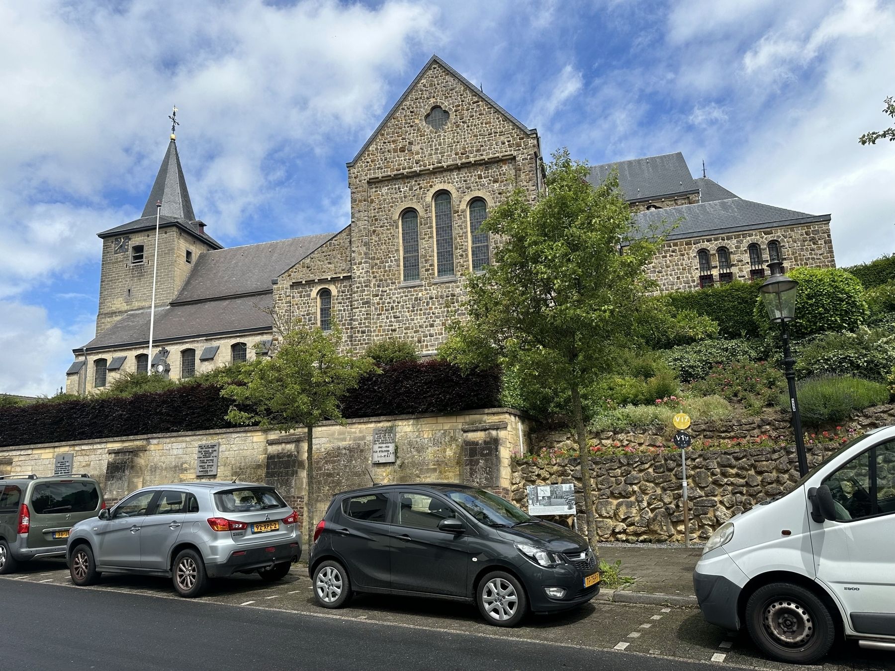
By Andrew Ruppenstein, May 29, 2024
Schin op Geul - May 10, 1940 Marker - wide view
1 ► Netherlands, Limburg, Valkenburg aan de Geul, Schin op Geul — 18/20 — Schin op Geul - May 10, 1940 — 75 jaar Bevrijding fotoroute —  |
| On Kerkplein, on the right when traveling west. | |||
| 2 ► Netherlands, Limburg, Valkenburg aan de Geul, Valkenburg — 09/20 — “Panzerabwehrkanone” (PAK-40) / “Anti-tank Gun” (PAK-40) — 75 jaar Bevrijding fotoroute — |
| On Geneindestraat. | |||
| 3 ► Netherlands, Limburg, Valkenburg aan de Geul, Valkenburg — 19/20 — 466th Bomb Group Plane Crash — 75 jaar Bevrijding fotoroute — |
| On Daalhemerweg at Dorpstraat, on the left when traveling north on Daalhemerweg. | |||
| 4 ► Netherlands, Limburg, Valkenburg aan de Geul, Valkenburg — 12/20 — Brug Opgeblazen - 13 September 1944 - Bridge Blown Up — 75 jaar Bevrijding fotoroute — |
| On Pelerinstraat at Grotestraat Centrum, on the left when traveling east on Pelerinstraat. | |||
| 5 ► Netherlands, Limburg, Valkenburg aan de Geul, Valkenburg — 10/20 — Bruggen opgeblazen - 13 September 1944 - Bridges Blown Up — 75 jaar Bevrijding fotoroute — |
| On Wilhelminalaan, on the right when traveling north. | |||
| 6 ► Netherlands, Limburg, Valkenburg aan de Geul, Valkenburg — 13/20 — Duitse invasie - May 10, 1940 - German Invasion — 75 jaar Bevrijding fotoroute — |
| On Berkelstraat, on the left when traveling north. | |||
| 7 ► Netherlands, Limburg, Valkenburg aan de Geul, Valkenburg — 05/20 — Gemeentegrot als schuilplaats / Municipal Cave as Shelter — 75 jaar Bevrijding fotoroute — |
| On Cauberg, on the right when traveling south. | |||
| 8 ► Netherlands, Limburg, Valkenburg aan de Geul, Valkenburg — 03/20 — Grendelpoort - Tweede Wereldoorlog / Grendel Gate - WW II — 75 jaar Bevrijding fotoroute — |
| On Kerkstraat at Muntstraat, on the left when traveling north on Kerkstraat. | |||
| 9 ► Netherlands, Limburg, Valkenburg aan de Geul, Valkenburg — 11/20 — Hendrik Colijn — 75 jaar Bevrijding fotoroute — |
| On Wilhelminalaan at Koninginneweg, on the left when traveling south on Wilhelminalaan. | |||
| 10 ► Netherlands, Limburg, Valkenburg aan de Geul, Valkenburg — 00/20 — Joodse deportations / Jewish Deportations — 75 jaar Bevrijding fotoroute — |
| On Wehryweg at Wehryweg, on the right when traveling south on Wehryweg. | |||
| 11 ► Netherlands, Limburg, Valkenburg aan de Geul, Valkenburg — 07/20 — Philips Fabriek / Philips Factory — 75 jaar Bevrijding fotoroute — |
| On Plenkertstraat, on the right when traveling west. | |||
| 12 ► Netherlands, Limburg, Valkenburg aan de Geul, Valkenburg — 16/20 — Schuilbunker / Air Raid Shelter — 75 jaar Bevrijding fotoroute — |
| On Broekhem, on the left when traveling east. | |||
| 13 ► Netherlands, Limburg, Valkenburg aan de Geul, Valkenburg — 08/20 — SS Reichschule / 91st Evacuation Hospital — 75 jaar Bevrijding fotoroute — |
| On Kloosterstraat at Seringestraat, on the right when traveling north on Kloosterstraat. | |||
| 14 ► Netherlands, Limburg, Valkenburg aan de Geul, Valkenburg — 04/20 — Strijd om de bevrijding / Battle for Liberation — 75 jaar Bevrijding fotoroute — |
| On Daalhemmerweg at Konijnsgracht, on the right when traveling south on Daalhemmerweg. | |||
| 15 ► Netherlands, Limburg, Valkenburg aan de Geul, Valkenburg — 01/20 — Struikelstenen / “Stumbling Stones” — 75 jaar Bevrijding fotoroute — |
| On Walravenstraat, on the left when traveling east. | |||
| 16 ► Netherlands, Limburg, Valkenburg aan de Geul, Valkenburg — 06A/20 — Valkenburg en Anton Mussert / Valkenburg and Anton Mussert — 75 jaar Bevrijding fotoroute — |
| On Plenkertstraat, on the right. | |||
| 17 ► Netherlands, Limburg, Valkenburg aan de Geul, Valkenburg — 06/20 — Valkenburg en de NSB / Valkenburg and the NSB — 75 jaar Bevrijding fotoroute — |
| On Plenkertstraat, on the right when traveling east. | |||