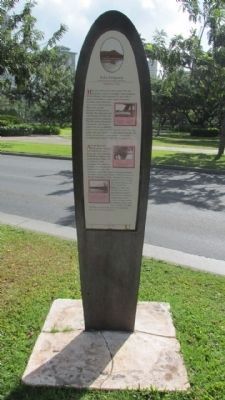
Had you walked across this road in 1897 you might have landed in Waikĩkĩ’s largest fishpond, the Ka’ihikapu, which measured 13 acres. All of today’s Fort DeRussy on the mauka (toward the mountain) side of the road was covered with . . . — — Map (db m73113) HM
From olden times Waikīkī was viewed not only as a place of peace and hospitality, but of healing.
There was great mana (spiritual power) in Waikīkī. Powerful kahuna la‘au lapa‘au (or physicians) lived here. Throughout the . . . — — Map (db m13225) HM
On Kalia Road at Maluhia Road, on the left when traveling south on Kalia Road.
Named in honor of Staff Sergeant Robert T. Kuroda, 442nd Regimental Combat Team.
On 20 October 1944, during the battle of Bruyeres, France, Sergeant Kuroda led his squad in an attack against a strongly defended enemy position. He deployed . . . — — Map (db m13256) HM
This cannon was one of a battery of twelve guns placed on punchbowl crater by the Hawaiian monarchy beginning in 1831. Both to defend Honolulu Harbor and to fire salutes. The U.S. Army moved the cannon to Bishop Museum in 1920, where it remained . . . — — Map (db m82128) HM
On Kalakaua Avenue, on the left when traveling west.
Prince Jonah Kuhio Kalaniana’ole, the son of High Chiefess Kekaulike Kinoiki II and High Chief David Kahalepouli Pi’ikoi, was born on March 26, 1871 at Ho’ai, Kaua’i. His mother died soon after his birth and he and his two older brothers were hanai . . . — — Map (db m73117) HM
Near Ala Moana Boulevard (Hawaii Route 92) at Kalia Road.
This Rainbow Mural, tallest in the world, 286 feet high, 26 feet wide, comprises 8,046 pieces of hand-painted ceramic tile created for the Hilton Tower by Millard Sheets. Dedicated by Conrad N. Hilton and Fritz B. Burns. November 8, 1968. — — Map (db m19077) HM
Near Holomoana Street south of Ala Moana Boulevard.
The legendary surfer Duke Kahanamoku often strolled the sands of Waikīkī Beach fronting what is now Hilton Hawaiian Village Beach Resort & Spa, 1959.
In ancient times, the coastal plain where you now stand was known as . . . — — Map (db m13082) HM
On Kalaukaua Ave, on the left when traveling west.
Princess Lili’uokalani enjoyed spending time with Robert Louis Stevenson on Waikiki in “earnest conversation”, Feb 3, 1889
This section of Waikiki Beach contains four distinct areas: Outrigger Canoe Club, San Souci, Kapi’olani Park and . . . — — Map (db m73122) HM
On Kalakaua Avenue, on the right when traveling north.
The Moana Hotel opened on March 11, 1901 as Waikiki’s first hotel. Affectionately called “The First Lady of Waikiki,” this iconic resort embraces true Hawaiian hospitality. Walter Chamberlain Peacock, the original owner of the Moana . . . — — Map (db m73114) HM
On Kalaukaua Ave, on the left when traveling west.
Legend says these stones are the living legacy of four powerful Tahitian healers who once resided near this site at a place called Ulukon. From the court of the Tahitian chief, the names of the four were Kapaemahu, Kapuani, Kinohi, and Kahaloa. . . . — — Map (db m73116) HM
On Ala Moana Boulevard (Hawaii Route 92) at Kalia Road, on the right on Ala Moana Boulevard.
Chief Ma‘likūkāhi, who reigned over the island of Oahu in the mid-1400s, resided in Waikīkī and used it as his seat of government. He was greatly loved by his subjects who enjoyed unprecedented peace and prosperity. Ali‘i . . . — — Map (db m13200) HM
With the emergence of airborne troops in 1941 came the need for an airborne howitzer. The M3 was created by shortening an existing 105mm howitzer barrel and mounting it on a modified 75mm carriage. The lightweight M3 proved to be an effective weapon . . . — — Map (db m82125) WM
Used for scouting and reconnaissance in the late days of WWII. It mounted a 75mm main gun and three machine guns behind 1" of armor. Two Cadillac V-8 engines drove the 19 ton tank and its crew of four at speeds up to 35 MPH. — — Map (db m82124) WM
In the months before Dec 7th, many of these steel pillboxes were planted to defend military installations, airfields, and likely landing beaches around Oahu. Once buried in position, the 2-man crew entered through culvert pipe openings at the base . . . — — Map (db m82121) WM
Born to Chiefess Miriam Kapili Likelike (sister to King Kalākaua and Queen Lili’uokalani) and Governor Archibald Scott Cleghorn. She was the only child born to the last ruling dynasty of the Hawaiian Kingdom.
Princess Ka’iulani and her . . . — — Map (db m73229) HM
On Kalaukaua Ave, on the left when traveling west.
Waikiki means “spouting water” because it was a vast marshland fed by many streams. You are in fact standing on what was the mouth of an old stream, the Kuekaunahi. From ancient times Waikiki has been a popular surfing spot which is one of the . . . — — Map (db m73119) HM
Near Kuilima Drive 0.5 miles north of Route 83, on the left when traveling north.
On December 7, 1941, an SCR-270B Radar located
at this site tracked incoming Japanese aircraft
for over 30 minutes until they were obscured
by the island ground clutter. This was the first
wartime use of radar by the United States Military,
and . . . — — Map (db m154431) HM WM
Near Kuilima Drive 0.5 miles north of Route 83, on the left when traveling north.
Mobile Radar Unit SR-270B
has been designed a
National Historic Landmark.
This site possesses national significance
in commemorating the history of the
United States of America. — — Map (db m154432) HM
On G Street (Intrastate H 3 ), on the left when traveling north.
“It will all happen in a moment,
in the twinkling of an eye. When the
last trumpet is blown.
When this happens, then at last
this scripture will come true-
Death is swallowed up in Victory.”
I Corinthians 15:52 and 54
This . . . — — Map (db m111960) HM WM
While travelling around the world on an assignment to visit the
foreign missions of The Church of Jesus Christ of the Latter-day Saints,
Elder David O. McKay, a member of the Quorum of the Twelve Apostles, and
Hugh J. Cannon visited Hawaii in . . . — — Map (db m111520) HM
This is the site of the LDS Hawaii Mission School
where President David O. McKay, then member of
the Church’s Quorum of the Twelve Apostles,
witnessed a flag raising ceremony on February 7, 1921.
Observing the multi-ethnic student body . . . — — Map (db m111519) HM
The discipline which makes the soldiers of a free country reliable in battle is not to be gained by harsh or tyrannical treatment—on the contrary—such treatment is far more likely to destroy than to make an army. It is possible to impart instruction . . . — — Map (db m81310) HM
In the spring of 1951, units of the 25th Infantry Division crossed the Han River to liberate the City of Seoul. One of the units that took part in this operation was C Company, 89th Tank Battalion. In preparation for their assault across the Han, . . . — — Map (db m81311) HM WM
On Kalakalua Avenue at Kukio Avenue and Kuamoo Street, on the left when traveling south on Kalakalua Avenue.
(tablet on back of base)
David Kalākaua was born on November 16, 1836. He succeeded to the throne on February 12, 1874, and ruled with his queen, Kapi‘olani. King Kalākaua was the catalyst for the revival and flowering of . . . — — Map (db m13586) HM
On Kalia Road at Lewers Street, on the left when traveling north on Kalia Road.
Ancient Hawaii was governed by a sharply defined caste system. The kings were the highest authority. Chiefs, or Alii, ruled over sections of the land at the pleasure of the kings. At times there was a king for each of the major islands in the . . . — — Map (db m75626) HM
A hybrid between a False Killer Whale & Atlantic Bottlenose Dolphin.
Born May 15, 1985.
She shows her whale heritage in her dark coloration, bodylength, width, and large teeth.
Her profile is unique blend of both parents with a short, . . . — — Map (db m82138) HM
127 entries matched your criteria. Entries 101 through 127 are listed above. ⊲ Previous 100