165 entries match your criteria. Entries 101 through 165 are listed.⊲ Previous 100
Canada, Toronto Heritage Historical Markers
Following millenia of Indigenous presence, trade routes and villages in the area, and French presence for the fur trade in the 17th and 18th centuries, York (later renamed Toronto) was established as a British settlement in 1793. This series INCLUDES markers erected by the City of Toronto and its agencies (such as Heritage Toronto), that describe Toronto's historical heritage. EXCLUDED are those terse plaques that merely describe that a property has been designated under the Ontario Heritage Act.
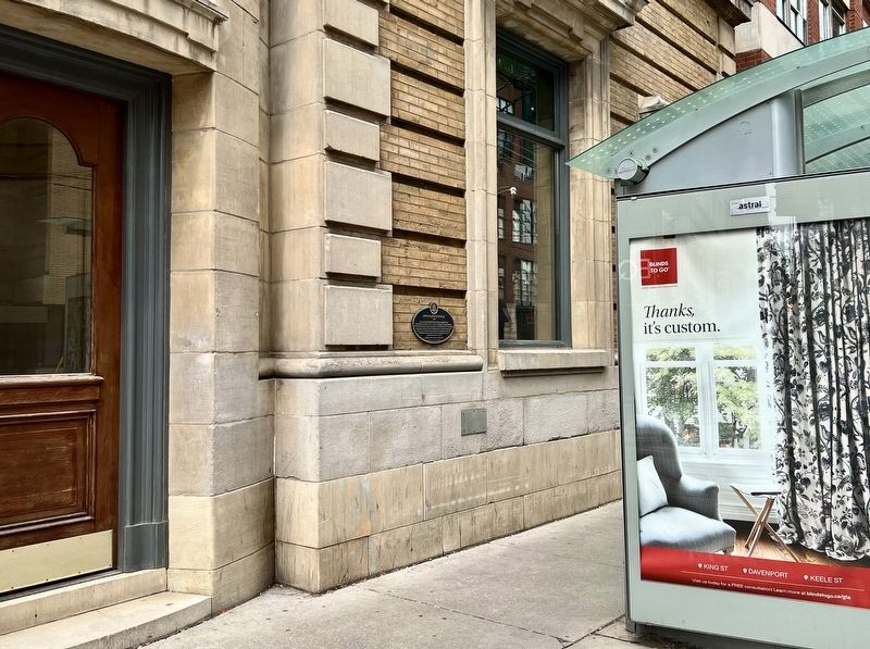
This two-storey Edwardian Classical bank was designed for the Imperial Bank of Canada by the Toronto firm, Darling and Pearson, Architects. After the bank merged with The Canadian Bank of Commerce in 1961, the building continued as a branch of the . . . — — Map (db m271975) HM
Toronto architecture firm Langley, Langley & Burke designed this building and its accompanying stables on George Street. It is a rare example of decorative Second Empire architecture, with intricately carved keystones over the windows. Robert . . . — — Map (db m271934) HM
The St. James Parking Garage, which opened in 1925, was one of the first multi-level parking garages in Toronto. In the mid-1920s, increased demand for parking led to the construction of several parking garages in Toronto’s downtown core. . . . — — Map (db m217857) HM
In 1796 the first Anglican priest arrived from England to minister to the citizens of York. The following year the province set aside this piece of land for the building of a church. The present cathedral, the fourth church erected on this site, . . . — — Map (db m217444) HM
This building was first constructed in 1833 for owner Daniel Brooke, a prominent merchant in the Town of York. It was substantially rebuilt between 1848-1849 prior to the Great Fire of April 1849 which started in a nearby stable. While much of the . . . — — Map (db m217196) HM
The Underground Railroad restaurant was one of the first Black-owned and operated soul food establishments in Toronto. It opened on February 12, 1969, in the basement of 406 Bloor Street East and soon became a destination for locals as well as . . . — — Map (db m312172) HM
Healey Willan, Canada's first internationally known
composer, was born in Balham, Surrey, England, and came
to Canada in 1913. He taught at the Toronto Conservatory
of Music and became professor of music at the University
of Toronto. From 1921 . . . — — Map (db m316307) HM
The son of an affluent Toronto family, Monsignor Athol Murray attended
St. Augustine Seminary in Scarborough. A salty priest of unshakeable faith, he believed in the development of the individual through rigorous education and sport. He founded . . . — — Map (db m316235) HM
Before it was named for Queen Victoria in the 1840s, Queen Street was known as Lot Street. Once lined with large family estates, by the late 19th century Queen Street was a major commercial street populated by blacksmiths, cabinetmakers, . . . — — Map (db m277268) HM
Dave (Bookie) Bookman was a radio and concert host who promoted and nurtured Canadian indie-rock music more than 30 years.
Bookman's career began in the 1980s at CIUT-FM, the University of Toronto's campus radio station. His show Don't Look . . . — — Map (db m277377) HM
"Sunlight Park" was constructed in 1886 as the Toronto Baseball Grounds. The smell of baked potatoes and cigars greeted fans filing in to the park through an avenue of workers' cottages called "Baseball Place". The stands, four storeys high and . . . — — Map (db m64502) HM
From 1839 to the late 1860s, a military blockhouse stood at the intersection of Bloor and Sherbourne Streets. This small, two-storey fort served a defensive purpose. Constructed of square logs, it could house up to 20 soldiers on the top floor and . . . — — Map (db m274529) HM
Humbercrest Public School is one of the oldest buildings still standing in the Baby Point area. First Nations have lived on this land for thousands of years. The earliest recorded were the Wendat, who were forced out of the area due to warfare and . . . — — Map (db m310489) HM
Designed by the Office of the City Architect under the management of Robert McCallum, this Edwardian Classical-style building was constructed as Police Station No. 11 serving the area bounded by St. George, Christie, and College Streets, and by St. . . . — — Map (db m297300) HM
This was the site of the Yonge station on the Belt Line Railway, a short-lived steam railway that circled Toronto from 1892 to 1895.
The Belt Line Railway Company was incorporated in 1889 by a group of Toronto businessmen. Their goal was to buy . . . — — Map (db m297468) HM
Thousands of people lived on Toronto Island year-round when the regional government of Metropolitan Toronto (Metro) began to clear the land of homes for a public park in the 1950s.
The Island is part of the treaty lands and territory of the . . . — — Map (db m295402) HM
The Anglican Parish of St. Simon-the-Apostle was
founded in 1883. The congregation first worshipped in
the chapel of St. James-the-Less, Parliament Street, until
this church, by architects Strickland and Symons, was
completed in 1887. Five years . . . — — Map (db m274528) HM
The Toronto Street Railway Company built this three storey Renaissance Revival style stable and car barn to designs by architect H. G. Salisbury in order to house its fleet of horse drawn streetcars. In 1891, when the Toronto Street Railway ceased . . . — — Map (db m270461) HM
Designed by the renowned Canadian firm
Moriyama & Teshima Architects, this mixed-use building
opened when the St. Lawrence area was undergoing
urban renewal. It features a large sunlit atrium
with a landscaped watercourse. — — Map (db m270264) HM
Designed in the Renaissance Revival style by architects Strickland & Symons, this building was part of a major expansion of the Consumers’ Gas Company manufacturing plant. The final stages of coal gas production took place in the Purifying House, . . . — — Map (db m270474) HM
This Toronto landmark was built for George Gooderham, the president of Gooderham and Worts - the largest liquor distillery in Canada and one of Toronto's biggest employers.
Front Street to your left once followed the historic shoreline of Lake . . . — — Map (db m270184) HM
Mary Ann Shadd Cary was an anti-slavery activist, an advocate for the rights of women, and a pioneering woman newspaper editor and publisher. The daughter of a free African American shoemaker and abolitionist, Shadd began a life of teaching at age . . . — — Map (db m57756) HM
For more than 50 years, the O'Keefe Centre has been one of the premier performing arts venues in Toronto, hosting ballet and opera, concerts, and a variety of stage productions. The O'Keefe Centre was vital to the renewal of the St. Lawrence area . . . — — Map (db m270159) HM
This former industrial building was constructed in phases over two decades as Standard Woollen Mills expanded its operations. The earliest portion, constructed in 1882 and distinguished by its buff and blackened brick detailing, was designed by E.J. . . . — — Map (db m270471) HM
In 1793, John Graves Simcoe, Lieutenant-Governor of Upper Canada, established a fort and chose the site for a small town at a natural harbour on the north shore of Lake Ontario. The location was strategic, near major Indigenous trails to the . . . — — Map (db m270455) HM
Founded by Bishop Arthur Sweatman in 1883, St. Alban-the-Martyr served as the Cathedral of the Anglican Diocese of Toronto. Provincial legislation established the Cathedral Chapter and then annexed the surrounding lands to Toronto. Several grand . . . — — Map (db m316407) HM
This façade was part of a studio designed by John M. Lyle for his architectural practice.
Lyle, one of Canada's most distinguished architects, trained a number of noteworthy Canadian architects at the studio and worked there until his retirement in . . . — — Map (db m274766) HM
This ten storey building was constructed by a consortium of doctors to provide facilities for the medical profession, and was a landmark redevelopment of a formerly
residential section of Bloor Street. Designed in a Georgian influenced style by . . . — — Map (db m274769) HM
This building and many other Space-Age apartments in this neighbourhood were designed by Estonian Canadian architect Uno Prii.
Born in Tallinn, Prii left Estonia in 1943 during the Second World War.
He studied applied engineering in Stockholm, . . . — — Map (db m316401) HM
Before you is part of the red-brick façade of Eden Court, a farmhouse built for Edward Stock in
1886. Originally, the home featured round-arched windows decreasing in size on each storey, sandstone ornamentation on the front gable, and stained . . . — — Map (db m310562) HM
Before it was named the Queensway, this road was considered an extension of Queen Street West from Roncesvalles to Kipling Avenues.
Here, from the early until the mid-20th century, the rich soil was a prime location for market gardens — small . . . — — Map (db m310561) HM
Designed by architect Alan Crossley and structural engineer Laurence Cazaly, this Space Age comfort station is a local landmark and a rare example of the Googie architectural style in Toronto. Also known as the Oculus, the South Humber Park Pavilion . . . — — Map (db m310537) HM
For 50 years, a bronze sculpture by Walter Yarwood, one of
Canada's leading artists, was located here in a sunken
courtyard outside the Toronto offices and bottling plant of the
Coca-Cola Company of Canada.
Coca-Cola Canada commissioned . . . — — Map (db m281893) HM
The development of the Town of Leaside, named for 19th-century farmer and settler William Lea, is, historically linked to the Canadian Pacific and Canadian Northern Railways. By 1894, a railway station was established at "Leaside Junction". The . . . — — Map (db m309802) HM
Crawford Street passes through Trinity Bellwoods Park over a graceful triple-span concrete bridge which still exists, but is now buried beneath the street. The bridge once crossed a ravine carved by Garrison Creek as it flowed from north of St. . . . — — Map (db m316056) HM
In March 1966, Muhammad Ali trained here to fight Toronto-born George Chuvalo for the World Boxing Council heavyweight championship at Maple Leaf Gardens.
The fight came at a pivotal time in Ali's career. He was effectively banned from . . . — — Map (db m259772) HM
Garrison Creek once flowed south through ravine land from the ancient Lake Iroquois shoreline, now at Davenport Road, to Lake Ontario. Along the way, it provided a fresh water source for Fort York.
With the westwand expansion of the City of . . . — — Map (db m259643) HM
St. Hilda's was founded in 1888 as an Anglican women's college affiliated with the University of Trinity College, once located nearby. At the time, women in Canada had little access to higher
education. Located first on Euclid Avenue and then on . . . — — Map (db m259711) HM
Designed in the Second Empire style, this landmark building features a
mansard roof with dormers and rich detailing in stone and wood. From its completion until 1894, it was the private residence of James Cooper, a partner in the prominent . . . — — Map (db m282066) HM
The actor Raymond Massey (1896-1983), brother of Vincent, and best known for playing Abraham Lincoln on stage and screen, lived here in the family mansion from 1896 to 1915. — — Map (db m282153) HM
The Underground Railroad restaurant was one of the first Black-owned and -operated soul food establishments in Toronto. Opened February 12, 1969, at 406 Bloor Street East, it soon became a destination for locals as well as touring musicians, . . . — — Map (db m312171) HM
The diplomat and philanthropist Vincent Massey (1887-1967), the first Canadian-born Governor General, and a key figure in creating the Canada Council and the National Library of Canada, lived here from 1887 to 1911. — — Map (db m282088) HM
A vital part of Toronto's cultural history, the Royal Alexandra is one of North America's oldest, continuously operating theatres. An early work of Toronto architect John M. Lyle, the theatre was financed By a consortium headed by "Toronto’s . . . — — Map (db m276925) HM
This building was commissioned in 1908 by the Mail Job Printing Co., a company that printed a range of material from railway timetables to movie posters, and even fake snow for theatrical shows.
Designed by Sproatt & Rolph, the five-storey . . . — — Map (db m307931) HM
This is the last remaining building of Upper Canada
College, located here 1831-1891. Built in the Georgian
Style in 1855, the student residence was altered and
enlarged first in 1856 by Cumberland and Storm architects
and again several times in . . . — — Map (db m276931) HM
When the military hospital closed after the War of 1812, York was left without a hospital. Surplus funds raised by the Loyal and Patriotic Society of Upper Canada for those who suffered as a result of the war, were used to build a hospital at the . . . — — Map (db m276934) HM
Architect Earle L. Sheppard designed this factory in a blend of Art Deco and Art Moderne styles for Chr. Hansen's Laboratory, a Danish maker of dairy products such as rennet, an enzyme used in cheese making, and powdered desserts. Essential oil . . . — — Map (db m259551) HM
The world-champion distance runner
Tom Longboat
(1886-1949), known in the Onondaga language
as 'Cogwagee,' trained here for his victory
in the 1907 Boston Marathon. — — Map (db m316009) HM
The Toronto Young Men's Christian Association (Y.M.C.A.) commissioned architecture firm Gordon & Helliwell to design a new West End branch, which included a meeting hall, a library, and a gymnasium with a raised running track and a bowling alley. . . . — — Map (db m316008) HM
Weston is distinguished by many retaining walls constructed from Humber River stone. One man, skilled stonemason James Gilbert Gove, built a number of these walls, as well as the war memorial in this park. Before immigrating to Canada in 1923, . . . — — Map (db m259825) HM
Originally the head office of the Canadian General Electric Company, this building was designed in the Beaux-Arts Classical style by the noted Toronto architecture firm
of Darling and Pearson. It was the first of three adjacent buildings . . . — — Map (db m276923) HM
Formed during the First World War, No. 2 Construction Battalion was the largest Black military unit in Canadian history.
In August 1914, thousands of men from across Canada enlisted to serve in the war; however, by the end of 1915, at least . . . — — Map (db m289249) HM
This ornate cast iron fence was completed in 1867, the year of Canadian Confederation, according to designs by architect William Storm.
Osgoode Hall is the home of the Law Society of Ontario, the body that governs the province's legal . . . — — Map (db m302401) HM
The first Chinese resident recorded in Toronto was Sam Ching, the owner of a hand laundry business on Adelaide Street in 1878. Though immigration to Canada directly from China was restricted after 1885, Ching was eventually joined by Chinese men . . . — — Map (db m288883) HM
In the early 19th century, individual citizens were responsible for firefighting. Each house was required by law to have two leather buckets and two ladders to reach burning roofs. The "bucket brigades" drew water from Lake Ontario or water tanks. . . . — — Map (db m274570) HM
Eastern Sound was a renowned Yorkville recording studio that attracted prominent Canadian as well as international musicians and producers at a time when this neighbourhood was at the heart of Toronto's counter-culture movement.
Founded in . . . — — Map (db m274632) HM
This brick façade was once part of the first Mount Sinai Hospital, an institution founded in 1922 to provide medical services particularly for the city's many Jewish immigrants. Since existing hospitals did not offer such services as . . . — — Map (db m274640) HM
Yorkville has been a vital centre for public transit for more than 150 years. The first transit, in 1849, was a horse-drawn omnibus service owned by cabinetmaker and carriage builder H. Burt Williams. His vehicles carried passengers and mail on a . . . — — Map (db m274678) HM
In 1963, John and Marilyn McHugh, owners of one of Yorkville's first coffee houses, the Half Beat, opened the Penny Farthing in this Victorian house. For the next seven years, the venue hosted folk, blues, and jazz performances.
Inside, . . . — — Map (db m274676) HM
The coat of arms above is from the Yorkville Town
Hall, built on Yonge Street in 1859. It contains symbols
representing the occupations of the first councillors:
John Severn, brewer; Thomas Atkinson, Brickmaker; Reeve
James Dobson, carpenters . . . — — Map (db m274566) HM
The Heliconian Club, founded in 1909 to provide a forum
for women in the arts, purchased this property in 1923.
Opened in 1876 as the Olivet Congregational Church, this
small gothic revival building became the church hall and
sunday school in . . . — — Map (db m274674) HM
Once crossed by an ancient aboriginal trail (Davenport Road), the area known today as Yorkville was first permanently settled by those of European descent in the early 1800s. The Red Lion Inn, one of the first buildings in the area, was a stagecoach . . . — — Map (db m274540) HM
Yorkville Branch is the Toronto Public Library's oldest building, the first of four librarles constructed with a 1903 grant from the Carnegie Corporation. It replaced the Library's first branch, ‘Northern', which had opened in the former Yorkville . . . — — Map (db m274541) HM
Designed by William Hay, one of Toronto's most important early architects, the Yorkville Town Hall was built by William McGinnis, and opened on this site in 1860, fronting onto Yonge Street. High Victorian in style, it was constructed of local . . . — — Map (db m274538) HM
165 entries matched your criteria. Entries 101 through 165 are listed above. ⊲ Previous 100